


Rongai route at a glance
The Rongai route is 73 km (45 miles) in total, and can be completed over six or seven days. We always recommend opting for the seven-day Rongai itinerary (as opposed to the six-day itinerary) as you really need the extra day in order to acclimatise properly and so avoid developing altitude sickness.
The Rongai route is the only route that approaches the summit from the northern side of the mountain, near the Kenyan border. It's one of the least crowded of the seven Kilimanjaro routes.
To trek the Rongai route, you enter Kilimanjaro National Park at Rongai Gate. During the trek you pass through the different Kilimanjaro climate zones on your way to the arctic summit, namely rainforest, Afro-alpine moorland and high-altitude alpine desert.
The highest point of Mount Kilimanjaro is Uhuru Peak, which sits at 5,895 m (19,341 ft) above sea level. After hopefully summiting, you descend the mountain via the Marangu route on the southeast side of the mountain. This means you don't retrace your steps on the Rongai route but are always trekking new trail – yay!
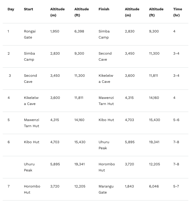
The table below shows the distances you trek each day on the seven-day Rongai route, and where and at what altitude you camp each night.
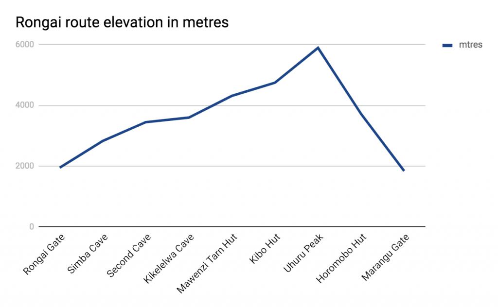
The graph below shows the elevation of the Rongai route in profile. It offers a good visual of the very gentle and gradual climb involved in trekking the Rongai route.
Detailed route description
We describe the seven-day Rongai route in the day-by-day itinerary below.
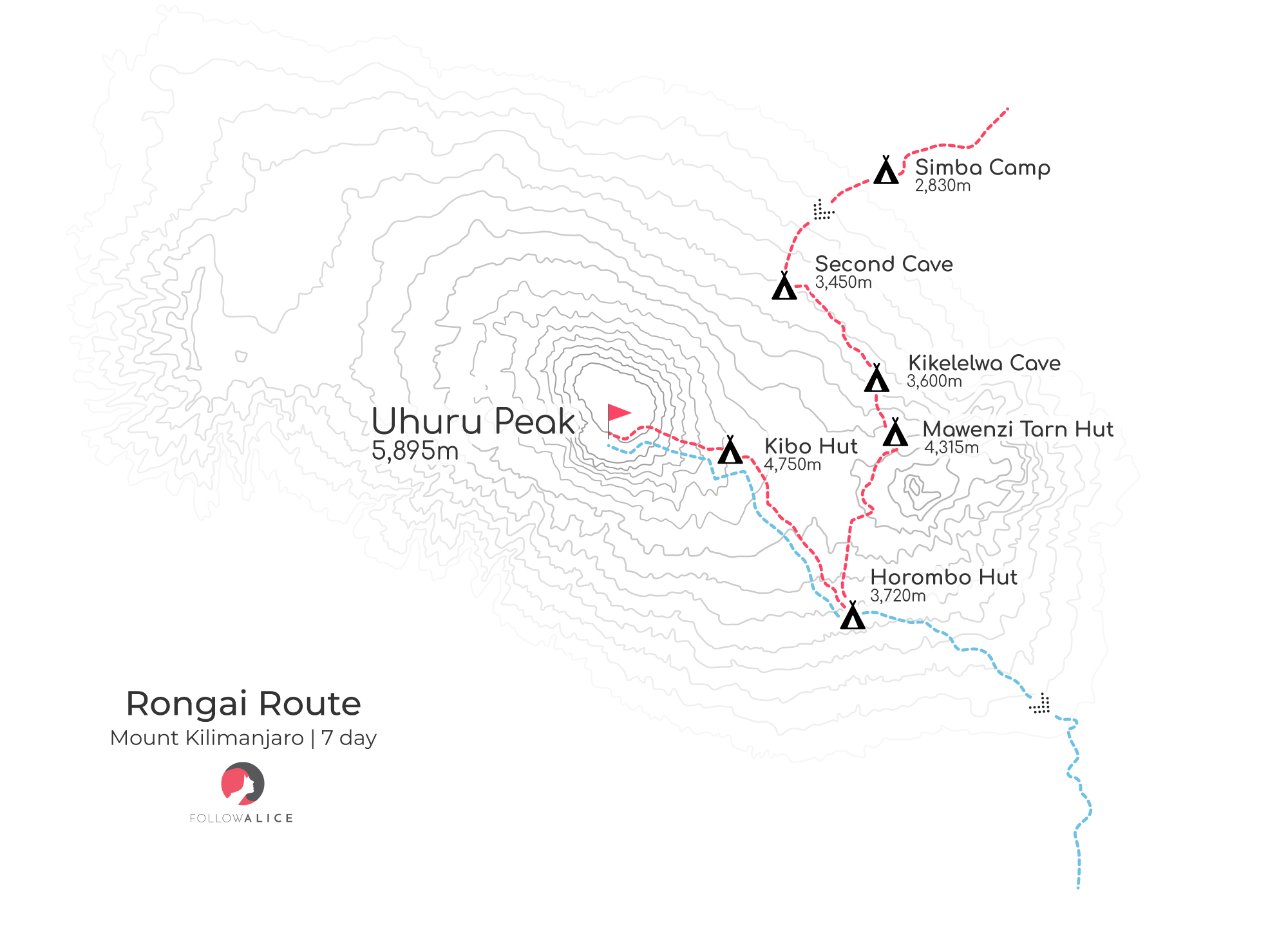
Map showing the seven-day Rongai route on Kilimanjaro
Day 1: Rongai Gate to Simba Camp
First things first, you drive to Rongai Gate where you're recorded in the Kilimanjaro National Park's registry. You begin your climb by trekking through rainforest. At points you have breaks in the vegetation that offer magnificent views of cultivated fields down below. You climb for about four hours to reach Simba Camp, where you spend the night.
- Elevation: 1,950 m to 2,830 m
- Distance: 8 km / 5 miles
- Hiking time: 4 hours
- Habitat: Forest
You start the Rongai route in rainforest
Day 2: Simba Camp to Second Cave
Today you trek through moorland to Second Cave. This takes three to four hours.
- Elevation: 2,830 m to 3,450 m
- Distance: 6 km / 4 miles
- Hiking time: 3-4 hours
- Habitat: Moorland

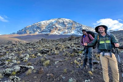
Trekkers on the Rongai route
Day 3: Second Cave to Kikelelwa Cave
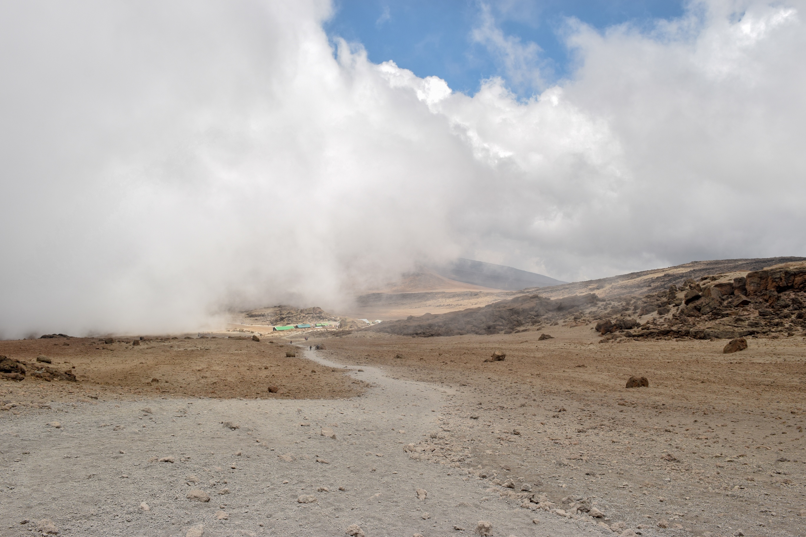
Today you trek through alpine desert to Kikelelwa Cave. The scenery along this part of the journey is quite remarkable. You hike for about four hours.
- Elevation: 3,450 m to 3,600
- Distance: 6 km / 4 miles
- Hiking time: 3-4 hours
- Habitat: Moorland

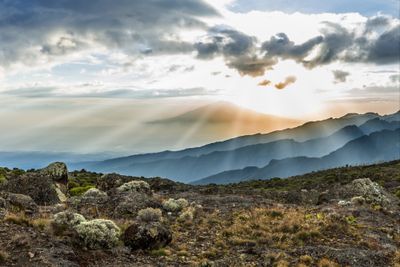
View from Kikelelwa Cave at dawn looking towards Kenya
Day 4: Kikelelwa Cave to Mawenzi Tarn Hut
After breakfast you trek to Mawenzi Tarn Hut, which takes around four hours. Here, as on future nights, you camp next to the permanent huts housing trekkers using the Marangu route, as the two routes have now merged. You can also expect the trail to therefore be a little busier from now on.
- Elevation: 3,600 m to 4,315 m
- Distance: 4 km / 2 miles
- Hiking time: 4 hours
- Habitat: Moorland and alpine desert

Mawenzi Tarn Hut campsite
Day 5: Mawenzi Tarn Hut to Kibo Hut
Today you trek for five to six hours through alpine desert to reach Kibo Hut. The trek is a gradual incline that heads west through the Saddle, a ridge of barren land that connects the peaks of Kibo and Mawenzi.
- Elevation: 4,315 m to 4,703 m
- Distance: 8 km / 5 miles
- Hiking time: 5-6 hours
- Habitat: Alpine desert
Kibo Hut serves as a little oases of comfort high up on Kilimanjaro
Day 6: Kibo Hut to Uhuru Peak to Horombo Hut
Today is the day! All going well, you'll be standing at the tippy top of Africa before lunchtime and glorying in your mega achievement. Summit day is split into two parts: the ascent to Uhuru Peak, followed by a descent of over two vertical kilometres.
Part 1 | Kibo Hut to Uhuru Peak
The first half of today's journey starts much earlier than on every other day. Your guide wakes you up at midnight. The follow a rocky, moonlit trail to Uhuru Peak. Welcome to the Roof of Africa!
- Elevation: 4,703 m to 5,895 m
- Distance: 6 km / 4 miles
- Hiking time: 7-8 hours
- Habitat: Arctic

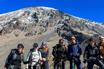
We invite you to Follow Alice to the summit of Mount Kilimanjaro!
Part 2 | Uhuru Peak to Horombo Hut
Part two of today's trek sees you make your way down the mountain from Uhuru Peak to Horombo Hut, which is where you overnight.
- Elevation: 5,895 m to 3,720 m
- Distance: 12 km / 7 miles
- Hiking time: 7-8 hours
- Habitat: Arctic, alpine desert and moorland

Horombo Hut campsite is often above the clouds
Day 7: Horombo Hut to Marangu Gate
Today is the last day of your incredible journey! You do however have a relatively long hike down the mountain ahead of you. You trek for five to seven hours from Horombo Hut to Marangu Gate, where you bid Kilimanjaro farewell.
- Elevation: 3,720 m to 1,843 m
- Distance: 10 km / 6 miles
- Hiking time: 5-7 hours
- Habitat: Moorland and rainforest

A glorious view from Horomobo Hut
{{leadmagnet-one}}
What is the scenery like on the Rongai?
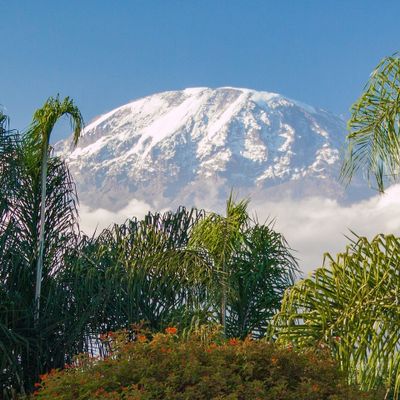
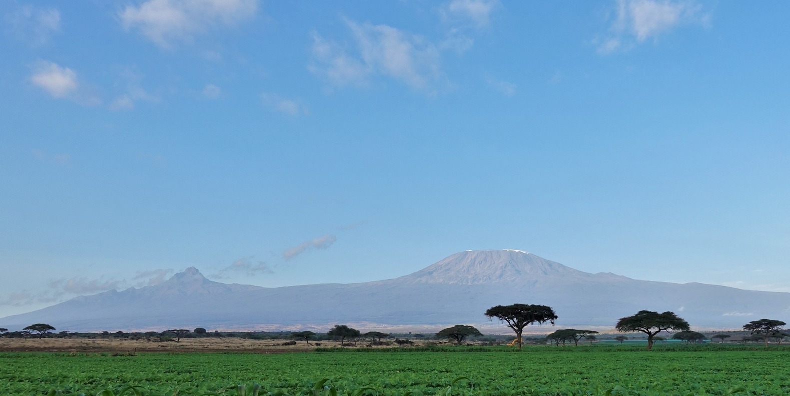
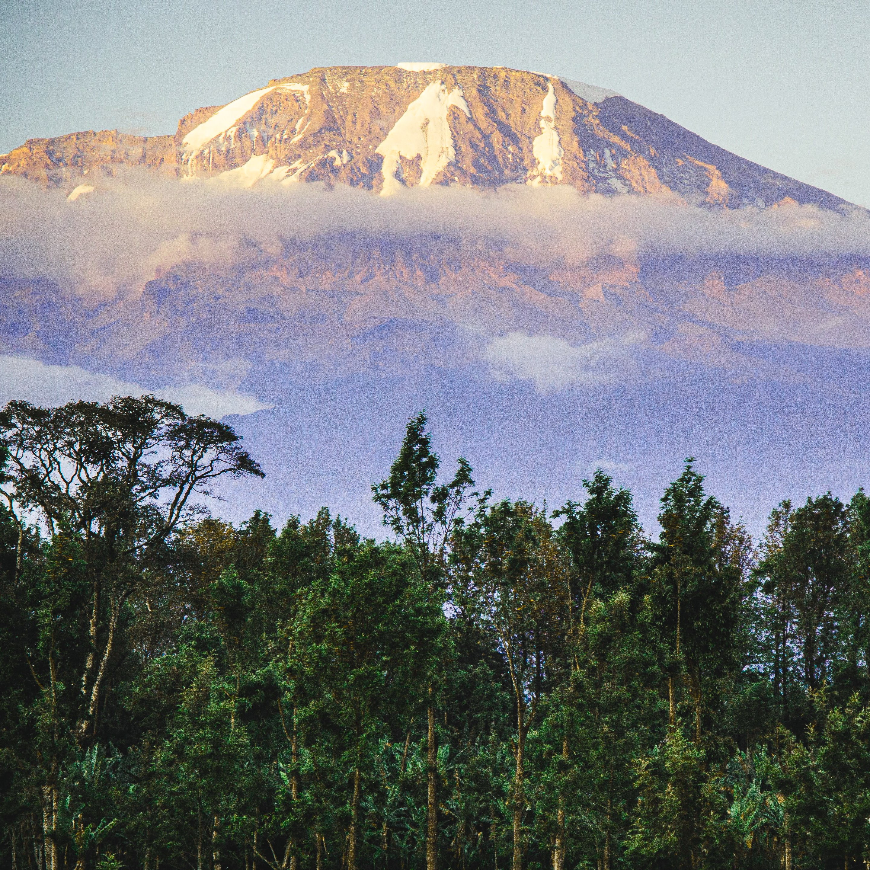
The Rongai route is often considered one of the less scenic Kilimanjaro routes. But we don't think that this is fair. For starters, you get to enjoy walking through the rainforest, moorland, alpine desert and arctic bands just the same as most of the other routes. What's more, because the northern side of the mountain is a little less prone to rainfall, you're more likely to get clear, unclouded views of the mountaintop along the way. Whoop whoop!
Furthermore, you come very close to Mawenzi Peak on the Rongai route, and Mawenzi is arguably the most beautiful peak on Kilimanjaro. There's also a good chance that you could spot large wildlife like elephants and giraffes on the plain to the north of the mountain during your early days on the trek.

The moorland section of the Rongai route is incredibly pretty
How hard is the Rongai route?
No Kilimanjaro climb is easy – it's important you know that. But relatively speaking, the Rongai route is considered one of the 'easier' routes, as it has a gentle incline throughout. It's a bit of a longer hike for this reason.
Whilst there are no official statistics, the average summit success rate (the percentage of trekkers on a route who reach the summit) across all Kilimanjaro tour operators is around 70% to 80% for the seven-day Rongai route, and around 60% to 70% for the six-day Rongai route. If you compare these statistics with those of routes like the Lemosho route and Northern Circuit route, you'll see that they aren't particularly good.
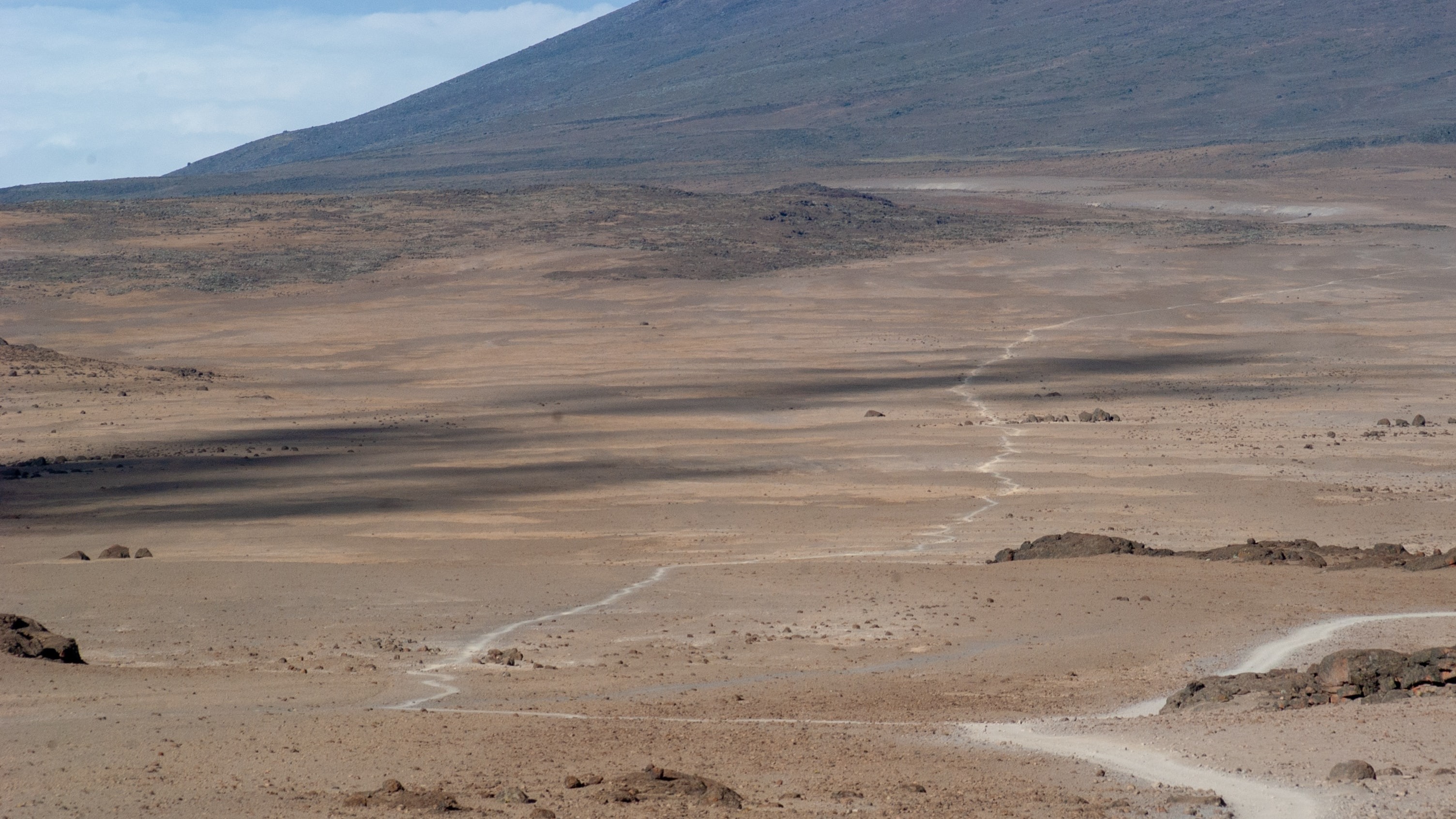
A long stretch of the Rongai route through alpine desert
Note that you should be physically fit to attempt to climb Kilimanjaro, though you don't need any previous trekking experience. The Rongai route is not technical at all, meaning a good pair of hiking boots strapped onto some decently strong legs is all you need. That said, if you're new to multiday hikes, we recommend you read our trekking tips for beginners.
How busy is the Rongai route?
The Rongai route is the least frequented of the Kilimanjaro routes. It's the only route to approach the summit from the northern side of the mountain.
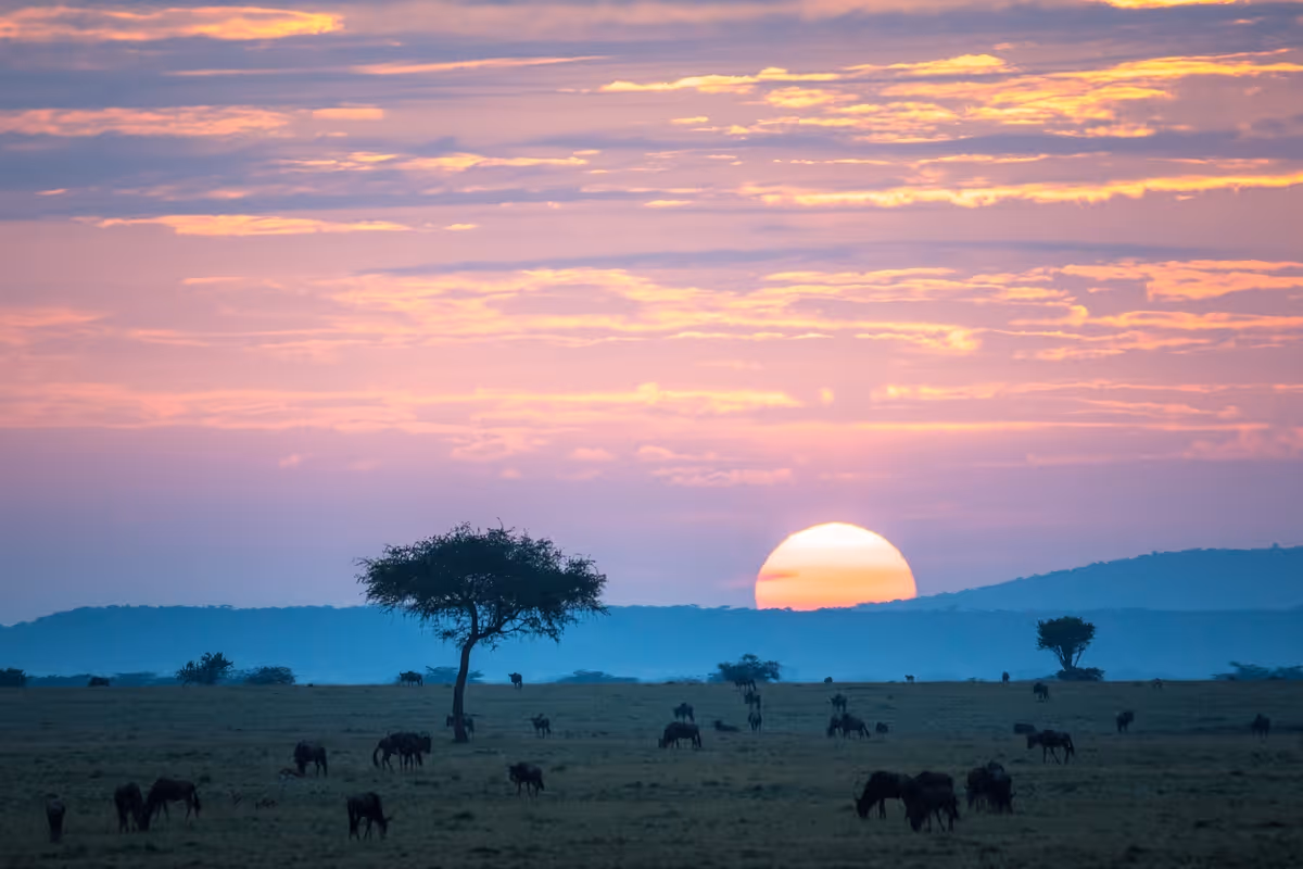
Trekkers often don't consider the Rongai route because of the perception that it's not as beautiful as the other routes. However, it's actually a very beautiful Kilimanjaro route. And it's possibly the best route for seeing large game, as you look out over Kenya's Amboseli National Park where you can sometimes see herds of elephants, stands of giraffes, and more!
We think the seven-day Rongai route is a good choice if you're looking for a quieter climb but don't have the time or money necessary to consider the nine-day Northern Circuit route.

Horombo Hut campsite is used by both Rongai and Marangu route trekkers
Good to note
Though the Rongai route is one of the least frequented Kilimanjaro routes, over the last couple of years the route has grown in popularity. If you climb in peak season and start on a group departure date (most commonly a Sunday), you may experience some crowds. Speak to us for the latest updates on the Rongai route.
What does the Rongai route cost?
As of June 2024, Follow Alice offers the Rongai route as a seven-day group or private climb. Our seven-day Rongai route package costs $2,850 per person. Please note that this package includes seven days and six nights on the mountain as well as one night on either side of your trek at our beautiful parter lodge in Moshi. Also, the fee is based on double occupancy, which means you'll be sharing your tent and lodge room with a partner in crime.
For more information on the inclusions and exclusions of the Follow Alice trip fee, as well as more details about the trip, please visit our Rongai trip page.

Your package fee with Follow Alice includes all camping equipment
Keen to explore more of Tanzania?
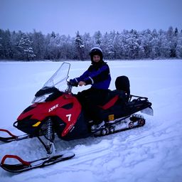
If you want to add a little adventure onto the end of your Kilimanjaro climb, we recommend going on a Tanzania safari – you won’t find a better African safari! Or hop over the border into Uganda to trek with mountain gorillas. Or hit up the beaches of Zanzibar! Alternatively, if you’ve limited time and budget, why not do one or two extra activities in the Kilimanjaro region like visit a Maasai village or jump into hot springs?
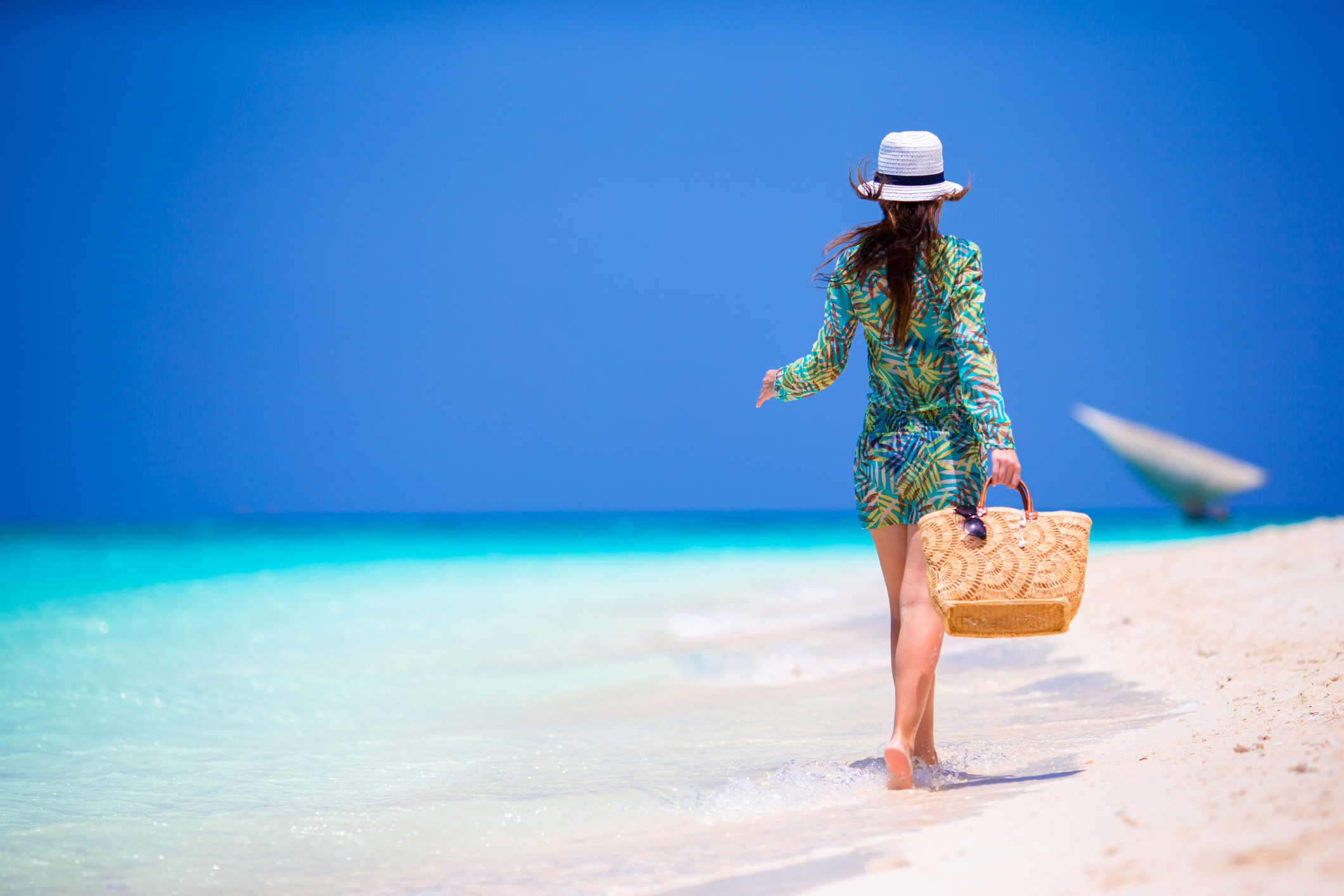
Zanzibar is a popular Kilimanjaro follow-up destination