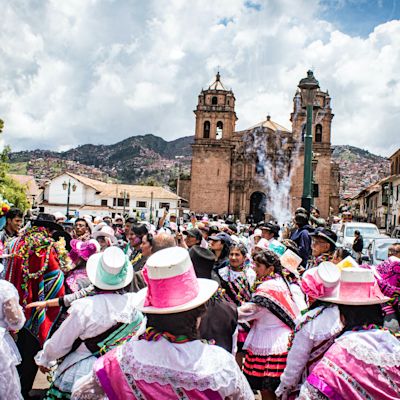


Route overview
The Classic Inca Trail is a spectacular four- or five-day high-altitude trek in the Peruvian Andes that starts near the historic city of Cusco and ends at the famous ruins of Machu Picchu.
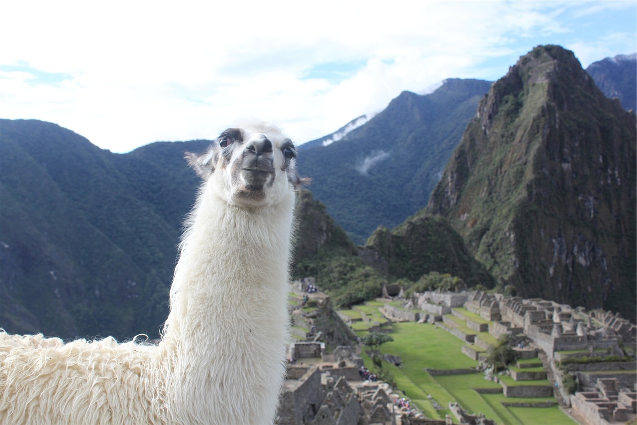
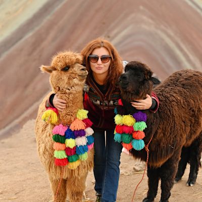
A llama poses for a photo with Machu Picchu down below
The Inca Trail is by far the most well-known and popular of Peru's treks. It's a truly memorable experience in a dramatic and beautiful corner of the Andes. Moreover, you get to see and explore various mediaeval Inca ruins throughout the trek and learn about the region's rich cultural heritage.
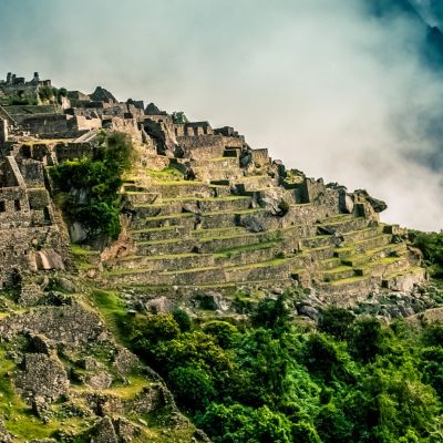
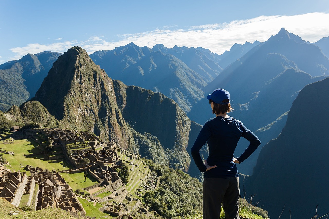
The Machu Picchu Historical Sanctuary is a UNESCO World Heritage Site for both culture and nature!
The Inca Trail's natural wonders and incredible architectural ruins make it one of only 39 sites globally to be a UNESCO World Heritage Site for both nature and culture!
If you have any questions, feel free to book a call with us.
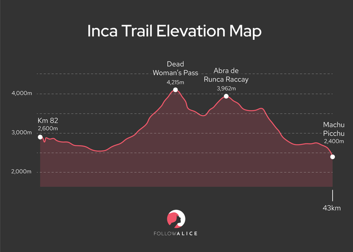
Inca trail elevation
The Classic Inca Trail is a challenging up-and-down route, as the elevation map below shows.
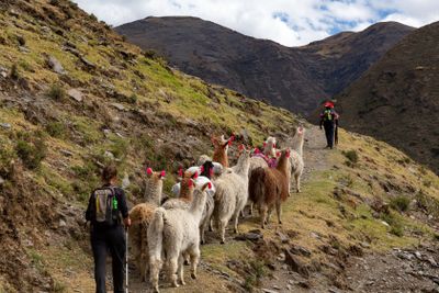
But nobody does it alone; everyone trekking the Inca Trail travels with a tour operator, and your guide is there to encourage and look after you. The group dynamic is also a wonderful part of the experience.
Importantly, porters carry the bulk of your belongings and all that's needed for camping and cooking. This means that all you need to carry is a backpack with your water, snacks, rain gear, camera and other bits and bobs.

Porters nearing the highest point of the Inca Trail
The trail's two climate zones
Trekkers of the Inca Trail hike through beautiful cloud forest as well as high-altitude grassland known as puna.
The cloud forest in this part of the Andes lies between 2,400 to 3,500 m (7,900 to 11,500 ft). The vegetation is thick and tangled, and boasts incredible biodiversity. You can look forward to seeing a variety of ferns, orchids, bromeliads and mosses, among other beauties.
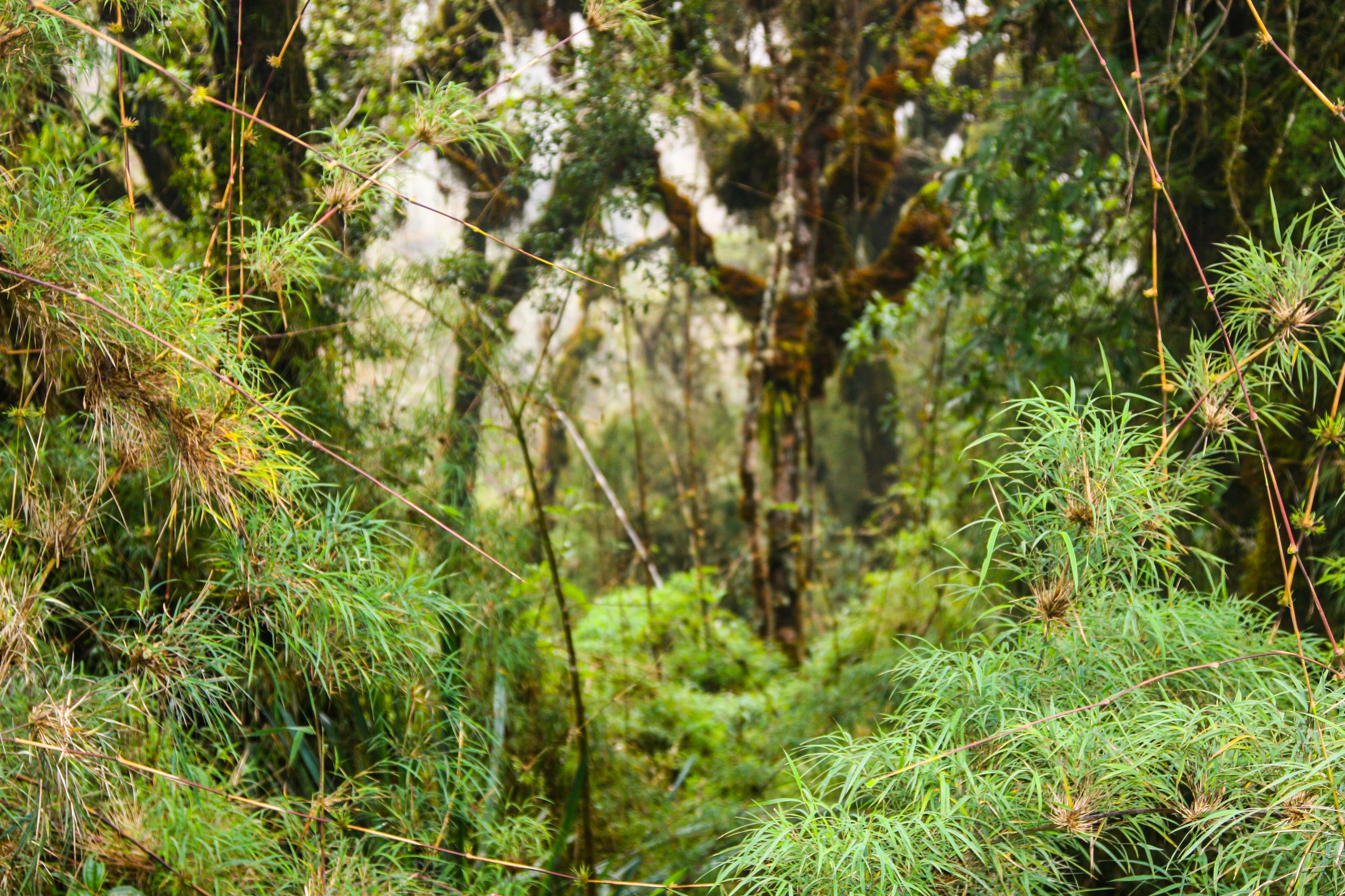
A section of cloud forest along the Inca Trail
The Inca Trail's cloud forest is – as its name suggests – often shrouded in mist.
Once you climb above 3,500 m (11,500 ft), you enter a harsh mountain environment where only hardy grasses, mosses and lichens grow. The views from this high up are just incredible!

The views on the Inca Trail are the stuff of legend
Throughout the trek, be sure to keep your eyes open for the animals and birds of the Inca Trail. These include llamas, Andean deer, Andean condors, hummingbirds and more.
The trail in the rainy and drier seasons
The conditions on the Inca Trail vary depending on the season. There are two main seasons to note: the wet season and the dry season.
November to March is the wet season on the Inca Trail, and April to October is the drier season.
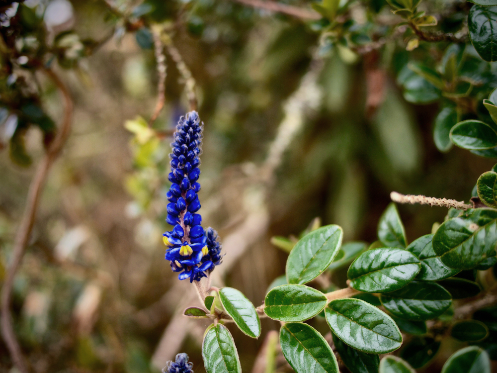
The Inca Trail's lupins usually bloom during the rainy season
You probably noticed that we say 'drier season' and not 'dry season', because the region sees clouds and rain all year round. In fact, you should expect cloud and mist to be part of your Inca Trail experience, no matter what time of the year you trek.
Also, you should note that Machu Picchu is often shrouded in mist first thing in the morning. Fortunately, this usually clears after a little while to let you enjoy panoramic views of the ruins and the surrounding valleys and peaks.

Visitors exploring Machu Picchu in some mist

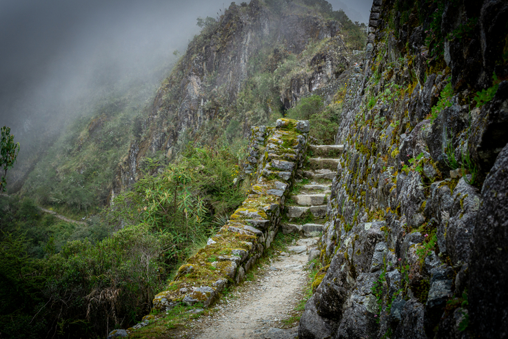
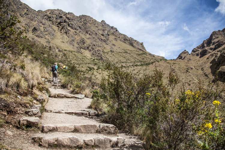
The footpath
During the trek, you can expect to walk along:
- Dirt paths.
- Pathways that are paved with uneven stones.
- Stone steps (some now have wooden handrails in place).
- Narrow contour paths with very steep drop-offs.
- A handful of bridges.
During and after rainfall, you need to take extra care with muddy sections and slick rocks.
Trekking poles are really useful on the Inca Trail. But please note that you're not allowed to use poles with sharp metal tips (unless you cover them with bungs). This rule exists to protect the integrity of the historic stones as well as the mountains' fragile ecosystems.
The Inca Trail was mostly constructed during the 1400s
As you saw in the elevation map earlier, the Classic Inca Trail involves a series of steep ascents and descents. This is why we encourage you in How should I train for trekking to Machu Picchu? to prepare yourself for long stretches requiring big steps up and then long stretches requiring big steps down.

A footbridge over the Urubamba River on the Inca Trail
A day-by-day itinerary
Let's now discuss what you can expect each day on the Classic Inca Trail if you do it over four days.
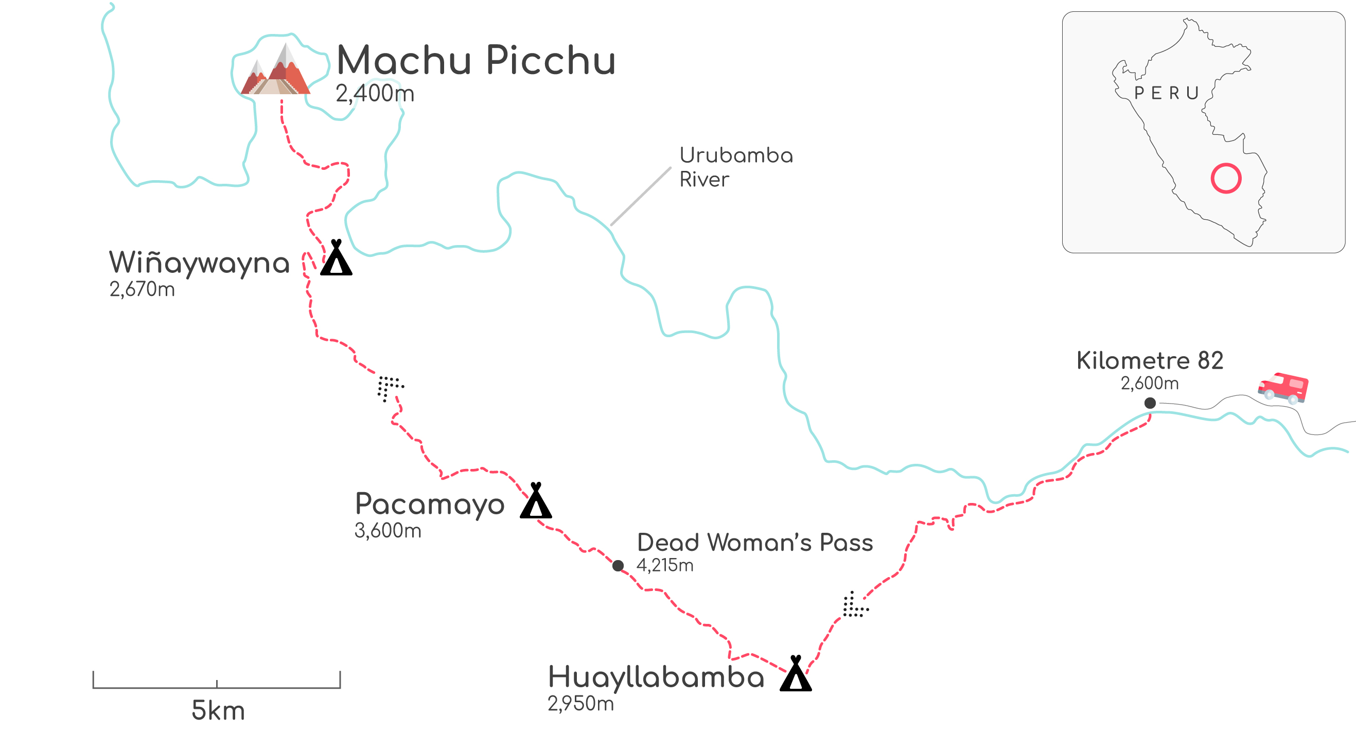
Map of the four-day Classic Inca Trail
Day 1: Inca ruins of Urubamba Valley
- Start point: Km 82 train station (2,600 m / 8,530 ft)
- End point: Huayllabamba (2,750 m / 9,022 ft)
- Distance: 11 km
- Duration: Around 5 hours
- Highlight: Ruins of Llactapata
In the morning, you're driven from Cusco to the start of the Inca Trail in the Urubamba Valley, where the adventure begins!

On Day 1 of the Inca Trail, you encounter the ruins of Huillca Raccay
On this first day of trekking, you pass through some rural villages and farms and cross a few streams. You walk into the forest and, excitingly, you encounter a few Inca ruins straight away! For instance, there's Qanabamba, which was created as a resting place for travellers, and Huillca Raccay (also spelt Willkaraqay), the impressive ruins of a hill fort.
The highlight, however, is the sprawling, crescent-shaped ruins of Llactapata (also spelt Patallacta or Llaqtapata). The settlement is thought to have been abandoned around 1540. It has 116 buildings and five baths, plus a canal that would channel water to the baths.

You visit the ruins of Llactapata on Day 1 of the Inca Trail
Today's trek is relatively easy compared with those of Days 2 and 3. There are some ups and downs, but nothing extreme. That said, depending on how long you spent acclimatising before starting the trek, you may find exercising at such a high altitude quite challenging.
Tonight you camp near the pretty village of Huayllabamba, which has the Río Llulluchayoc running through it. This is the largest settlement on the trail, and the last place where you can buy some basic supplies.
Day 2: Climb Dead Woman's Pass
- Start point: Huayllabamba (2,750 m / 9,022 ft)
- End point: Pacaymayo (3,000 m / 9,843 ft)
- Distance: 7.5 km
- Duration: Around 6 hours
- Highlight: Crossing Dead Woman's Pass (4,215 m / 13,829 ft)
Things get serious today, as you must climb 1.5 km in elevation to cross Dead Woman's Pass! While the approach looks gentle enough at points, it's longer and harder than it looks, so it's time to dig deep.
Known abroad as Dead Woman's Pass, this high point on the Inca Trail is locally called Abra de Huarmihuanusca (or Warmiwanusca in Quechua). It's also sometimes called First Pass, simply because it's the first of the three passes that you cross on the classic Inca Trail.
The approach to Dead Woman's Pass
Note that once you've summited Dead Woman's Pass, your work isn't done. You now have a very long and steep descent ahead of you. In fact, you drop down 500 metres or so in the space of just two kilometres! The steps are deep and often rocky and uneven, making those trekking poles we mentioned earlier an invaluable asset.
Much of today is spent trekking through high-altitude grassland. The views are expansive and absolutely breathtaking – they're every bit what you came to the Andes hoping to find! There are jagged, snowcapped peaks all around.

Llamas and alpacas are commonly seen on the Inca Trail
For most of us, encountering a llama on the Inca Trail is a real bucket-list moment!
During the descent to your camp for the night, you enter the beautiful and humid cloud forest. This variety of scenery and vegetation is a huge part of the Inca Trail's appeal!
Tonight, you camp at Pacaymayo (or Paqaymayu in Quechua) in the heart of the gorgeous Pacaymayo Valley.
Day 3: Trek in beautiful cloud forest
- Start point: Pacaymayo (3,000 m / 9,843 ft)
- End point: Wiñaywayna (2,670 m / 8,760 ft)
- Distance: 16 km
- Duration: Around 9 hours
- Highlight: The ruins of Sayac Marca
The trail today is another one of steep climbs and sharp descents. You cross two passes en route to the next campsite.
The first mountain pass of the day – Runcuraccay (or Runkurakay) – sits at 3,750 m (12,335 ft) above sea level and is sometimes simply called Second Pass on maps. Runcuraccay is named for the ruins that sit a little below the pass; these probably served as a storehouse and resting spot for passing foot messengers during the days of the Inca Empire.
Later in the day, you cross Third Pass (or Phuyupatamarca), which is 3,650 m (11,975 ft) above sea level.

You trek through pristine cloud forest on the Inca Trail
The various Inca ruins you encounter today are just next-level amazing. And on top of that, you can look forward to walking through more beautiful cloud forest, where you should be able to spot colourful orchids, hummingbirds and much more.
For many, Day 3 of the Inca Trail is their favourite day of the trek, as the scenery and ruins are staggeringly impressive.
Visiting the ruins of Sayacmarca (or Sayakmarka) is one of the undisputed highlights of the day. In fact, they're arguably the most beautiful example of Inca architecture on the entire trail. Sayacmarca means 'inaccessible town', and refers to the fact that the compound sits on a ledge of the mountainside high above the valley floor.
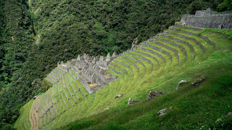
The Inca ruins of Wiñaywayna
You overnight alongside the Inca ruins of Wiñaywayna (also spelt Wiñayhuayna). There are cold showers on offer here for a small fee.
Wiñaywayna (whose name means 'forever young') hangs onto a steep slope and is simply astonishing. At the centre of the site is the compound, and then on all sides of this are many terraces that are still in amazing condition.
The terraces at Wiñaywayna showcase the Incas' amazing ability to grow crops in even the most challenging mountain environments.
If, however, the campsite at Wiñaywayna is too full, you must head to Phuyupatamarca (3,680 m / 12,073 ft) for the night. This campsite – whose name means 'town in the clouds’ – offers an incredible view of the surrounding mountains!

The campsite at Phuyupatamarca
Day 4: Sunrise hike to Sun Gate and Machu Picchu
- Start point: Wiñaywayna (2,670 m / 8,760 ft)
- End point: Machu Picchu (2,430 m / 7,972 ft)
- Distance: 5.5 km
- Duration: 2 hours
- Highlight: First view of Machu Picchu from Sun Gate (2,720 m / 8,924 ft)
The final day of the Inca Trail is a relatively short one. But utterly memorable!
Trekkers usually wake up and set out well before dawn in the hopes of reaching the fabulous lookout point offered by the ruins of Sun Gate (Intipunku) around sunrise. Sun Gate was an Inca fortress and its positioning affords you your first iconic view down towards Machu Picchu.
View of Machu Picchu from Sun Gate
But be warned: there's a flight of steps just before Sun Gate that's taxing and involves some massive steps! These require you to use your hands as well and are often called the Gringo Killer! The Inca built them this steeply to ensure no enemy could stage an ambush.
The Inca Trail ends with you entering Machu Picchu and exploring these incredible and iconic ruins. The stone masonry skills of the Incas – and the scale of their undertakings – are truly astounding, and never fail to inspire awe to this day. As noted in The Architects' Take:
The Inca people of the Andes had a special relationship with rock. Stone informed their entire culture, and was key to their empire-building success.
After visiting Machu Picchu, you enjoy lunch at the on-site restaurant if you're doing the trip with Follow Alice. Tummies full, you're then driven down to Machu Picchu Town (also often referred to as Aguas Calientes), where you could also enjoy lunch if you haven't already.

Machu Picchu Pueblo (Machu Picchu Town) sits in the valley below its eponymous ruins
Later in the afternoon, you enjoy a truly scenic train ride to Ollantaytambo. Here, your driver meets you and whisks you back to Cusco for the night.
Keen to trek the Classic Inca Trail?
So are you inspired to trek the Classic Inca Trail to Machu Picchu? If so, please give us a shout. Those of you who know us at Follow Alice know that high-altitude trekking is our thing, and we'd love to help you make this adventure a reality!