


The Everest Base Camp and Gokyo Lakes trek route offered by Follow Alice is an incredibly beautiful, remote and challenging high-altitude trek in the beautiful Everest region of the Himalayas.
The route follows the classic Everest Base Camp trek route on the outward-bound journey. Then, on the return journey, you hike a marginally longer route that detours to the beautiful Gokyo Lakes region. We love that you're not retracing your steps here, but rather exploring another, quieter section of Sagarmatha National Park! If you have any questions schedule a call with our team.

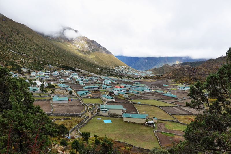
The hamlet of Gokyo in the snowy season
Trek distance
The Everest Base camp and Gokyo Lakes trek route is roughly 112 km (70 miles), not counting two optional day hikes.
When you include the two optional roundtrip day hikes to Hotel Everest View and the top of Gokyo Peak, you cover 121 km (75 miles). It's a breathtaking route – both literally and figuratively!
We give a brief outline below of the Follow Alice itinerary for the Everest Base Camp and Gokyo Lakes trek, after which we give a far more detailed itinerary.
Prepare to get excited while you read!
But first, here's a map of the trek route to help you picture things better:
Map of the EBC and Gokyo Lakes trek

Map of the EBC and Gokyo Lakes trek route
EBC and Gokyo Lakes route overview
Day 1: Fly into Kathmandu and gather together at the hotel in Thamel, Kathmandu.
Day 2: Drive southeast to the city of Manthali.
Day 3: Take a short but exhilarating plane ride from Manthali Airport to Lukla. Trek to Phakding (2,610 m) and enjoy the rivers, green mountains and relatively mild temperatures.
Day 4: Trek from Phakding up the valley to Namche Bazaar (3,440 m), the largest town in the Khumbu region. This day involves a big jump in elevation.
Day 5: Today is an acclimatisation day. So explore Namche Bazaar (attractions include the Sherpa Museum and Namche Monastery) and take a day hike if you'd like to the beautiful village of Khumjung or to Hotel Everest View for coffee.

The monastery in Khumjung
Day 6: Trek from Namche Bazaar up to Tengboche (3,867 m), where you can visit the Tengboche Monastery, the largest monastery in Khumbu.
Day 7: Trek from Tengboche to the small settlement of Dingboche (4,260 m).
Day 8: Trek from Dingboche to the tiny village of Lobuche (4,940 m).
Day 9: Trek to Everest Base Camp (5,364 m) and snap 1,000 selfies! 🏆 Turn around and trek down to Gorakshep (5,164 m) for the night.
Day 10: Hike up Kala Patthar (5,643 m) for the best view of Mt Everest. Then trek to Dzongla (4,830 m) for the night

Cho La is a mountain pass 5,420 m above sea level
Day 11: Cross Cho La pass (5,420 m) and descend to Tagnag (4,500 m) for the night.
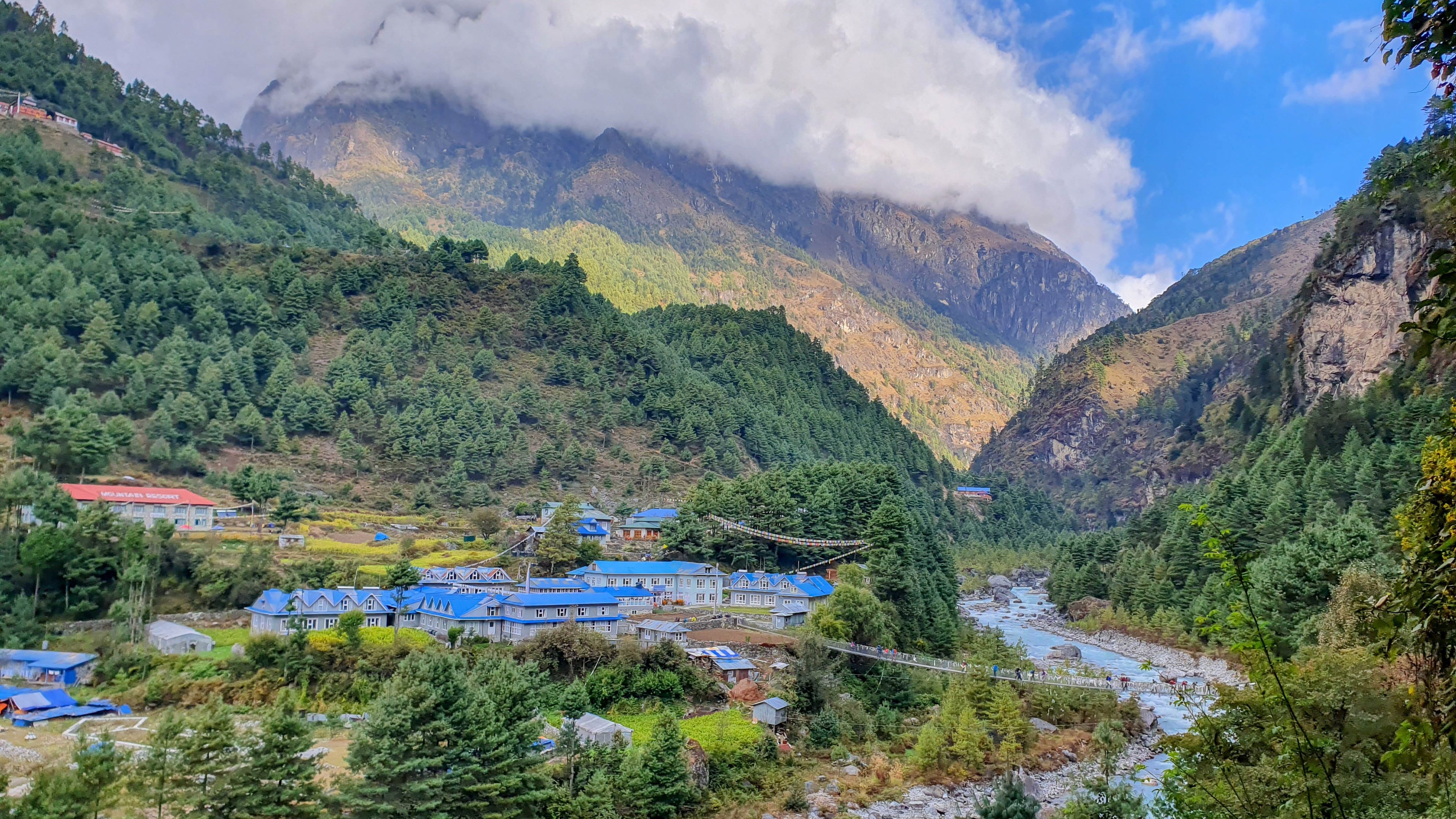
Day 12: Trek to the tiny village of Gokyo (4,750 m) and marvel at the beautiful, pristine lake.
Day 13: Hike up to Gokyo Peak (5,357 m) for a panoramic view of some of the world's mightiest mountains. Then trek to the village of Machhermo (4,470 m) for the night.
Day 14: Descend to Namche Bazaar.
Day 15: Descend to Lukla and enjoy all that oxygen-rich air!
Day 16: Fly to Manthali, then drive to Kathmandu.
Day 17: Depart Nepal. Relive the memories over a lifetime. 😀

Ngozumpa Glacier and Gokyo village
Let’s now look at each day in turn, including some of the natural and cultural highlights along the way. We dare you to remain unexcited as you read on.
Detailed itinerary
Let's now look at what each day holds, all the better to get excited for the trek!
Day 1 – Arrive in Kathmandu
- Arrival: Tribhuvan International Airport
- Drive: Airport to Thamel (30 min)
- Overnight: Thamel, Kathmandu
- Accommodation: Arushi Boutique Hotel (or similar)
Today is simply about arriving in Nepal and getting together as a group. We take care of all your travel once you land in Kathmandu, so you’ll be met at the airport and brought to the hotel in Thamel, a vibey district of Kathmandu. We’ll have dinner together and get to know each other a bit. Then it’s time to rest well, as it’s all go from the moment we land in Lukla tomorrow!
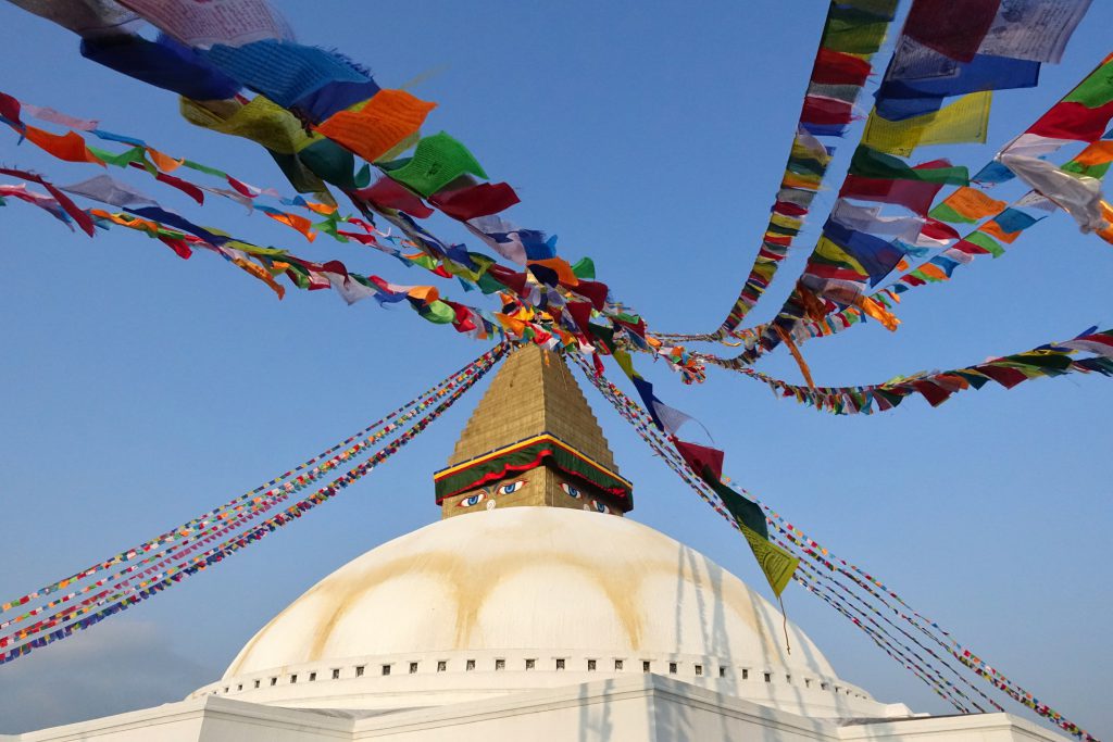
A stupa and prayer flags in Kathmandu
Day 2 – Drive to Manthali in Ramechhap District
- Drive: Kathmandu to Manthali (5 hr)
- Overnight: Manthali
- Accommodation: TBD
Given that we can't currently fly directly from Kathmandu to Lukla because of the construction taking place at Tribhuvan international Airport, we need to insert an extra travel day here.
In the morning, we drive southeast in our private vehicle to reach the pretty district of Ramechhap. We overnight in the city of Manthali, ready to catch the morning flight tomorrow to Lukla.
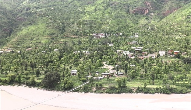
Ramechhap District is green and hilly
Day 3 – Fly to Lukla and trek to Phakding
- Flight: Manthali Airport to Lukla Airport (15 min)
- Trek starting point: Town of Lukla (2,860 m / 9,383 ft)
- Trek distance: 8.2 km / 5.1 mi
- Trek duration: 3 hours
- Highlight: Beautiful trek through a forested valley
- Overnight: Village of Phakding (2,610 m / 8,562 ft)
- Accommodation: Teahouse (lodge)
Today starts with the short flight to Lukla, which you’ll do dressed in your trekking gear, as the moment we land, we’re off on the trail!
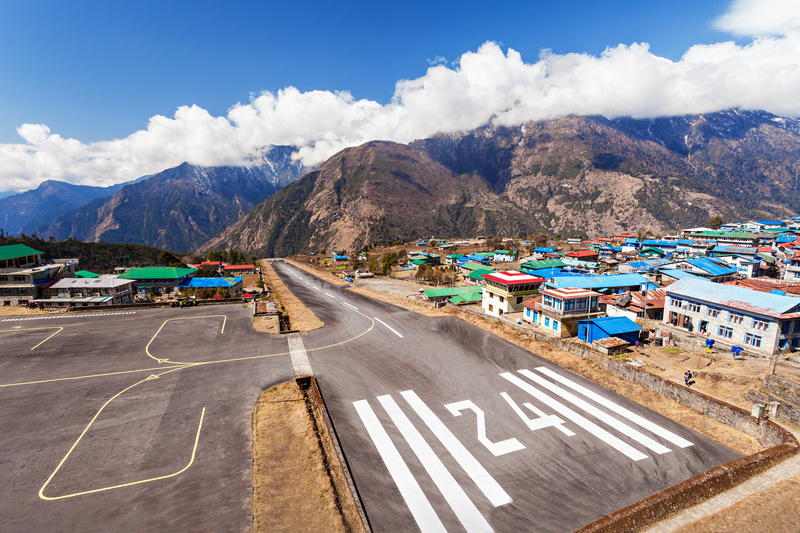
Lukla Airport
Many people picture bare rock and snow when they imagine the Everest Base Camp route. While this is true of the higher portion of the trek, the lower part is quite lush. For the first few days of the trek you’ll be hiking in a temperate zone. You can expect pine, fir and juniper forests as well as rushing rivers, bridges and waterfalls. If you trek in the Everest Base Camp route in summer (April and May), you’ll see the beautiful and iconic rhododendron trees in bloom.
Phakding
Our first night’s destination is the picturesque village of Phakding (2,610 m). The main industry in Phakding is tourism, so there are plenty of teahouses. We’re confident you’ll love Phakding, as it sits in a lush, forested valley alongside the Dudh Khosi river.

In the lower part of the Everest Base Camp trek we cross several suspension bridges
Day 4 – Trek from Phakding to Namche Bazaar
- Starting point: Phakding (2,610 m / 8,562 ft)
- Trek distance: 9.4 km / 5.6 mi
- Duration: 5-6 hours
- Highlight: Crossing the Hillary Suspension Bridge
- Overnight: Namche Bazaar (3,440 m / 11,286 ft)
- Accommodation: Teahouse
Today we trek for around five to six hours to the town of Namche Bazaar. The hike involves a big jump in elevation of about 800 m. So you’ll be working those calves hard. The trail runs roughly parallel to the Dudh Khosi river for most of the day, and then finally we have a steep climb up to reach our destination of Namche Bazaar.
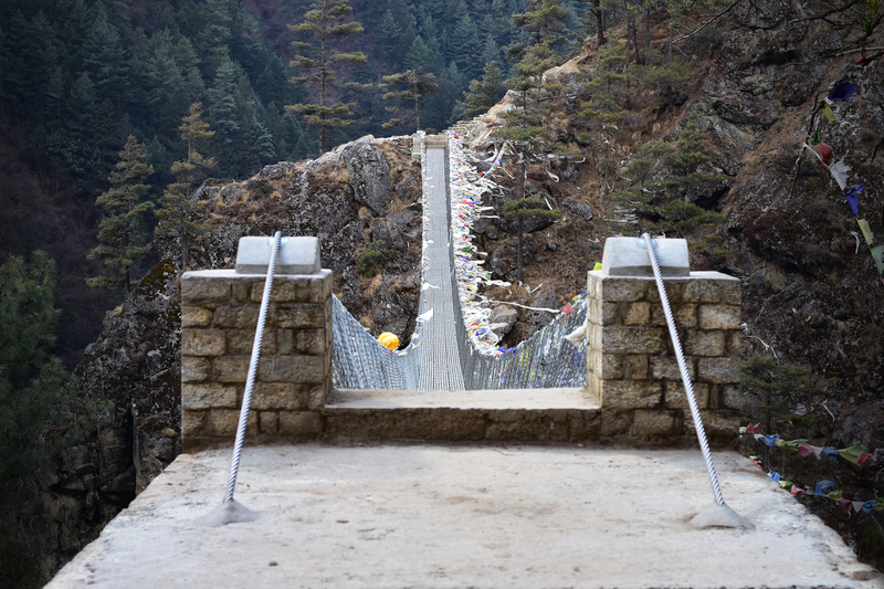
You cross suspension bridges like this one on the trek route
Namche Bazaar
Namche Bazaar sits high on a mountain, overlooking the confluence of two rivers. It’s the largest town in Sagarmatha National Park as well as the entire Khumbu region. But this is, of course, quite relative, as with fewer than a hundred buildings and around 2,000 residents, it’s actually a very small town.
Namche is an historic trading hub, and continues to be an important trading post among the Sherpa today. If you’re lucky enough to be there on a Saturday, you can visit the weekly market.

Namche Bazaar, the main settlement in Sagarmatha, as seen from above
{{leadmagnet-one}}
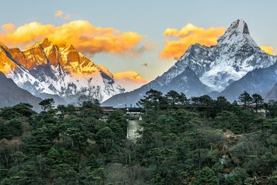
Ama Dablam
Namche Bazaar offers trekkers their first breathtaking view of the mountain Ama Dablam to the northeast.
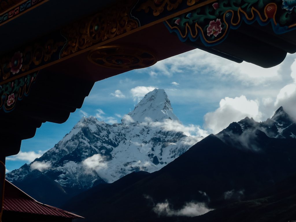
A monastic view, if you will, of Ama Dablam
This mountain keeps trekkers company for much of the Everest Base Camp route. It’s a favourite peak in the Everest region for its striking shape: it looks a little like a mother with outstretched arms. The word ama means ‘mother’ and dablam means ‘necklace’. The mountain’s glacier is somewhat reminiscent of the necklaces worn by Sherpa women.
Day 5 – Acclimatisation day in Namche Bazaar
- Highlight: Roundtrip hike to Hotel Everest View for tea
- Hotel Everest View elevation: 3,880 m / 2,730 ft
- Hike distance: 5.4 km / 3.4 mi
- Hike duration: 3 hours
- Overnight: Namche Bazaar (3,440 m / 11,286 ft)
- Accommodation: Same teahouse as the night before
It’s very important that we rest in Namche Bazaar for a day to allow our bodies to acclimatise to the high altitude. Remember, Namche is 3,440 m above sea level!

The fountain in the centre of Namche Bazaar
Following Hillary and Norgay’s successful Everest climb, tourism in the Everest region has grown tremendously. Namche’s topography makes it a natural departure point for a few different trekking trails, including the main one to Everest, so the town has grown in prosperity over recent decades.
In fact, Namche is one of Nepal’s wealthiest districts, with a higher average income than that of the capital city.
Namche is an exciting place to visit.
For starters, there’s Namche Monastery, the Sherpa Culture Museum, Sagarmatha National Park Museum, Lawudo Gompa, and more. It’s also a great base for some fantastic day trips, two of which we describe in a moment.
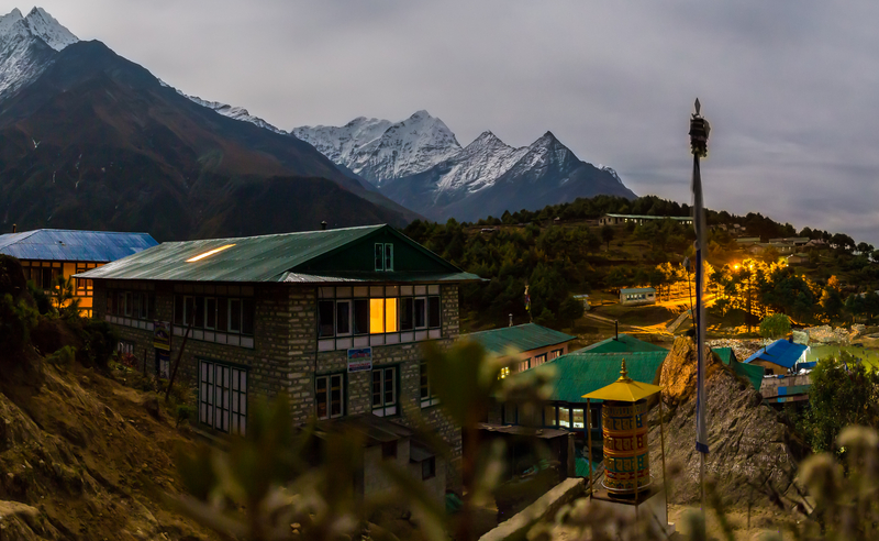
Night starts to fall over Namche Bazaar
Khumjung and Kunde day hike
Khumjung is a widely spread valley town. Almost all of the buildings have green or blue roofs, giving it an attractively cohesive look. Drystone walls divide the land into dozens of small fields. In summer, the village and surrounding mountains are covered in green.
It would be very appropriate to get excited about visiting Khumjung, as many consider it the prettiest of all the Sherpa villages!
Khumjung village is arguably the prettiest Sherpa village
Khumjung is home to the first school started by Sir Edmund Hillary’s Himalayan Trust. Speaking on the topic, Hillary said: “Reaching the summit of a mountain gives great satisfaction, but nothing for me has been more rewarding in life than the result of our climb on Everest, when we have devoted ourselves to the welfare of our Sherpa friends.”
Slightly higher in the valley, and to the west of Khumjung, is Kunde, another pretty village.

Kunde in its winter finery
Khumjung Monastery
One can also visit Khumjung Monastery, a small working Tibetan Buddhist monastery that’s colourfully painted and decorated. The monastery is famous for housing a purported yeti scalp (though you’ll be forgiven if you decide you don’t wish to actually see an ancient, severed scalp).
Khumjung Monastery
Mt Khumbila
Khumjung sits at the base of Mt Khumbila (5,761 m). Khumbila is said to be an old god, and its name actually means ‘God of Khumbu’. Most Sherpa people believe the mountain is too sacred to be climbed.

Mt Khumbila with a stupa in the foreground near Khumjung
Hike to Hotel Everest View
Another great day hike is that taking you for drinks at Hotel Everest View, the world's highest hotel! The hotel, which opened in 1971, sits at roughly 4,000 m (3,000 ft) and offers 360-degree views of the surrounding mountains, including your first peak of Mt Everest!
Hotel Everest View has a sublime location in the Himalayas
Can you picture yourself capsizing into a chair and then sipping coffee and eating cake while looking out through the glass at the soaring, white peaks of the Himalayas? Knowing you're doing all this at a higher elevation than anyone else in the world?
Take a look at this Google Earth map of the hotel's location to give yourself an idea of how high it really sits!
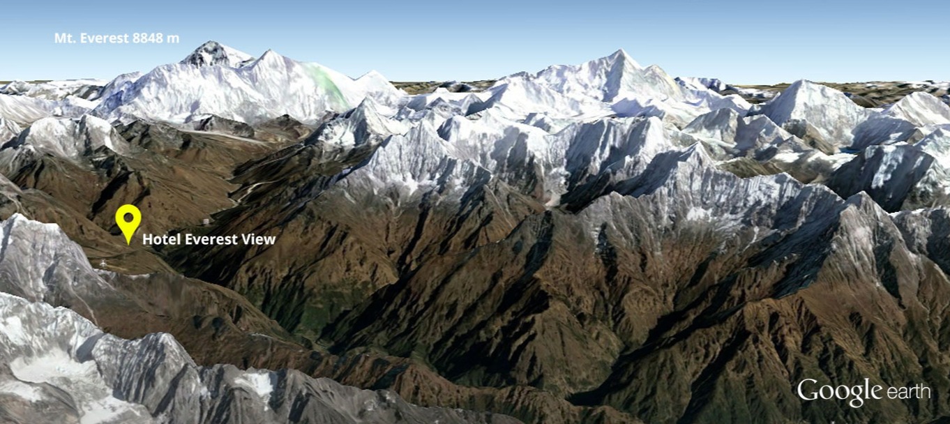
Google map of Hotel Everest View's location
The hike to the hotel and back to Namche Bazaar is also a great acclimatisation strategy, as you must climb up to the hotel, then you descend lower in elevation for the night. This is what we call the "hike high, sleep low" strategy, and it really is great in helping your body to acclimatise better to the high altitude.
Day 6 – Trek from Namche Bazaar to Tengboche
- Starting point: Namche Bazaar (3,440 m / 11,286 ft)
- Trek distance: 9.6 km / 6 mi
- Duration: 5 hours
- Highlight: Visit Tengboche Monastery
- Overnight: Tengboche (3,870 m / 12,696 ft)
- Accommodation: Teahouse
Today’s trek takes about five hours. You’ll feel the altitude as you climb, but hopefully the acclimatisation day in Namche Bazaar has steadied your body enough to cope. We again head up the valley, which involves trekking along forest paths, passing through small traditional villages, crossing some narrow suspension bridges, seeing magnificent snow-capped peaks ... just another day on the Everest Base Camp trek!
Many settlements in Khumbu use drystone walls to separate fields
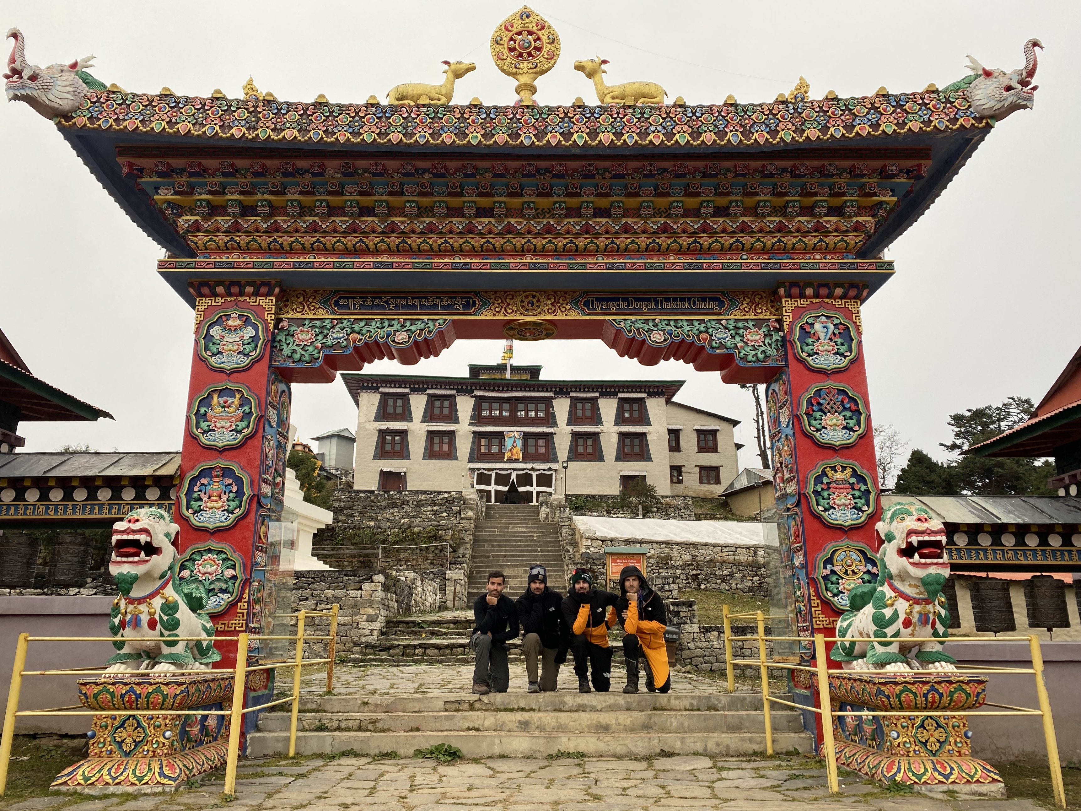
Tengboche
Tengboche (or Thanyboche), much like Namche, sits at the meeting point of two valleys. It overlooks the confluence of the Dudh Khosi and Imja Khola rivers. Head northeast out of town and you’re on the main trail to Everest Base Camp; head northwest and you’re heading to Gokyo Ri.

Mt Thamserkhu as seen from Tengboche with a very old stupa in the foreground
Tengboche Monastery
A highlight of stopping at Tengboche is visiting Tengboche Monastery, a working monastery and the largest in the Khumbu region.

Tengboche is a working Tibetan Buddhist monastery
It’s a relatively new gompa (religious building), having been built in 1916. The large gateway to the monastery is highly impressive, with a mythical creature on a pedestal standing guard to each side.
The gompa’s exterior is covered in colourful and ornate decorations and religious symbolism, but nothing can beat the exuberant display of colour on the inside. The monks themselves add to the mix, wearing traditional maroon robes. The monastery is very welcoming of visitors.
Entrance to Tengboche Monastery
Day 7 – Trek from Tengboche to Dingboche
- Starting point: Tengboche (3,870 m / 12,696 ft)
- Trek distance: 10.5 km / 6.5 mi
- Duration: 6 hours
- Highlight: Looking at Ama Dablam from Nangkartshang viewpoint
- Overnight: Dingboche (4,360 m / 14,304 ft)
- Accommodation: Teahouse
Today we hike for five to six hours to reach the village of Dingboche. We hike up out of the valley, leaving Imja Khola river well behind.

Dingboche is a small settlement, but as you can see from the sign: visitors are welcome!
Dingboche
Dingboche is a small settlement. It isn’t much of a looker: the buildings are utilitarian, and trees are a distant memory. But the mountains surrounding it are sublime, and Ama Dablam is on your porch.

Mt Nuptse and Lhotse as seen from Dingboche
The area has an alpine climate, and is always cold. Dingboche has an average temperature of just 1° C, and the thermometer doesn’t even crack 10° C at the height of summer. You can expect to feel the altitude keenly every time you exert yourself. Some find it starts to affect the quality of their sleep too. We’re really in the thick of the trek now.
Day 8 – Trek from Dingboche to Lobuche
- Starting point: Dingboche (4,360 m / 14,304 ft)
- Trek distance: 8.4 km / 5.2 mi
- Duration: 5 hours
- Overnight: Lobuche (4,940 m / 16,207 ft)
- Accommodation: Teahouse
Today we wind our way up a wide valley for five to six hours to reach Lobuche. The terrain in this area is pretty barren.
Lobuche
The settlements grow ever smaller and more modest the higher and further into the Himalayas we climb, and Lobuche is no exception. This far into the mountains we no longer look for cultural and religious gems but are just grateful for a hot meal and a bed to drop onto at night.
A view from above of Lobuche village
Lobuche is particularly busy in spring when porters pass through while transporting supplies to Everest Base Camp in preparation for summiting season in May.
Day 9 – Trek from Lobuche to EBC, then Gorakshep
- Starting point: Lobuche (4,940 m / 16,210 ft)
- Trek distance: 11.2 km / 6.8 mi
- Duration: 4 hours
- Highlight: Visiting Everest Base Camp, of course!
- Everest Base Camp elevation: 5,364 m / 17,598 ft
- Overnight: Gorakshep (5,164 m / 16,942 ft)
- Accommodation: Teahouse
Today is a big day: it’s Everest Base Camp day! It’s also one of our longest and toughest days, as we trek for nearly eight hours and for the first time climb above 5,000 m in elevation. Time to strap on some determination.
Everest Base Camp
For most of the year Everest Base Camp is empty, marked just by a sign and a flurry of wind-battered prayer flags. It’s a barren, rocky site, though of course the views in every direction are amazing.
Fun times at Everest Base Camp, cos you gotta celebrate!
If it’s important to you that you see Everest Base Camp when it’s in operation, then you need to do the trek in May. This is when the camp is awash with tents and teems with mountaineers and support staff. It’s exciting to watch people from around the world readying themselves to summit Everest.
Gorakshep
After glorying in having reached Everest Base Camp, we turn around and trek back the way we came for a little while to reach the small settlement of Gorakshep. Gorakshep exists to service hikers tackling the EBC trek as well as those transporting goods to and fro from Everest Base Camp in season.

Gorakshep is small and its amenities are spare
You can expect a cold night whatever the time of year, as shown by the graph below.

Day 10 – Hike up Kala Patthar, then trek to Dzongla
- Starting point: Gorakshep (5,164 m / 16,942 ft)
- Kala Patthar elevation: 5,645 m / 18,519 ft
- Distance trekked: 10.4 km / 6.2 mi
- Hours trekking: 8-10 hr
- Highlight: Epic view of Everest from Kala Patthar
- Overnight: Dzongla (4,830 m / 15,850 ft)
- Accommodation: Teahouse
Today we hike up Kala Patthar, reaching our highest elevation (5,643 m) along the entire Everest Base Camp route. We then trek to Dzongla for the night. We’ll be on our feet for six to seven hours today.

The trail becomes barren and strewn with boulders, rocks and scree the higher we climb
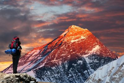
Kala Patthar
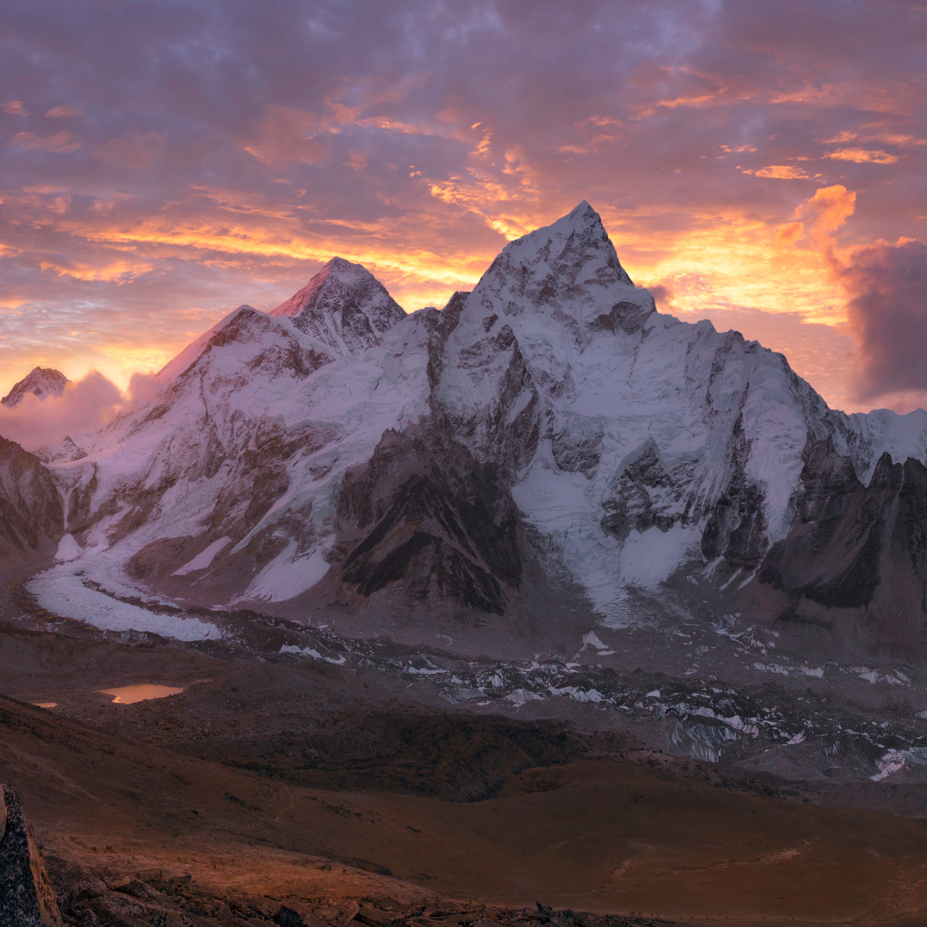
Kala Patthar means ‘black rock’ in Hindi, Urdu and Nepalese. This black rock near Gorakshep has become an absolute must on the Everest Base Camp route as it offers you your best and closest view of Mt Everest. You don’t actually see Everest from base camp, which is good to know beforehand so you’re not disappointed. Kala Patthar is therefore where it’s at.

You can expect to find extreme fatigue and euphoria at the top of Kala Patthar
The climb up Kala Patthar is a steep and tough one, so it’s good that we tackle it first thing in the morning.
Dzongla
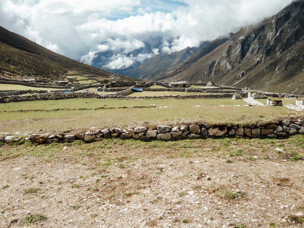
After standing in the conqueror pose atop Kala Patthar, we leave the main Everest Base Camp route to trek to the village of Dzongla (4,830 m). This is another small and remote settlement in the vein of blink and you might miss it.

There are many gompas and prayer flags along the EBC route
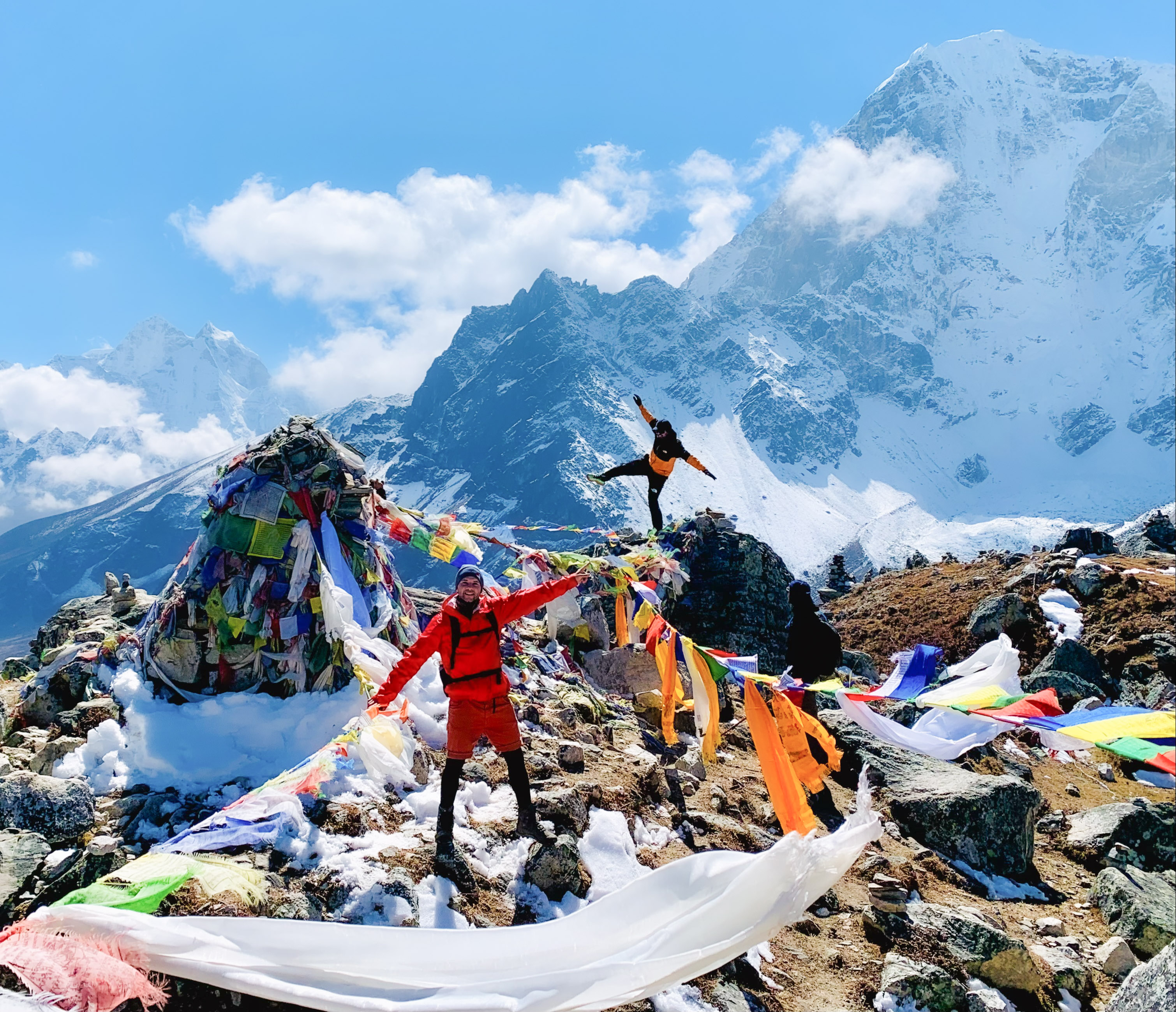
Day 11 – Summit Cho La, then head to Tagnag
- Starting point: Dzongla (4,830 m / 15,850 ft)
- Cho La elevation: 5,420 m / 17,782 ft
- Distance trekked: 9.4 km / 5.8 mi
- Hours trekking: 5-6 hr
- Highlight: Epic views from Cho La!
- Overnight: Tagnag (4,700 m / 15,420 ft)
- Accommodation: Teahouse
Some might think that having visited Everest Base Camp, the excitement of the trek is mostly over. So wrong. Today’s trek route takes us all the way up to Cho La Pass (5,420 m) for some panoramic views. We then hike down to Tagnag (4,700 m), also called Dragnag, for the night.

Tagnag is the first village you encounter after crossing Cho La
Today is another very long day: we walk for nearly eight hours, and there are some steep ascents. Hopefully you haven’t eaten all your energy bars just yet.
Cho La
The mountain pass of Cho La is 5,420 m (17,782 ft) above sea level. The pass can be dangerous if you’re unfamiliar with it, which is why it’s vital that one hike it with a trek guide, as we do. The going is steep, and the ground can be rocky, loose and icy, with large boulders along the way.

Crossing Cho La
This is arguably the wildest, most formidable part of the entire Everest Base Camp and Gokyo Lakes trek route.
Day 12 – Trek from Tagnag to Gokyo
- Starting point: Tagnag (4,700 m / 15,420 ft)
- Distance trekked: 4.4 km / 2.8 mi
- Hours trekking: 4 hr
- Highlight: The stunning location of the village of Gokyo
- Overnight: Gokyo (4,750 m / 15,584 ft)
- Accommodation: Teahouse
Today we trek to the village of Gokyo (4,700 m), and see the beautiful Gokyo Lakes! This is a spectacular day indeed. And after yesterday’s huge effort, it’s a relatively tame trek of just four hours.

The village of Tagnag (or Dragnag) as seen from Cho La
{{leadmagnet-two}}
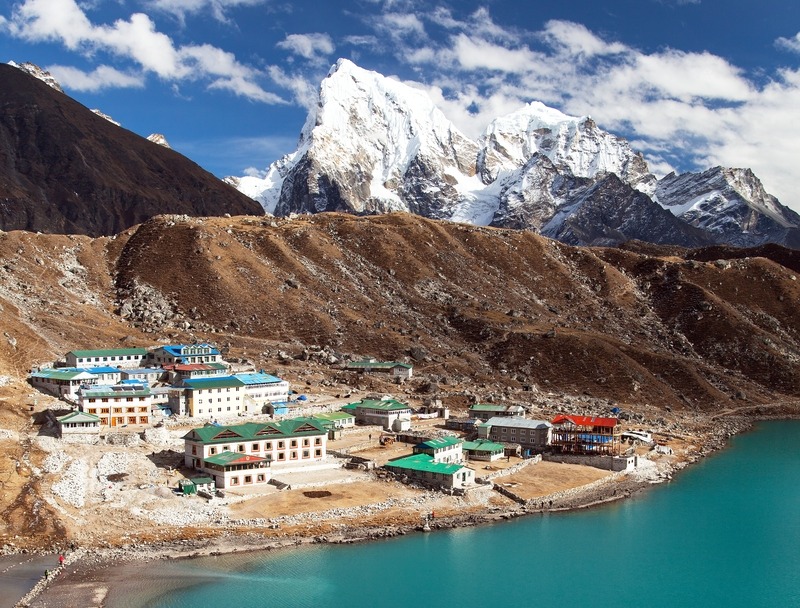
Gokyo Lakes
The Gokyo Lakes are six lakes sitting between 4,700 m and 5,000 m above sea level. The largest lake is Thonak Lake.

The Gokyo Lakes are sacred to both Buddhists and Hindus
The Gokyo Lakes are the world’s highest freshwater lake system, and they serve as an important wetland for migratory birds. Depending on when in the year you visit Gokyo, you can look out for ruddy shelducks, known locally as Brahminy ducks. These ducks are some of the most attractive you’ll ever see, being a beautiful mix of tan, white and black. They each have a black ‘choker’ encircling the neck, which makes them easy to identify.

Two ruddy shelducks
In late spring and summer the lakes are surrounded by green banks and mountains. In autumn there are red shrubs with snow starting to encroach on the lakes’ shores. And in winter, snow lays a white blanket over the entire landscape.
The Gokyo Lakes are important to both Hindus and Buddhists. Every year about 500 pilgrims come to the lakes in August to take a dip during Janai Purnima, a sacred festival in Hinduism.
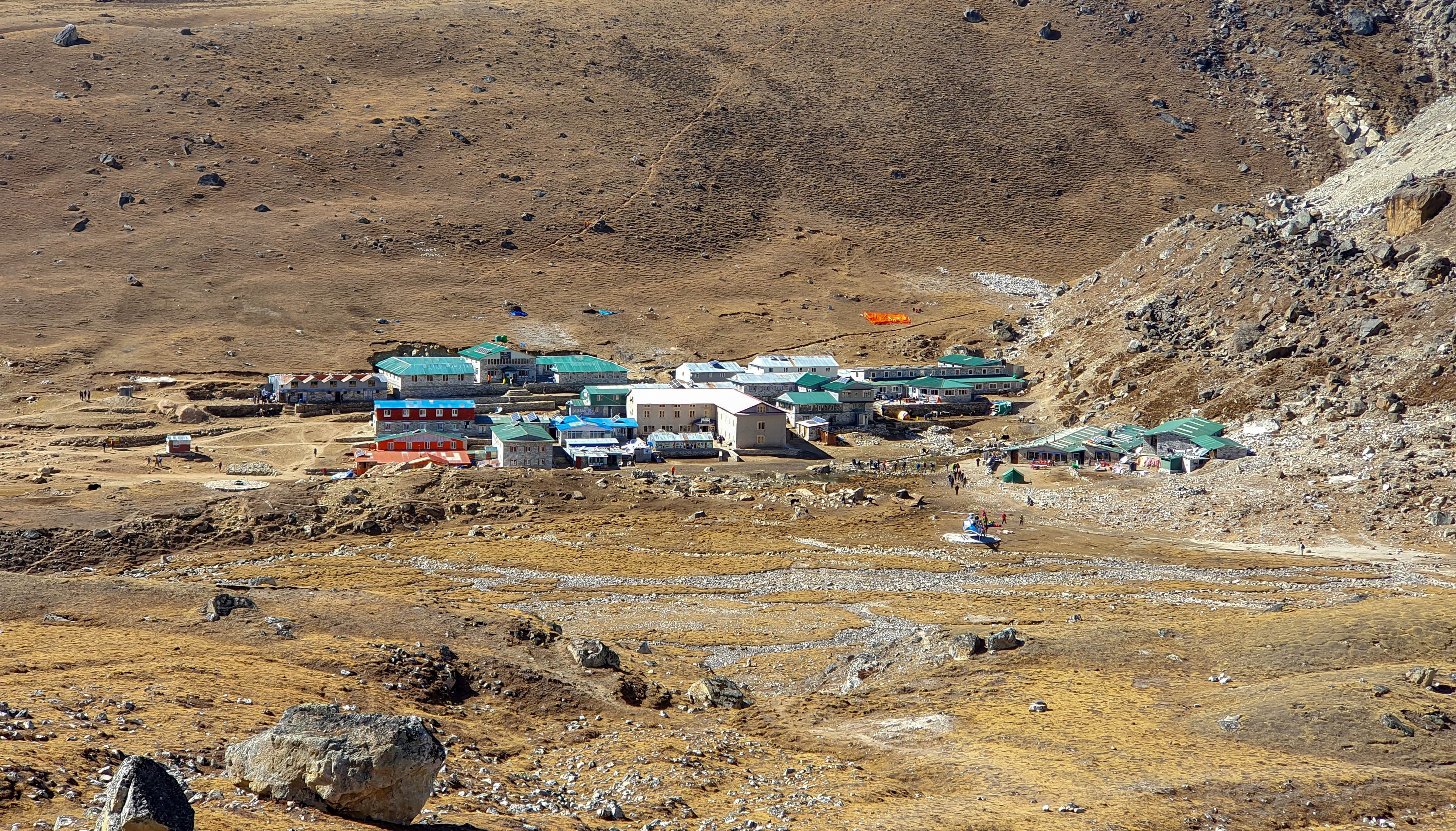
Gokyo
The tiny settlement of Gokyo on the shore of Dudh Pokhari Lake is a popular overnight stop with trekkers.
Gokyo receives about 7,000 visitors annually. But it’s a seasonal village, with locals moving in during the warmer months to service tourists, then moving down to milder villages like Namche Bazaar for the colder months.
The small village of Gokyo
Day 13 – Summit Gokyo Peak, then trek to Machhermo
- Starting point: Gokyo (4,750 m / 15,584 ft)
- Gokyo Ri elevation: 5,357 m / 17,575 ft
- Gokyo Ri hike distance: 4 km / 2.4 mi
- Hiking time: 3-4 hours
- Overnight: Machhermo (4,470 m / 14,665 ft)
- Distance trekked: 7 km / 4 mi
- Hours trekking: 1.5 hr
- Highlight: The incredible view from atop Gokyo Ri!
- Accommodation: Teahouse
Today we head northeast out of Gokyo to summit Gokyo Peak (5,357 m), known locally as Gokyo Ri. Then we head south to the village of Machhermo. We trek for four to five hours in total, the same as yesterday.
Gokyo Ri and Ngozumpa Glacier

Here you can see the village of Gokyo with the glacier Ngozumpa above it
Standing atop Gokyo Peak you can see four of the world’s 14 peaks reaching above 8,000 m! They are:
- Everest, which at 8,848 m is 237 m taller than the next highest mountain, K2
- Lhotse, which at 8,516 m is the fourth highest mountain
- Makalu, which at 8,485 m is the fifth highest mountain
- Cho Oyu, which at 8,188 m is the sixth highest mountain

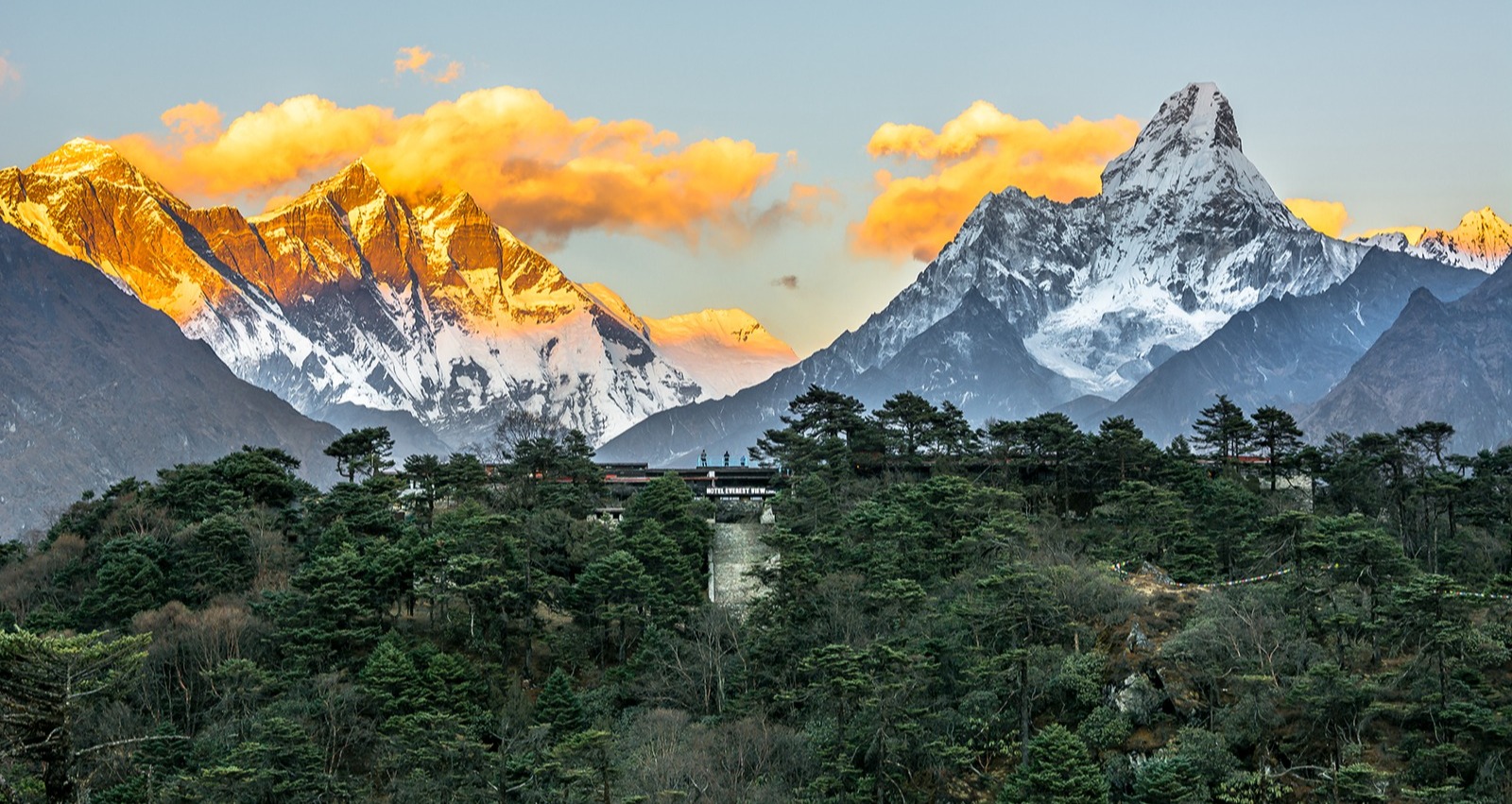
Mt Cho Oyu
Also, to the east of Gokyo Peak is Ngozumpa Glacier, Nepal’s longest glacier.
Standing on Gokyo Peak, you really won’t know which way to look first. Happy problems.
Machhermo and the Dudh Khosi
Machhermo sits in the Dudh Khosi River valley. It’s a small village, and while it’s not much in and of itself, the hike there and back is what makes this excursion incredibly special. We walk along contour paths and witness the Dudh Khosi in its infancy – a brisk, boulder-strewn stream in a steep mountain valley. (Eventually the Dudh Khosi is fed by the waters of the Imja Khola and widens out, flowing through the valley we trekked in our outward journey.)

Machhermo is dwarfed by the surrounding mountains
The views today are truly inspiring, whether decked with snow or covered in grass and shrub. It’s also easy to feel this little neck of the Himalayas is yours entirely, as we’re far from the trekking crowds here.
Day 14 – Trek from Machhermo to Namche Bazaar
- Starting point: Machhermo (4,470 m / 14,665 ft)
- Distance trekked: 9.6 km / 5.6 mi
- Hours trekking: 5-6 hr
- Overnight: Namche Bazaar (3,440 m / 11,286 ft)
- Accommodation: Teahouse
Today’s trek from Machhermo to Namche Bazaar takes about four to five hours. It’s a very pretty part of the Everest Base Camp route, and we pass through a handful picturesque mountainside villages like Dole along the way.

Leaving Machhermo
As the trek is relatively short, we reach Namche in good time, and you might like to visit any of the sites in the town you weren’t able to fit in on the outgoing trek.

Yaks and yak-cow hybrids are used throughout the Himalayas to transport goods
Day 15 – Trek from Namche Bazaar to Lukla
- Starting point: Namche Bazaar (3,440 m / 11,286 ft)
- Overnight: Lukla (2,860 m / 9,383 ft)
- Accommodation: Teahouse
- Distance trekked: 17.6 km / 10.7 mi
- Hours trekking: 7-8 hours
Today’s trek takes about five hours.
We’ll be on familiar turf here, hiking the same route as Days 1 and 2 in reverse. Having built up you trekking muscles over so many days, as well as descending into more oxygen-rich air, you might feel like you have the strength of a star athlete today.
You'll see the village of Phakding again today
Day 16 – Transfer to Kathmandu
- Flight: Lukla to Manthali Aiport (15 min)
- Drive: Ramechhap to Kathmandu (5 hr)
- Overnight: Thamel district, Kathmandu
- Accommodation: Arushi Boutique Hotel (or similar)
Today we say goodbye to Khumbu and fly to Manthali Airport in Ramechhap. We then drive in our private vehicle back to Thame in Kathmandu.
While it’s a sad day in many ways, our hotel in Kathmandu is ready to comfort us with hot baths and plush towels! At dinner tonight we’ll relive the adventures of the past two weeks. 😊
You might choose to spend some of today exploring some of Kathmandu's landmarks
Day 17 – Depart Nepal
- Drive: Kathmandu to Tribhuvan International Airport (30 min)
It's departure day, so we take you to the airport where we bid you farewell and (hopefully!) see you soon.
However, depending on the time of your flight, you might have time to do some exploring in Kathmandu!
While in Kathmandu, we recommend going on the heritage walk from Thamel that takes you to places tourists don't always see, like old streets, temples and markets. You can also visit Kathmandu Durbar Square, which is a UNESCO site for its historic temples, palaces and palace courtyards.
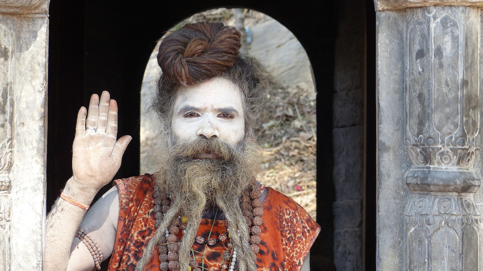
Kathmandu is a very religious city
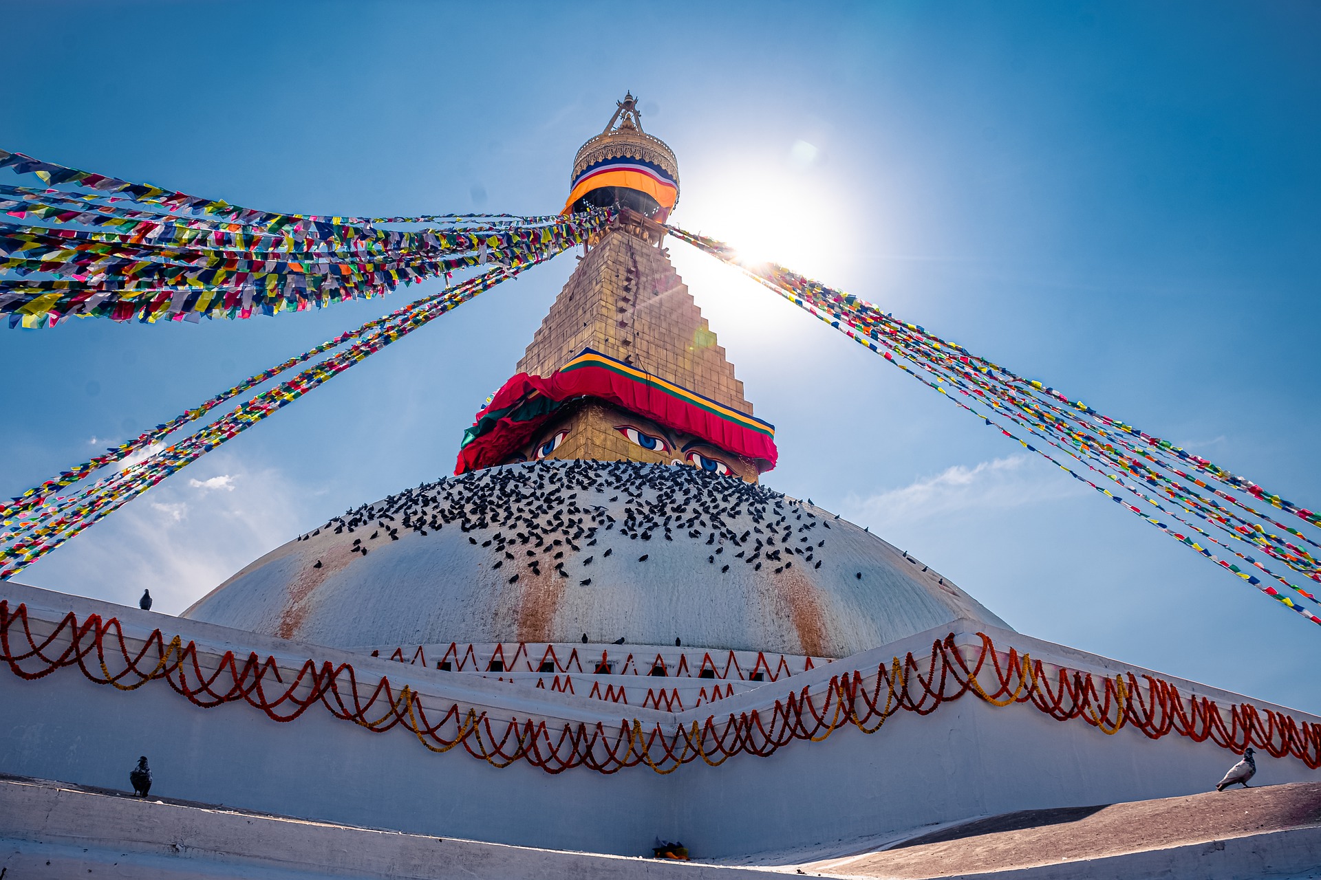
You might also like to pay a visit to Swayambhunath (also referred to as Monkey Temple), just west of the city on a hilltop. This ancient religious complex is an extremely important pilgrimage site for Tibetan Buddhists. It contains a large stupa, several shrines and temples, a monastery, and a museum. The name swayambhunath means 'sublime trees', and yes, there are a variety of lovely trees all over the complex to enjoy.
Something else you might like to consider for your day in Kathmandu is taking a cooking class at Nepal Cooking School. How awesome to go home and know how to reproduce a taste of the yummy Nepali food you've no doubt grown to love this past fortnight!