


EBC and Three Passes itinerary
As is the case with many multiday treks, the Everest Base Camp and Three Passes trek allows some flexibility in how you approach it. For instance, you can:
- walk the middle section in a clockwise or counterclockwise direction
- choose between different villages for your overnight stays
- decide how many acclimatisation and rest days you take
In this post, we describe the EBC and Three Passes trek route itinerary that we use at Follow Alice. It's a trail of 124 km (77 miles), not counting the optional round-trip hikes on the three acclimatisation and rest days.
Map of the EBC and Three Passes trek

Map of the EBC and Three Passes trek route
From the map above, you can see that we walk the route in an anticlockwise direction. This is the ideal choice as it gives you enough acclimatisation time. Also, you climb the passes in the mornings with the sun on your back, which is nicely warming.
We also include three rest and acclimatisation days, which are important for your health. If you have more questions, please schedule a call with our team, and we will be happy to help.
So let's tuck into all the juicy details of the trip ...
Day 1 – Arrive in Kathmandu
- Arrival: Tribhuvan International Airport
- Overnight: Thamel, Kathmandu
- Drive: Airport to Thamel (30 min)
- Accommodation: Arushi Boutique Hotel (or similar)
Kathmandu is chockfull of stupas and other religious monuments
On this day, we fetch you from Tribhuvan International Airport and drive you for about twenty minutes to the hotel in Thamel, a busy and vibey district of Kathmandu.
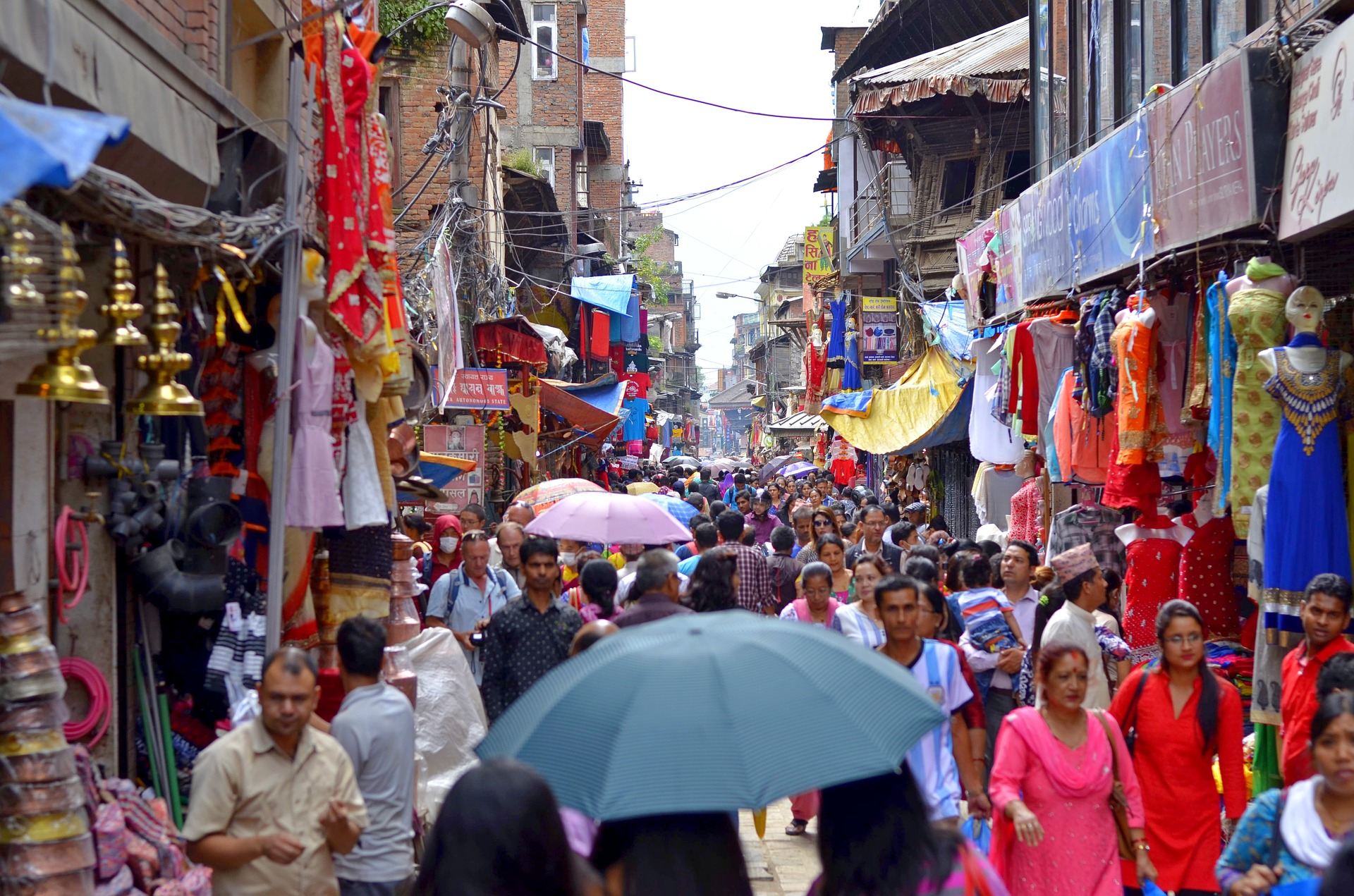
If you're not too tired from your trip, we encourage you to spend some time exploring Kathmandu. Even just walking the streets of Thamel – observing the architecture, mixing with the locals and trying some of the local cuisine – is a grand experience. The narrow lanes in the core of Thamel are only for pedestrians and are great for leisurely explores.
If you've forgotten anything for your trek or want to hire something, Thamel has a wide range of trekking gear shops, so you're sorted on that front. You can also buy a cheap SIM card for your time in Nepal.
If you feel like the Nepali equivalent of a bus-top tour, we recommend hopping on a rickshaw for a fun way to see the sights of Thamel. Or if you'd like to visit somewhere a little less busy, $2 gets you entrance into the Edwardian-style Garden of Dreams. Wander around and admire the pavilions, pergolas, sculptures, fountains and lily pads, verandahs and birdhouses, or just chill with a book and a drink on the grass. If you've forgotten to bring along some reading material, Thamel actually has quite a few bookstores that stock English literature.
Tonight we enjoy dinner together as a group and chat about what to expect in the upcoming days.

Kathmandu is a busy and humming city, night and day
Day 2 – Drive to Manthali
- Drive: Kathmandu to Manthali (5 hr)
- Overnight: Manthali
- Accommodation: TBD
A lovely view of the district of Ramechhap as snapped by S. Pradhan
This morning, we drive southeast in our private vehicle to reach the pretty district of Ramechhap so that we can catch a flight from Manthali Airport tomorrow to Lukla, the start of the EBC trek.
We can't unfortunately fly straight to Lukla from Kathmandu, as Tribhuvan International Airport is currently undergoing major construction that doesn't allow for domestic flights to take off and land there. This is why we've had to add another two days to this itinerary, to allow time to reach Manthali Airport in Ramechhap.
Day 3 – Trek to Phakding
- Flight: Ramechhap to Lukla (15 min)
- Starting point: Lukla (2,860 m / 9,383 ft)
- Overnight: Phakding (2,610 m / 8,562 ft)
- Accommodation: Teahouse
- Distance trekked: 8.2 km / 5.1 mi
- Hours trekking: 3 hours

We fly from Kathmandu to Lukla Airport, shown above
This morning, we take a short and exhilarating flight east from Raemchhap in a small aircraft to the mountainside town of Lukla. The flight is a moment in itself, offering incredible views of the mountains. And landing at Tenzing-Hillary Airport is not something you sleep through – this short runway perched on the side of a mountain demands just the right weather conditions and a skilled pilot!
Flight done and dusted, we then hand over our duffel bags for transport via yaks, put on our daypacks, and get walking. 😀 We head northwest out of Lukla on the start of the famous EBC trail! Whoop whoop! The route today isn't that tough or long, and we follow a nicely worn footpath through Sherpa countryside.
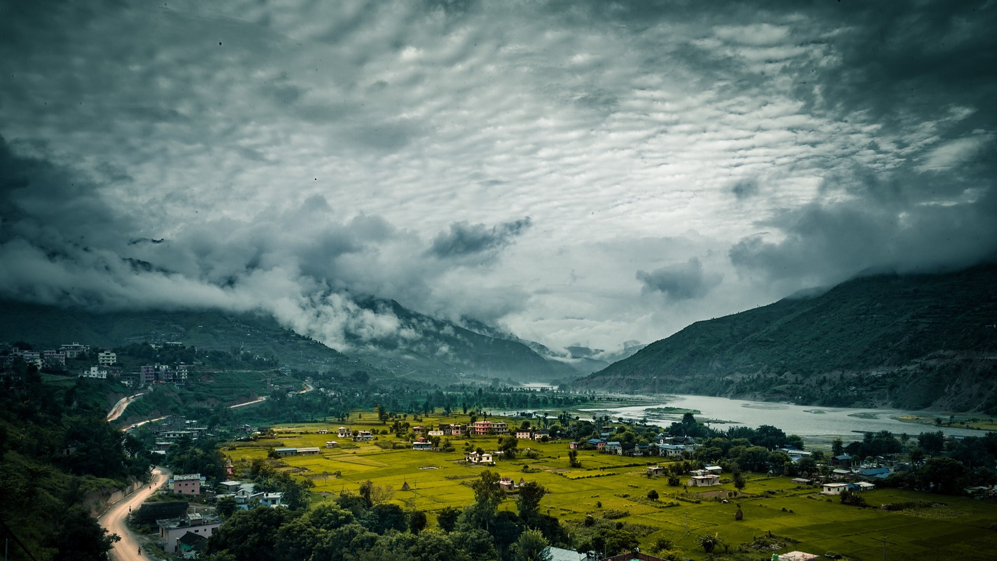
This section of the trek is incredibly pretty. We soon enter the lush and forested Dhudh Kosi river valley and wind our way up the valley, with the river staying on our left. En route, we pass by picturesque Sherpa settlements, like Surke (shown below).

The village of Surke near the river Dudh Kosi
What some might not realise is that the Everest Base Camp trek route is not a hikers-only path. Rather, the route followed by trekkers is the long-established 'highway' used every day by locals. There's no road or larger route connecting the various towns and villages of the Sherpas – the EBC trek route is the main thoroughfare. So expect to share the path with tourists and Sherpas alike, as well as yaks, horses and mules.
The prettily situated village of Phakding
We spend our first night on the trail in the pretty riverside village of Phakding. Phakding is actually at a lower elevation than Lukla, so your body won't be challenged by an altitude increase just yet.
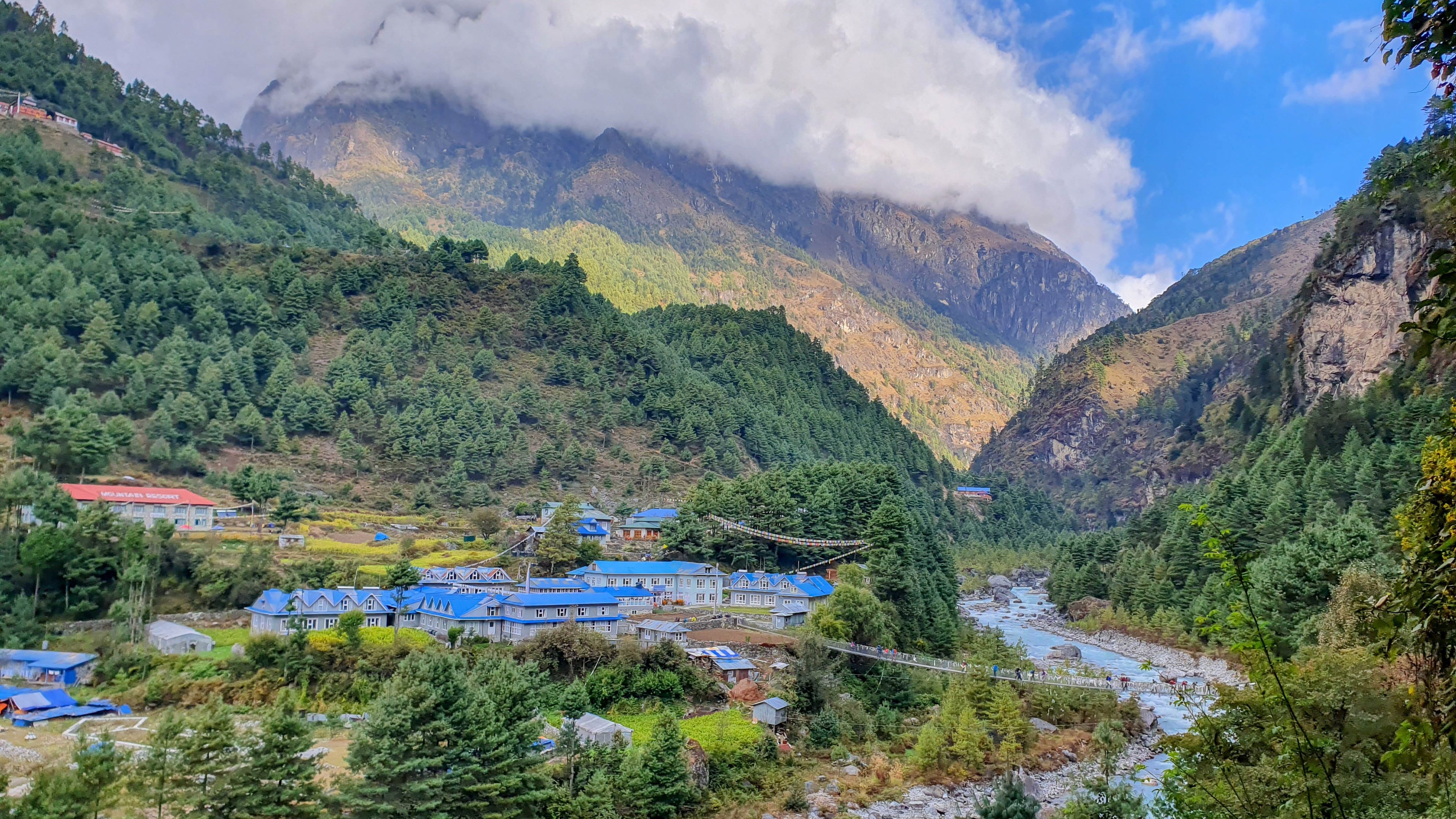
Day 4 – Trek to Namche Bazaar
- Starting point: Phakding (2,610 m / 8,562 ft)
- Overnight: Namche Bazaar (3,440 m / 11,286 ft)
- Accommodation: Teahouse
- Distance trekked: 9.4 km / 5.6 mi
- Hours trekking: 6-7 hours
- Highlight: Cross the Hillary Suspension Bridge
Today is a day of multiple suspension bridge crossings
Today's trek continues up the Dhudh Kosi Valley. During today's hike, we enter Sagarmatha National Park, a UNESCO World Heritage Site. We pass the lovely Toktok Waterfall near the park's entrance, and it's a great location for a little rest stop.
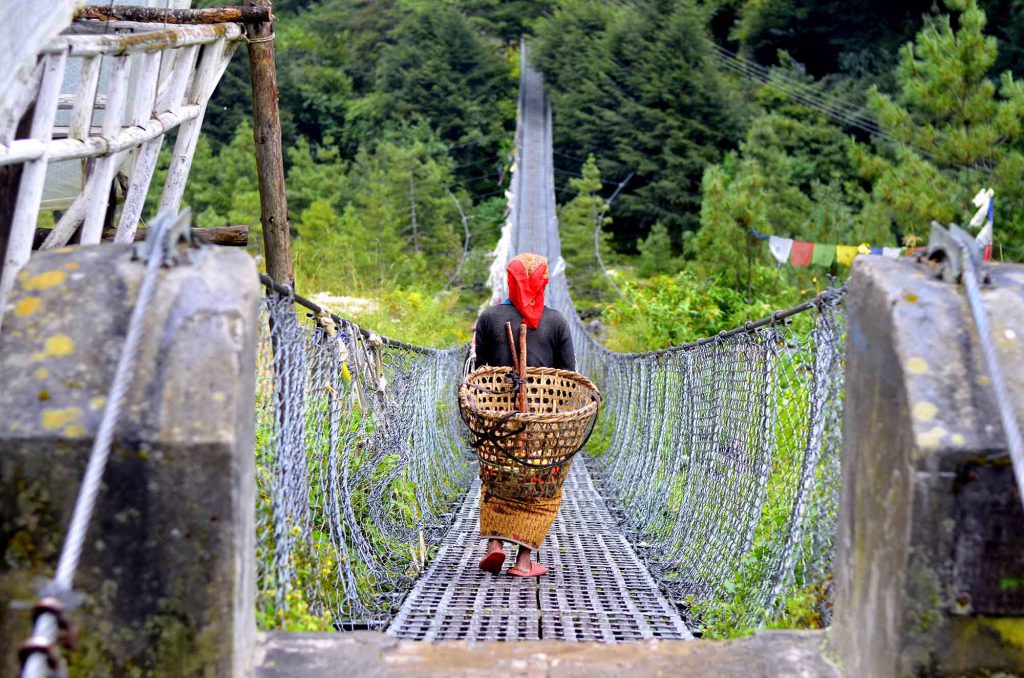
What's especially fun and noteworthy today are all the bridges we must use as we crisscross the river! The suspension bridges are draped in multicoloured prayer flags and are often high above the river. We share them with yaks and mules. The Edmund Hillary Suspension Bridge is the biggest showstopper: it sits 125 m (410 ft) above the river and is 140 m (459 ft) long – quite the daunting prospect if you struggle with heights!
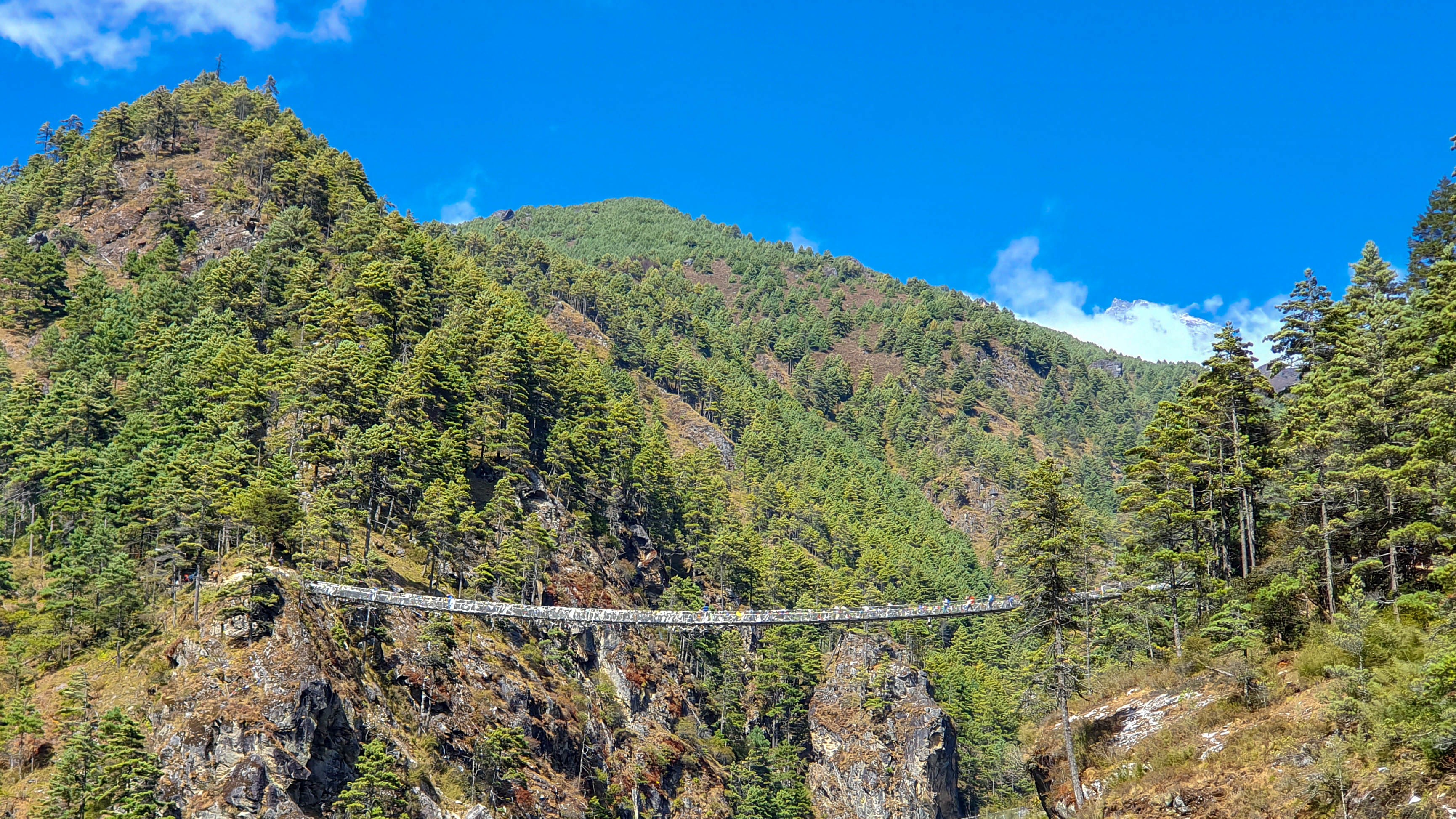
We cross the Edmund Hillary Bridge en route to Namche Bazaar
Pro tip: Don't enter a suspension bridge if there are yaks or mules busy crossing it, as they could well knock you over.
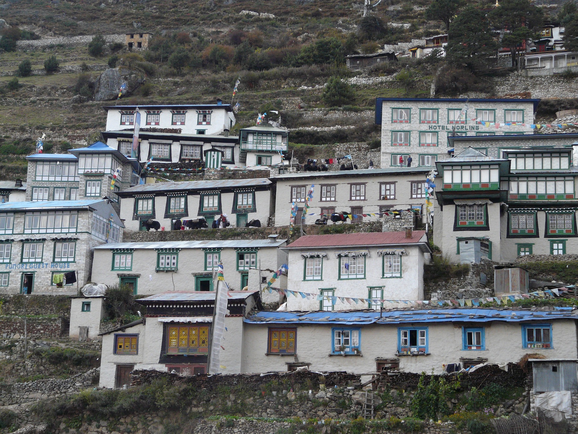
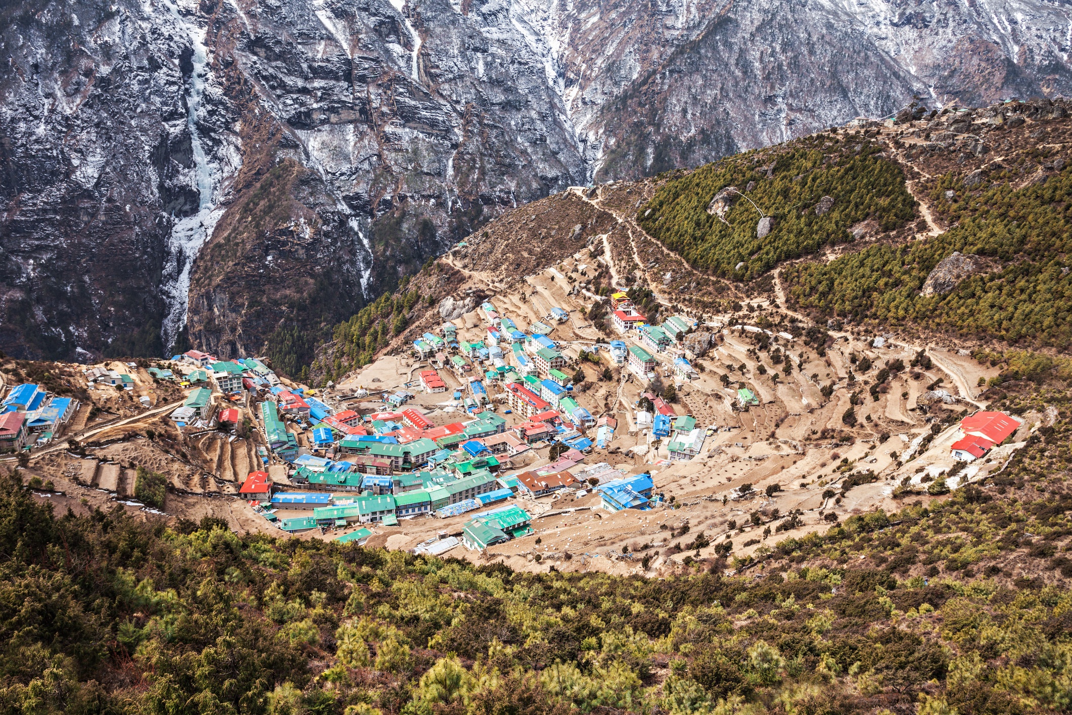
After this bridge, it's a steep and taxing climb up to Namche Bazaar, which sits on a high outcrop at the confluence of the Dudh Koshi and its tributary, the Bhote Khosi. Today is when the change in altitude can really be felt (we climb nearly a vertical kilometre!), and so taking a rest tomorrow is paramount.
{{leadmagnet-one}}
Namche has so much to offer the curious trekker, though most are tired from the trek and leave the exploration for tomorrow. A great treat after arriving is afternoon tea at one of the cafés. For many, the German Bakery is a great choice as it offers a comforting taste of home in the form of cappuccinos and dark chocolate cake.

Namche Bazaar is a regional hub and the largest Sherpa town
Day 5 – Acclimatisation and Hotel Everest View hike
- Overnight: Namche Bazaar (3,440 m / 11,286 ft)
- Accommodation: Teahouse
- Highlight: Hike to Hotel Everest View for tea
- Hotel Everest View elevation: 3,880 m / 2,730 ft
- Hike distance: 5.4 km / 3.4 mi
- Hiking time: 3 hours
Namche Bazaar is a town of steeply terraced buildings, so most of the buildings offer great views!
It's important to give your body time to adjust to the higher altitude, so today we stay put in Namche. That said, there are lots you can choose to do, like visit the Sherpa Museum or a local monastery, or do a beautiful day hike to Everest View Hotel for a drink and snack.
There are plenty of shops in Namche Bazaar for stocking up on snacks and any other trekking whatnots you might need. There are a couple of ATMs in town, but they don't accept all cards, and we wouldn't rely on them in case they're not working. The better option is to bring enough rupees with you, or exchange dollars or euros at the local bank in Namche.
Some like to do a day round-trip hike to Hotel Everest View, the famous hotel that opened in 1971. From here you can have drinks or a bite to eat while enjoying panoramic views that do, of course, include Mt Everest!
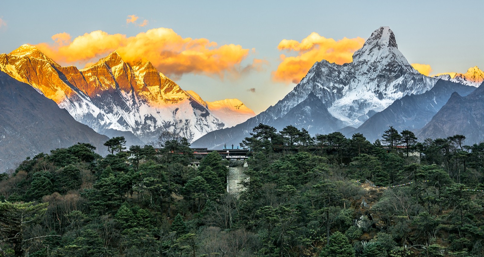
Hotel Everest View was built in the 60s and is one of the world's highest hotels
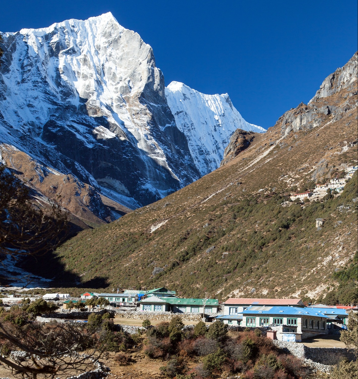
Day 6 – Trek to Tengboche
- Starting point: Namche Bazaar (3,440 m / 11,286 ft)
- Overnight: Tengboche (3,870 m / 12,696 ft)
- Accommodation: Teahouse
- Distance trekked: 9.6 km / 6 mi
- Hours trekking: 5-6 hours
- Highlight: Visit Tengboche Monastery
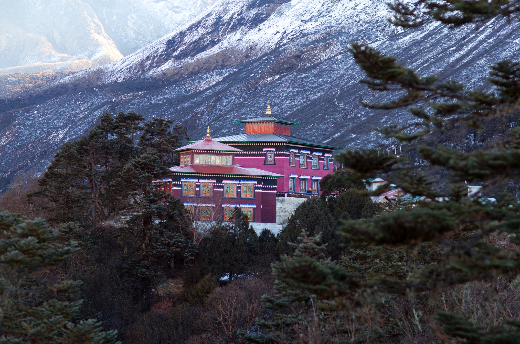
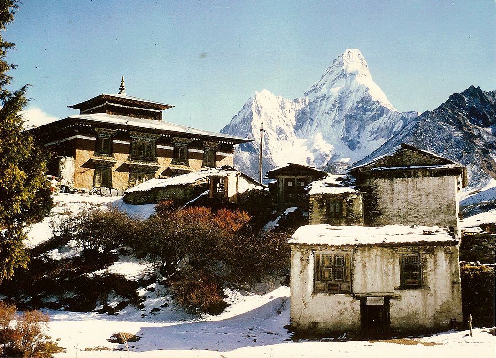
Tengboche Monastery is the largest in the Khumbu region
Today we head in a northeasterly direction up the Pheriche Valley to reach the village of Tengboche. We walk a pretty smooth and flat contour path for a long way. Eventually, the trail descends to the valley floor. And then, to reach Tengboche (or Thyanboche), which sits on a hill at the confluence of the Dudh Kosi and the Imja Khola, there's a big climb.
The views on today's hike of Lhotse, Everest and Ama Dablam are unforgettable!
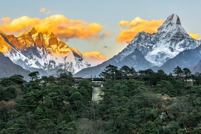
Given its high position on a hill, Tengboche offers visitors a view of some amazing peaks, which include Tawache, Everest, Nuptse, Lhotse, Ama Dablam, and Thamserku. When viewed from Tengboche, Ama Dablam looks like a mother with outstretched arms. The mountain's name literally means 'mother's necklace'. It's a favourite among many who trek in the region for its striking shape and beauty. It can also be seen on many days of the EBC trek, almost like a mother keeping an eye on things!
Local Sherpas use the EBC trek route as their primary means for getting around the region
Tengboche Monastery – also known as Dawa Choling Gompa – is a Tibetan Buddhist monastery. It's the largest in the whole Khumbu region, and is most definitely worth a visit! It contains a 20-foot Buddha sculpture, as well as detailed wall hangings, clothes and musical instruments. Visitors can also observe a prayer ceremony.
Here you can see Ama Dablam behind Tengboche in a 1974 photo by clemensmarabu
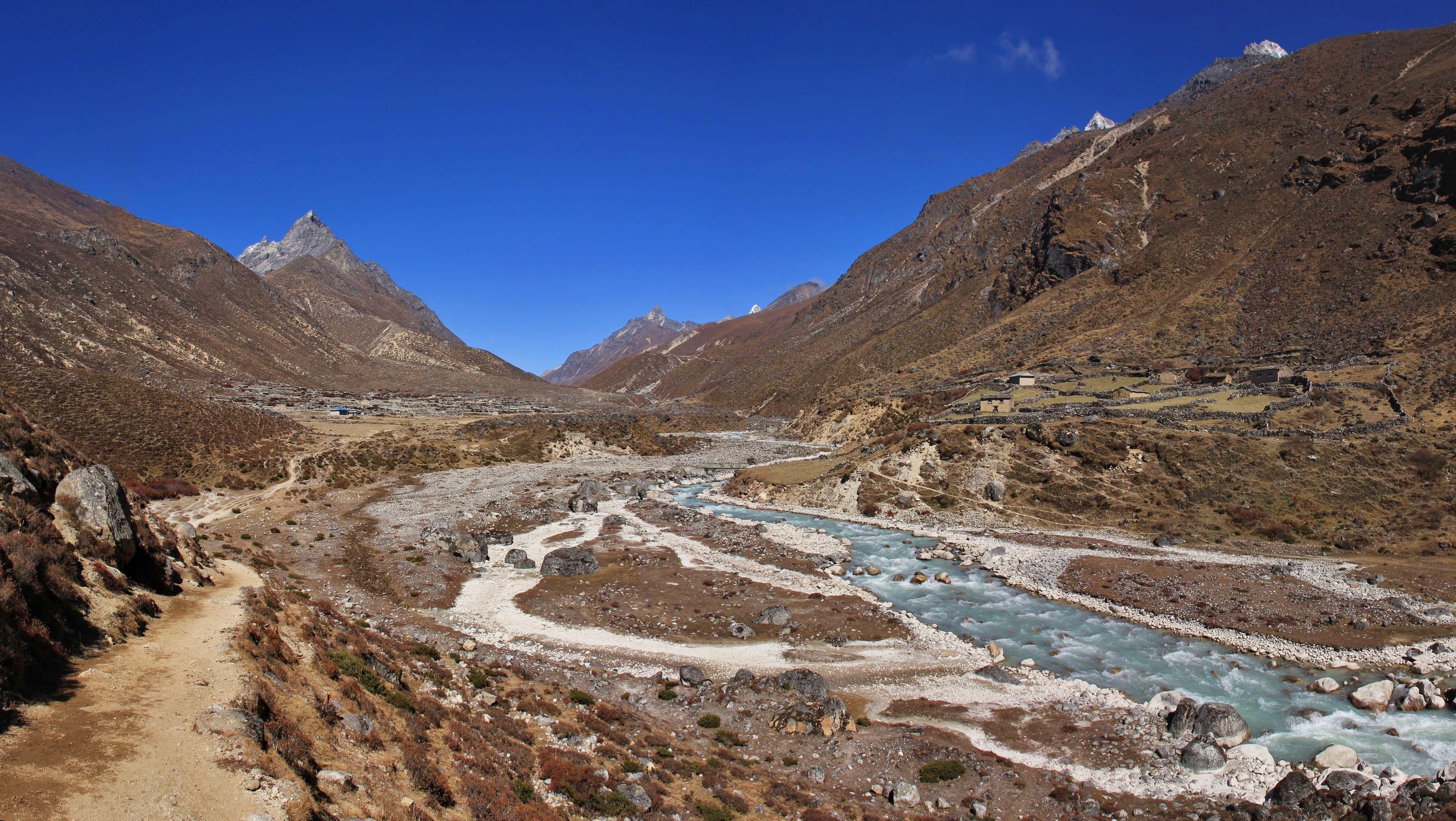
Day 7 – Trek to Dingboche
- Starting point: Tengboche (3,870 m / 12,696 ft)
- Overnight: Dingboche (4,360 m / 14,304 ft)
- Accommodation: Teahouse
- Distance trekked: 10.5 km / 6.5 mi
- Hours trekking: 6 hours
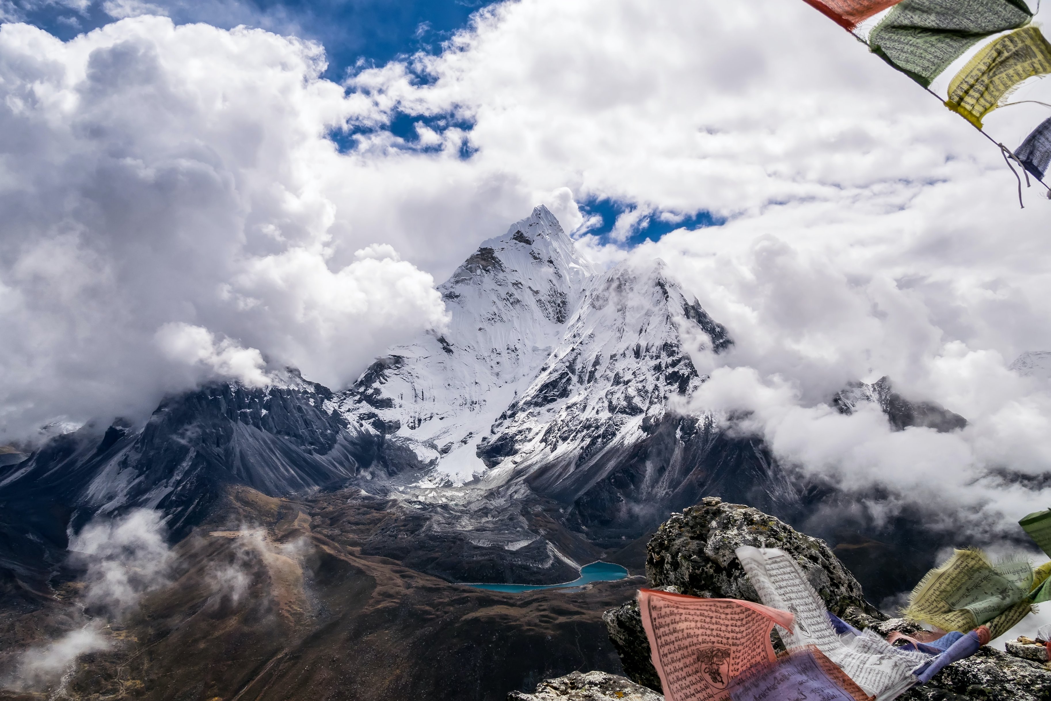
- Highlight: The view from Nangkartshang Peak
View of the beautiful Ama Dablam from Nangkartshang Peak above Dingboche
We climb up the Imja Khola valley, walking through woods and enjoying increasingly spectacular views of the snow-capped peaks towering around us. Ama Dablam and Island Peak, in particular, are breathtaking.
Three kilometres out of Tengboche, we pass by Pangboche (3,985 m), the highest year-round settlement in the valley. This green-roofed village is the base camp for trekkers climbing nearby Ama Dablam. Its monastery is the oldest in the region, and is famed for its supposed yeti scalp.

Glaciers, moraines, the village of Pangboche and the Imja Khola river
A little way before Dingboche, there's a fork in the road: those following the classic EBC trek keep left and head towards the village of Pheriche. We keep right, however, and soon cross a bridge, after which we tackle a steep climb up to Dingboche.

Welcome to Dingboche!
If you're a strong trekker who has made good time in reaching Dingboche, then we recommend taking on the additional climb to Nangkartshang Peak (which is a bit of a misnomer, as it's more a sub-peak of a higher ridge). From here, you have an incredible and rewarding vantage point of the surrounding mountains; you can see various beauties like Ama Dablam, Kangtega, Nuptse, Lhotse, Makalu, Cho Oyu and Taboche.
Dingboche with Island Peak in the distance
Day 8 – Trek to Chhukung
- Starting point: Dingboche (4,360 m / 14,304 ft)
- Overnight: Chhukung (4,730m / 14,334ft)
- Accommodation: Teahouse
- Distance trekked: 5 km / 3.1 mi
- Hours trekking: 2-3 hours
- Highlight: Hiking the beautiful and quiet Imja Khola valley
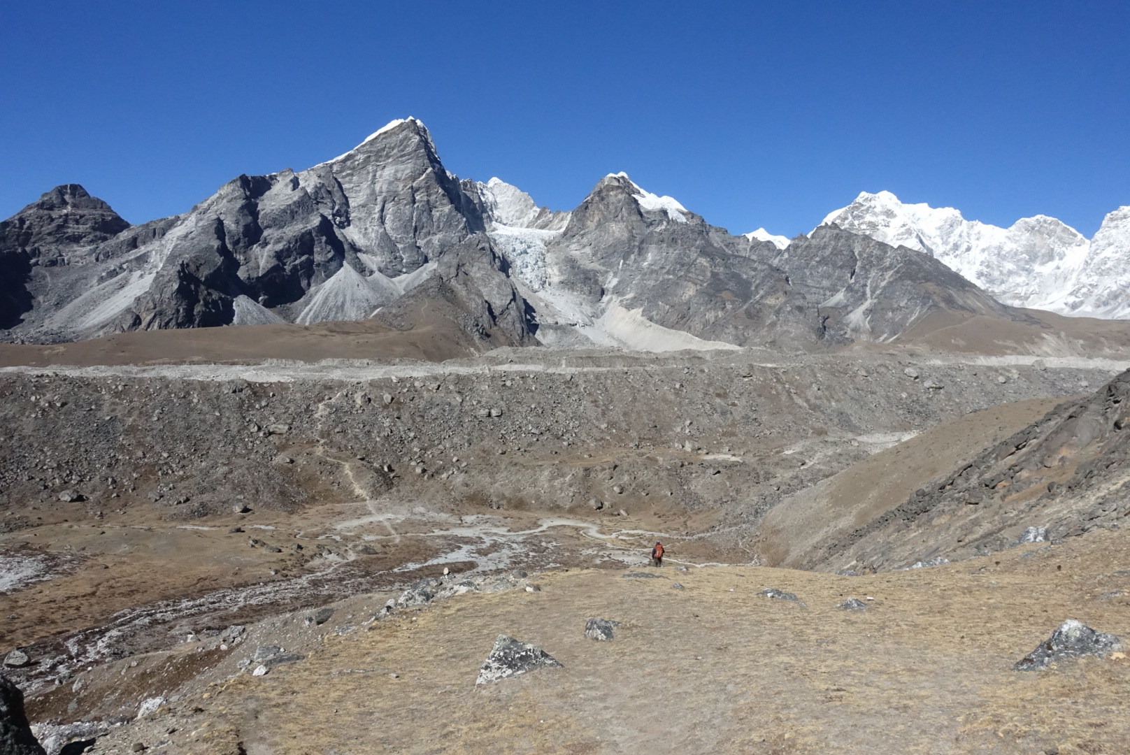
Looking back on the trek route from Dingboche to Chhukung
Today we have an easier trek on our hands, walking a relatively gentle incline up the Imja Khola valley floor to the village of Chhukung (or Chukhung). This is a much quieter part of Sagarmatha National Park, and so the trail won't be as busy as it was until around Tengboche. We pass by stone-walled fields and eventually enter moraine territory just before reaching Chhukung.
Chhukung developed as a teahouse (lodge) village to service those on their way to trek over Kongma La as well as climb Island Peak.

A view of Chhukung in winter, with Ama Dablam looming above all
Day 9 – Acclimatisation and hike
- Starting point: Chhukung (4,730 m / 14,334 ft)
- Overnight: Chhukung (4,730 m / 14,334 ft)
- Accommodation: Teahouse
- Highlight: Climb Chhukung Ri or visit Island Peak Base Camp
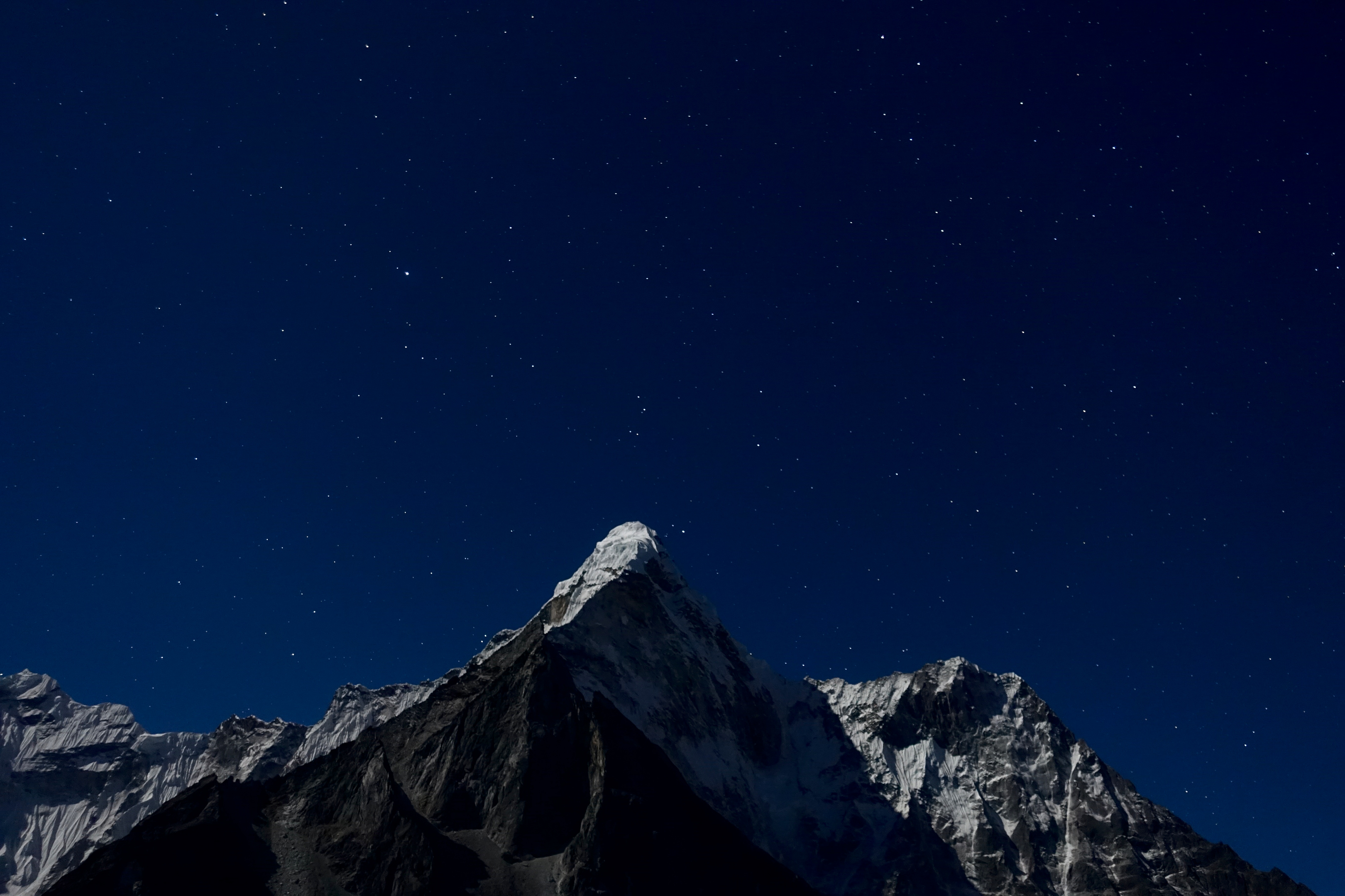
A night-time sky and Ama Dablam as seen from Chhukung
We stay put today and spend another night in Chhukung to help our bodies acclimatise to the ever-increasing altitude.
There are some options on the table: relax at the lodge with a good book and good companions, or head out and do a day hike. Then, if we choose the hike, we can either climb Chhukung Ri or visit Island Peak Base Camp.
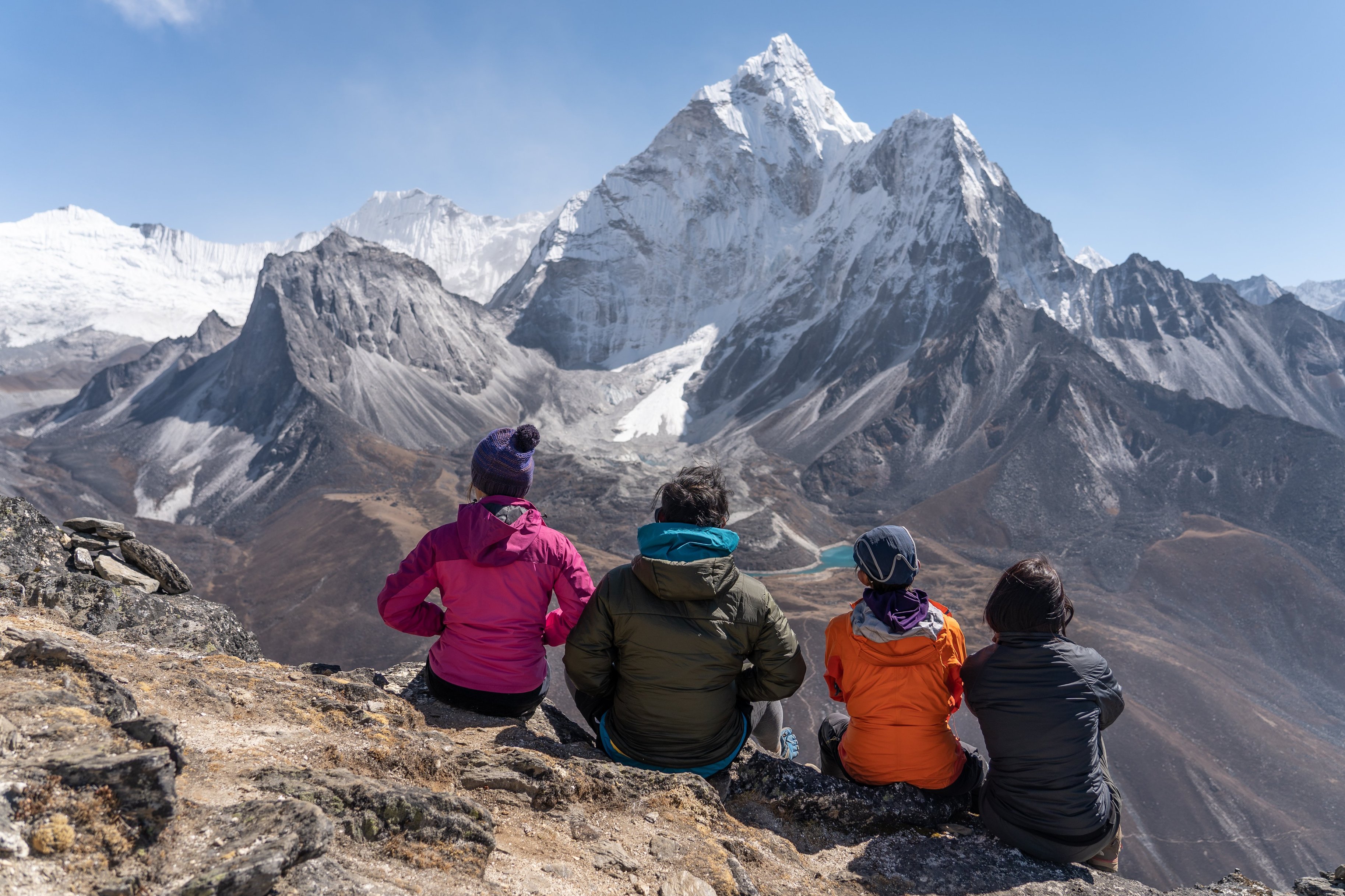
Chhukung Ri (5,550 m / 18,208 ft) is a taxing round trip of about four hours. It's great for helping the body to acclimatise, but you want to weigh that benefit against the possible need for a day of complete rest. Trekking fatigue is real. If you do choose to do the hike, the view from the top is simply incredible, letting you see Island Peak, Ama Dablam, Makalu and Nuptse, among other peaks.
The breathtaking view from Chhukung Ri
Island Peak is a whopping mountain at 6,160 m (20,210 ft). It earned its name in 1953 from an expedition team (which included Tenzing Norgay and Edmund Hillary) because they thought it looked like an island in a sea of ice when seen from Dingboche. In 1983, it was renamed Imja Tse, but many still refer to it as Island Peak. A great day hike of around eight hours is visiting Island Peak Base Camp (5,100 m / 16,732 ft) on the southern slope of the mountain. We pass Imja Tse lake en route.
Another amazing view from Chhukung Ri
Day 10 – Summit Kongma La
- Starting point: Chhukung (4,730 m / 14,334 ft)
- Overnight: Lobuche (4,940 m / 16,210 ft)
- Kongma La elevation: 5,535m/18,154ft
- Accommodation: Teahouse
- Distance trekked: 10.6 km / 6.6 mi
- Hours trekking: 9-10 hours
- Highlight: Views from the top, and crossing Khumbu Glacier
A November view while descending Kongma La
Today we tackle our first pass! Kongma La is a challenging mountain pass that's actually higher in elevation than Everest Base Camp. It's also the easternmost and highest of the three passes that make up the EBC and Three Passes trek.
With all that in mind, today is a very good day for concentration, crampons and trekking poles, as much of the route is rocky and uneven. But there are also some beautifully smooth sections of trail on the ascent.

Crampons are sometimes needed to help you navigate the passes
When you reach the top, you're rewarded with breathtaking views to the east and west. These make the climb worth every bit of effort! The descent is trickier than the ascent, as it's much steeper. So it's just about taking it slowly and at your own pace. There's no rush.
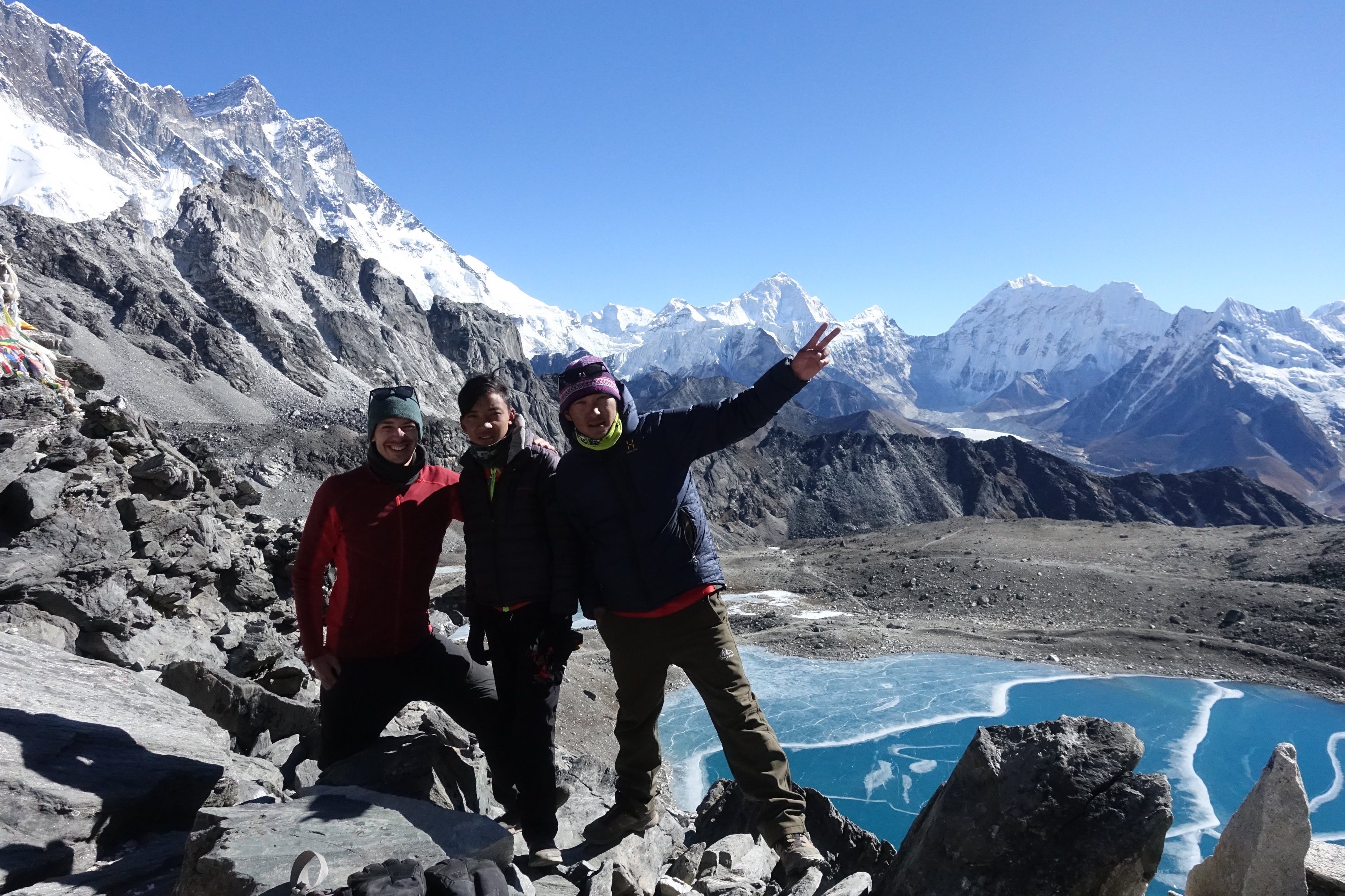
Celebrating having conquered Kongma La!
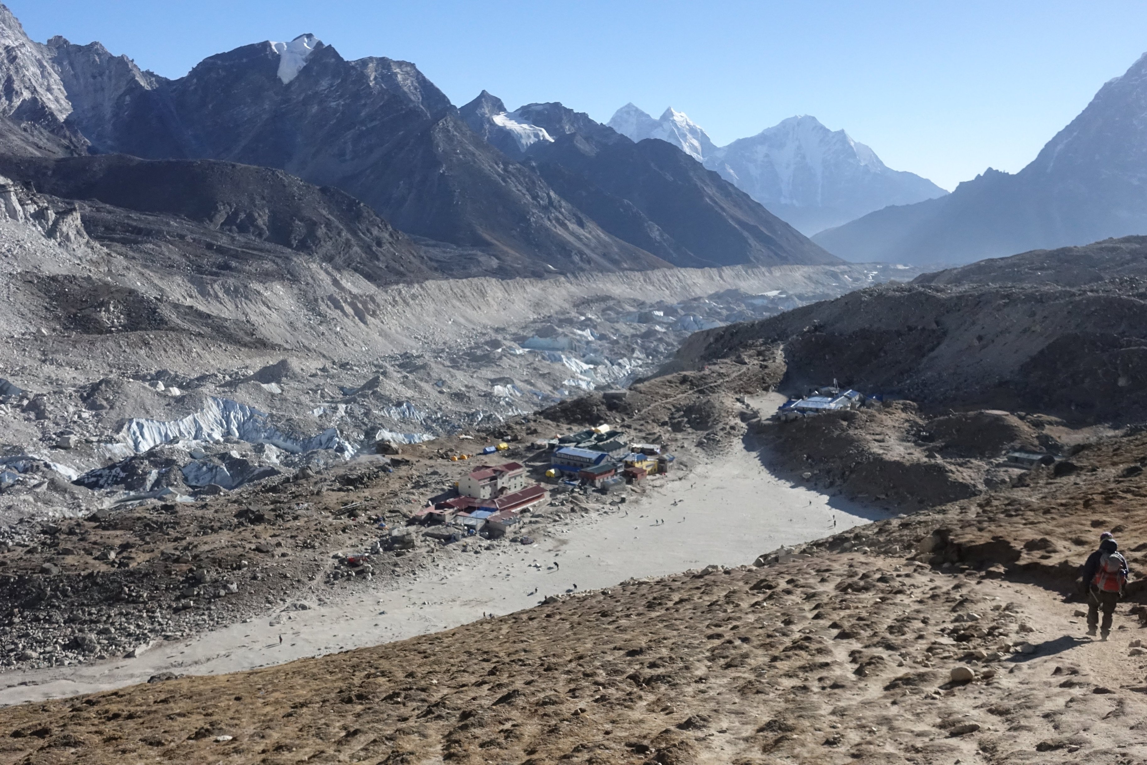
Near the bottom of the pass, we cross over Khumbu Glacier, which of course is the same glacier that famously flanks Everest! It's also the largest glacier in Nepal. Having crossed Khumbu Glacier, we head to Lobuche for the night. And by doing so, link back up with the classic EBC trail.
Excitingly, we cross Khumbu Glacier during our descent from Kongma La.
Tonight we stay at the village of Lobuche
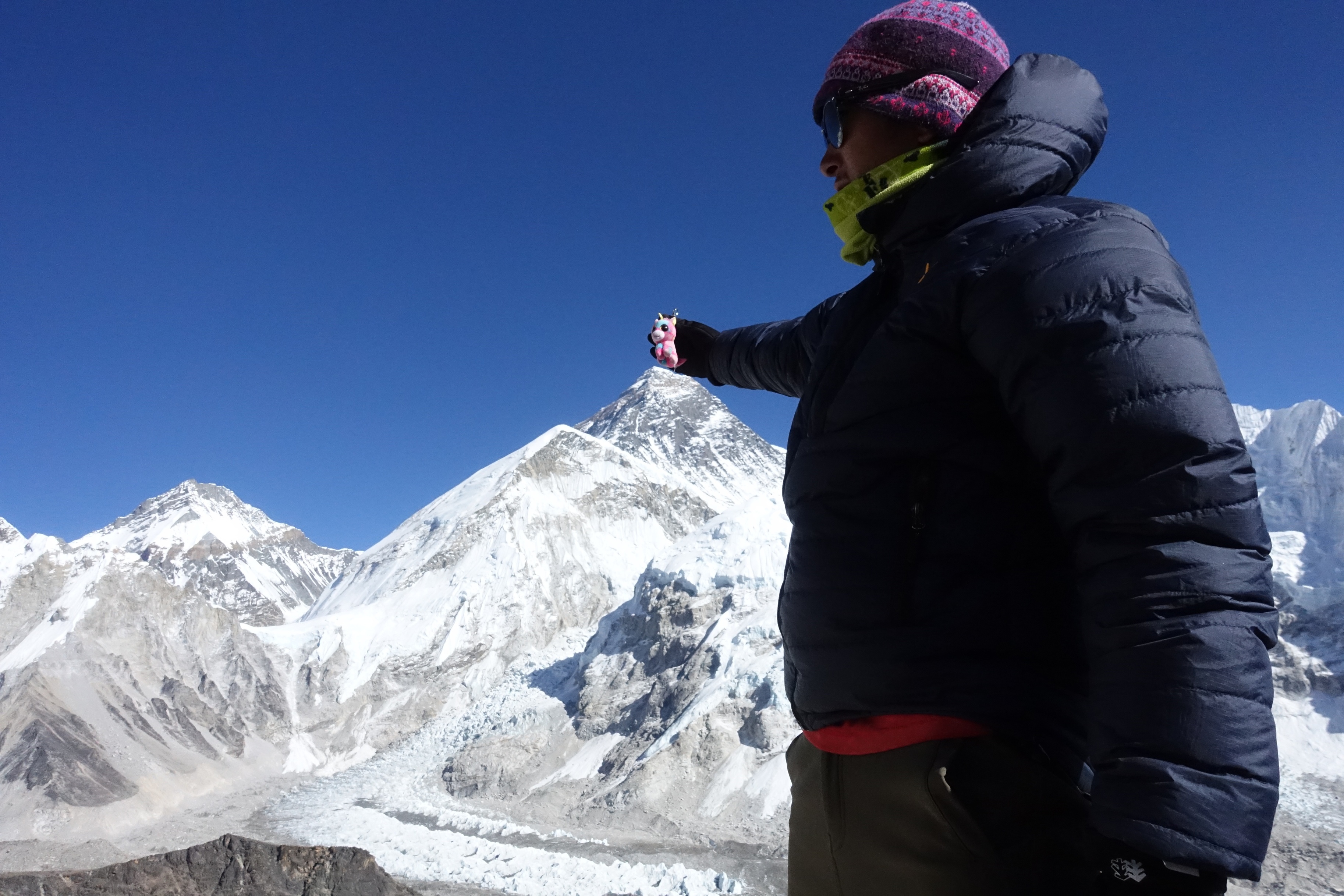
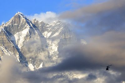
Day 11 – Visit Everest Base Camp!
- Starting point: Lobuche (4,940 m / 16,210 ft)
- Overnight: Gorakshep (5,164 m / 16,942 ft)
- Everest Base Camp elevation: 5,364 m / 17,598 ft
- Accommodation: Teahouse
- Distance trekked: 10.8 km / 6.7 mi
- Hours trekking: ~ 4 hours
- Highlight: It's finally EBC time!

Everest Base Camp – in the quiet season, the prayer flags mark the spot!
Today is the BIG DAY! We head northeast after breakfast along a well-worn path to reach Everest Base Camp. Bring. It. On.
The climbing season for Everest is spring (April to early June), so this is the time to plan your EBC and Three Passes trek if you want to see the base camp in action. At other times of the year, the camp is deserted. Prayer flags and a large, spray-painted rock (that you can climb atop for a photo) indicate you've reached the internationally renowned spot.
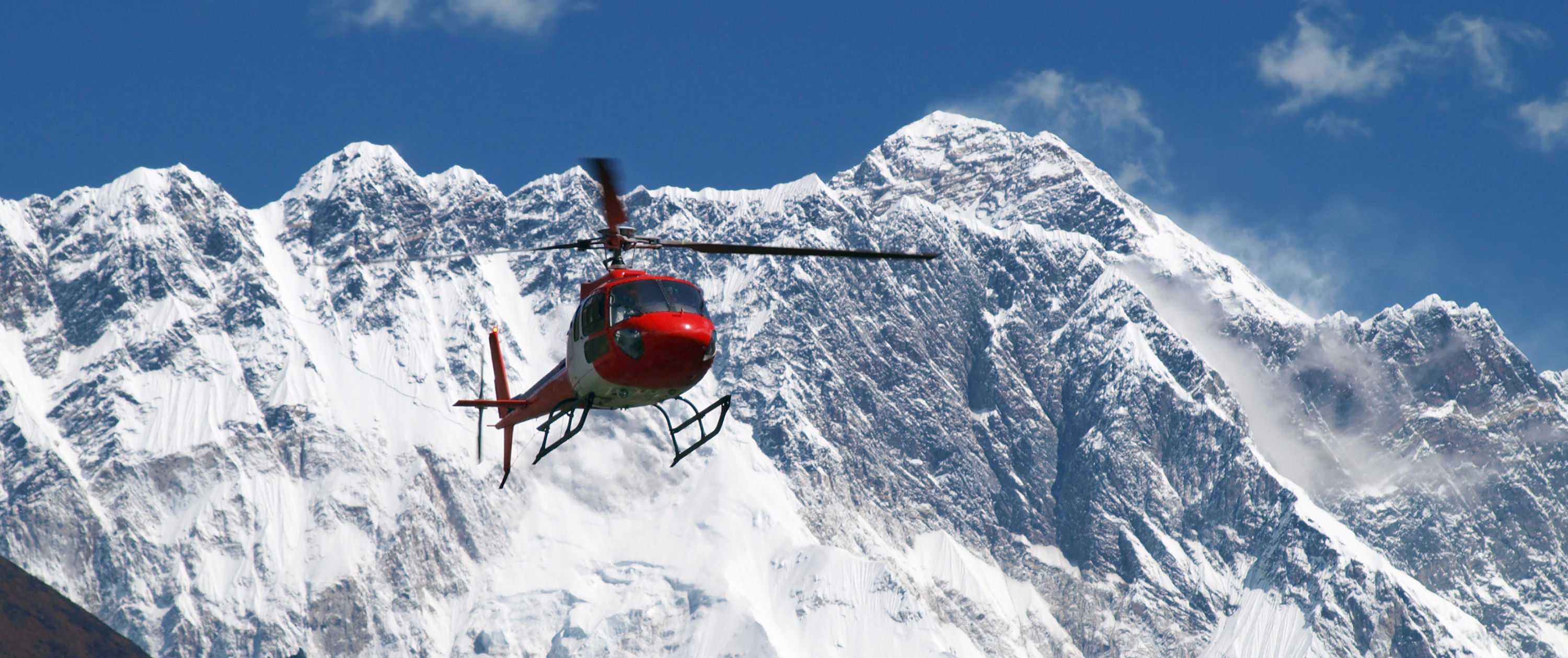
A helicopter is a speck against the enormity of Lhotse
Depending on the time of year, EBC will be pretty deserted, or a bustling hive of activity!
You can't actually see the peak of Everest from base camp. But you're standing amidst some incredible mountains, and you're also up close and personal with Khumbu Glacier, the world's highest glacier!
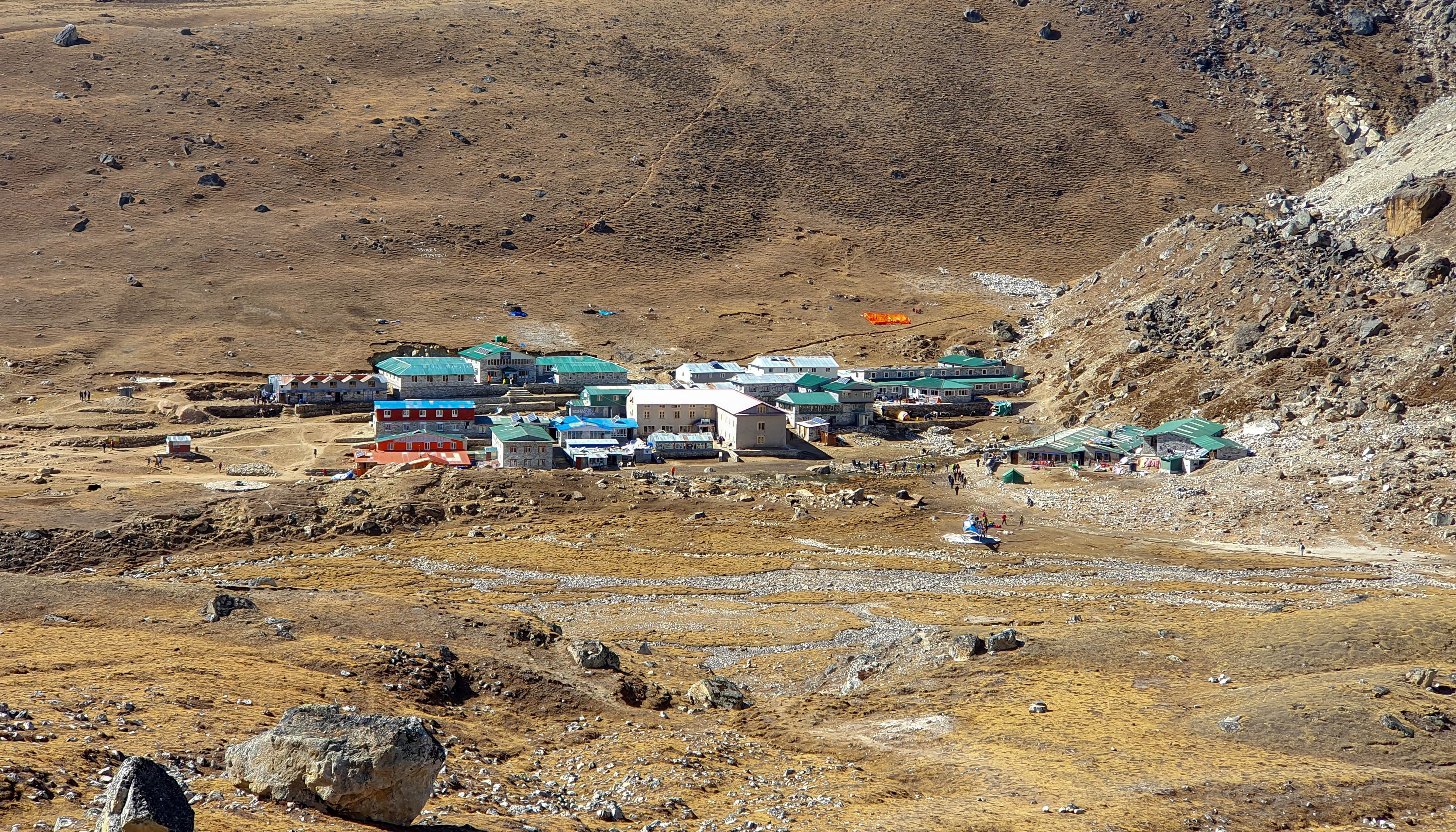
Having visited EBC, we travel the short distance back to the settlement of Gorakshep, where we spend the night. Gorakshep was the original EBC – it was used by Swiss mountain climbers in 1952 in their attempt to summit Everest.
An aerial view of Gorakshep
Day 12 – Climb Kala Patthar
- Starting point: Gorakshep (5,164 m / 16,942 ft)
- Overnight: Dzongla (4,830 m / 15,850 ft)
- Accommodation: Teahouse
- Kala Patthar elevation: 5,645 m / 18,519 ft
- Distance trekked: 10.4 km / 6.2 mi
- Hours trekking: 8-10 hr
- Highlight: Epic view of Everest from Kala Patthar

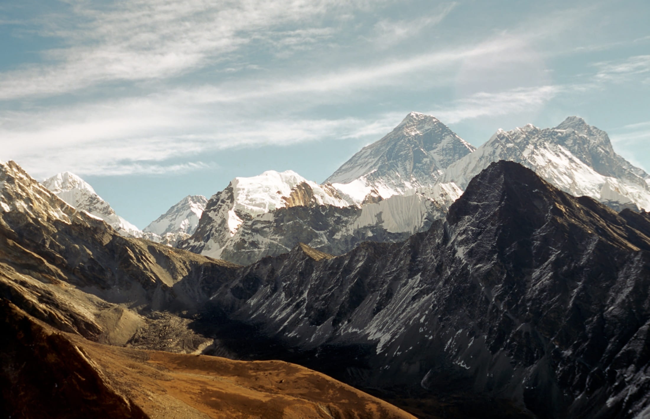
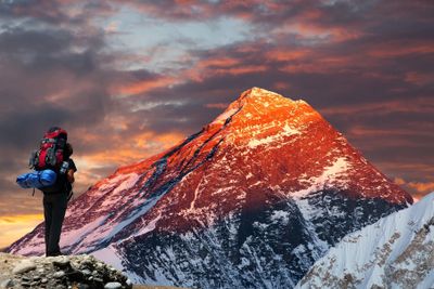
The view from Kala Patthar in the direction of Lobuche
We head first to Kala Patthar, a tough climb with a massive reward: an unobstructed view of Mt Everest!
Kala Patthar means 'black rock' in Nepali, and you'll find it looks similar to a black sand dune.
Kala Patthar is on everyone's itinerary as it offers a fantastic 'full frontal' of Everest. So after breakfast today, we head north to tackle Kala Patthar. While it's not a massive climb, it's tiring, given the altitude, and so fresh morning legs are helpful here.
Having taken in the view of Everest and its mates like Lhotse, Makalu and Cho Oyu from Kala Patthar, we head back south along the classic Everest Base Camp trek route. We pass through Lobuche, and then later on, when the trail nears the head of the Imja Khola river, we veer west away from the main route and head towards the village of Dzongla (or Dzonglha).
'Touching' the tippy top of Mt Everest while standing on Kala Patthar!
The path we walk to Dzongla is well-defined and offers simply incredible views of the surrounding mountains – it's the stuff of daydreams. We can see peaks like Arakam Tse, Cholatse and Taboche, and also pass the lake Chola Tsho. There's a fair bit of up and down along the route, and a final ascent to the blue- and green-roofed buildings of Dzongla.
Day 13 – Summit Cho La
- Starting point: Dzongla (4,830 m / 15,850 ft)
- Overnight: Gokyo (4,750 m / 15,584 ft)
- Cho La elevation: 5,420 m / 17,782 ft
- Accommodation: Teahouse
- Distance trekked: 12.5 km / 7.5 mi
- Hours trekking: 9-10 hours
- Highlight: View from Cho La of the mountain, glaciers and lakes

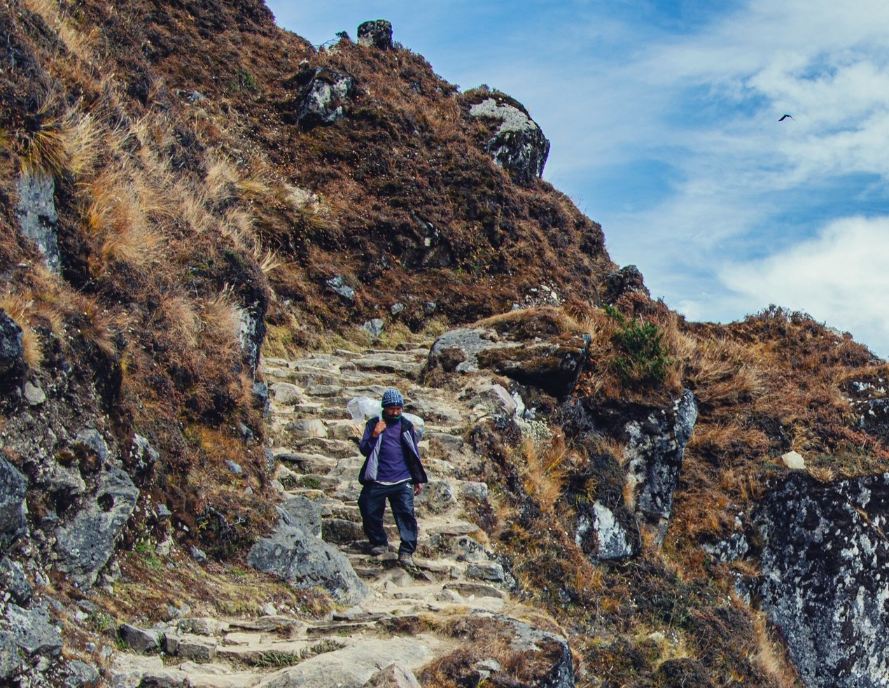
These hikers tackling the glacier on Cho La look like mere ants
It's time now to tackle our second pass! This is a relatively difficult pass, as we cross Cho La Glacier on the ascent. The top of the pass rewards us with magnificent views to both the east and west. The descent is once again steeper than the ascent.
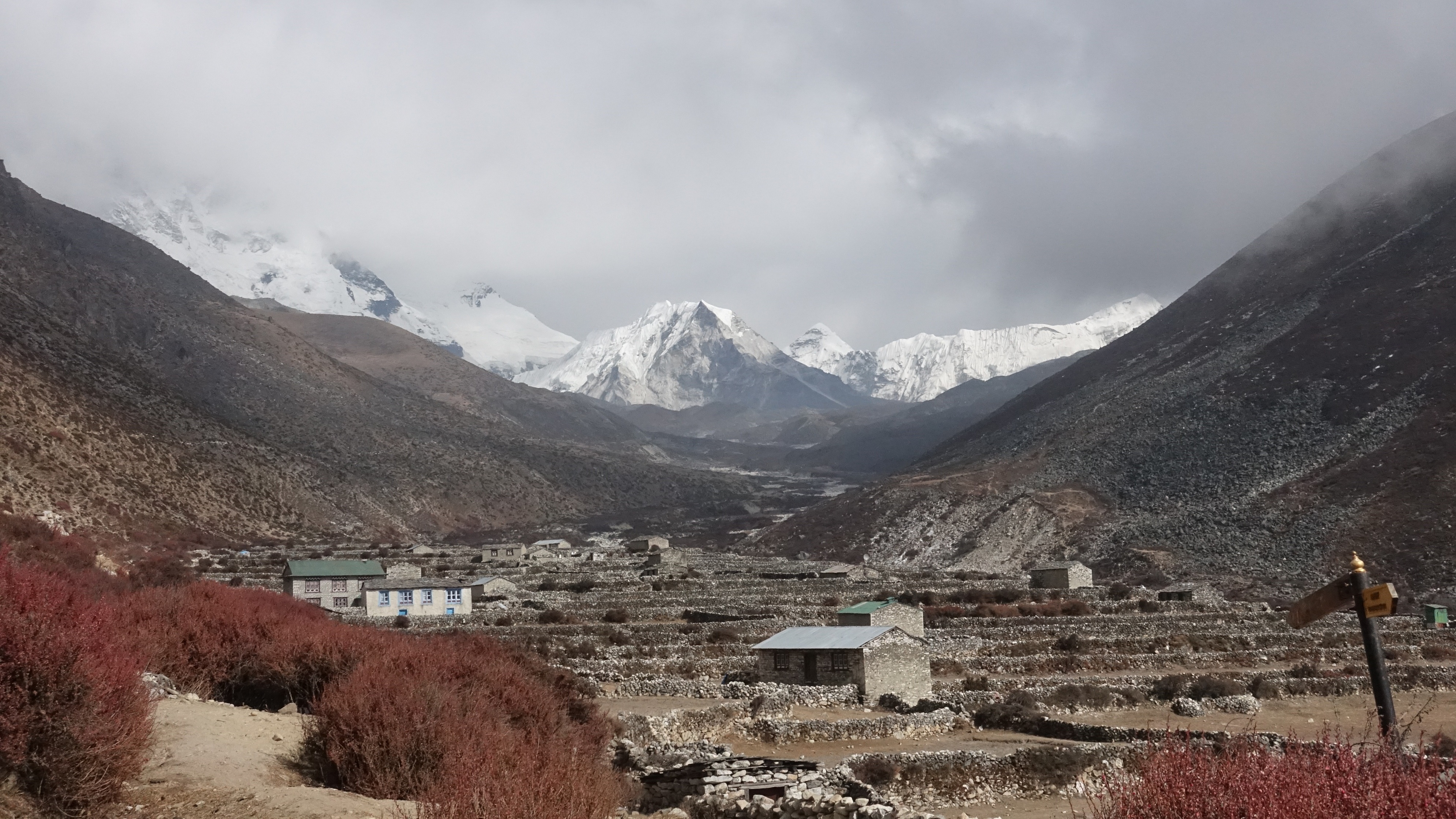
After conquering the pass, we trek through the small village of Thangnak (4,680 m / 15,350 ft) near its base. This is a remote and gorgeous section of Sagarmatha National Park that many don't get to see.
{{leadmagnet-two}}
We then strike out for our night-time destination of Gokyo, a small village with an outsized boast:
- It sits in the shadow of Cho Oyu (8,150 m / 26,739 ft), the world's sixth-highest mountain.
- Directly above the village is Ngozumpa Glacier, the longest glacier in the Himalayas at 36 km (22 mi).
- It's also on the shore of one of the Gokyo Lakes, the world's highest freshwater lake system.

The village of Gokyo can be seen below Ngozumpa Glacier and on the shore of Gokyo Cho
The Gokyo Lakes are sacred to both Buddhists and Hindus. Every August, around 500 Hindus make a pilgrimage there to bathe in their waters. The most well-known lake is the one alongside the village of Gokyo, and is called Gokyo Cho (or Dudh Pokhari).
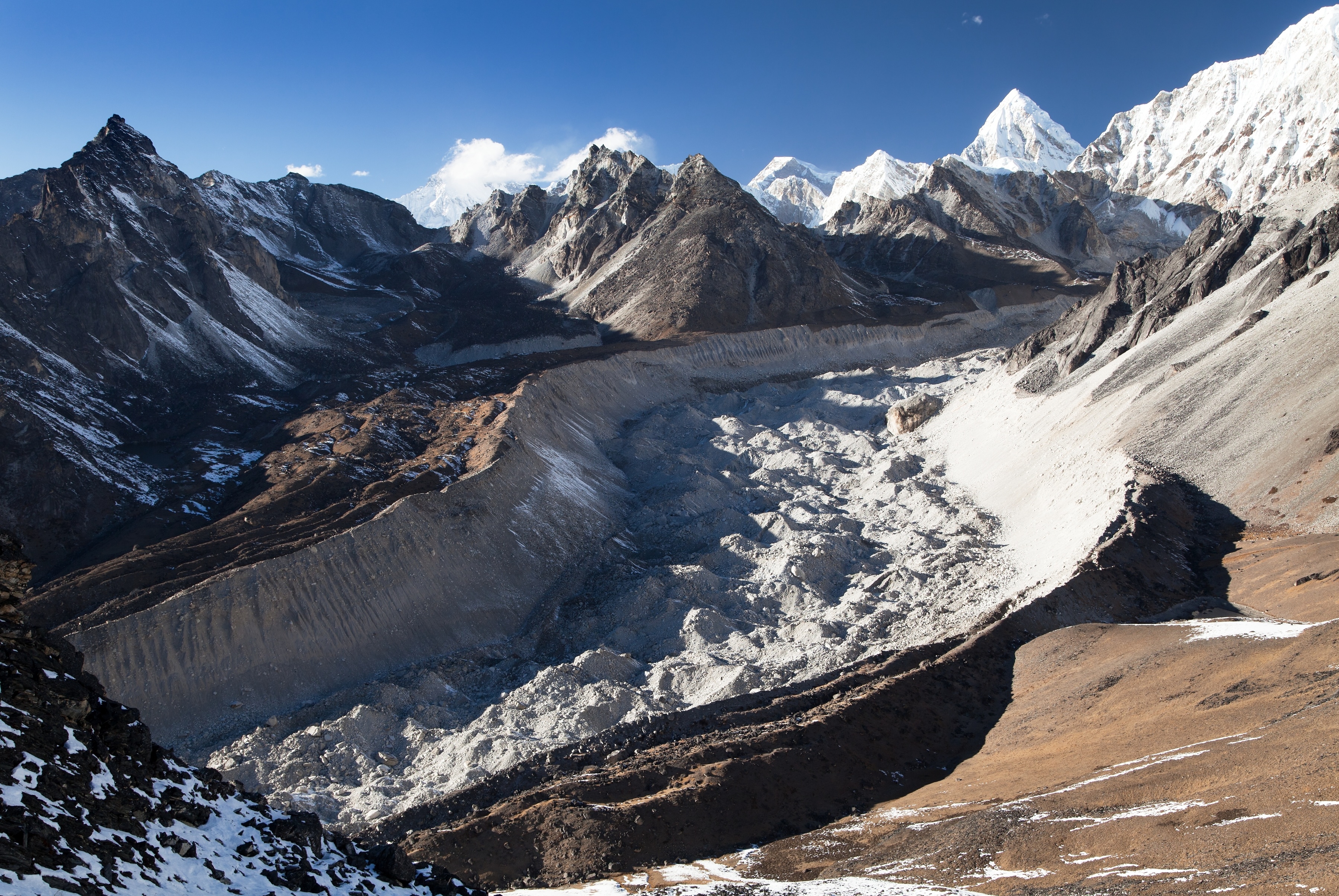
To reach Gokyo, we cross Ngozumpa Glacier, so you'll get to see this renowned glacier all up close and personal.
Day 14 – Acclimatisation and Gokyo Ri hike
- Starting point: Gokyo (4,800 m / 15,580 ft)
- Overnight: Gokyo (4,800 m / 15,580 ft)
- Gokyo Ri elevation: 5,357 m / 17,575 ft
- Accommodation: Teahouse
- Hike distance: 4 km / 2.4 mi
- Hiking time: 3-4 hours
- Highlight: 360° view from Gokyo Ri

View of Gokyo, Ngozumpa Glacier, Gokyo Cho and more from the top of Gokyo Ri
Today is a special day as we're going to hike to the top of Gokyo Ri (Peak) for some sublime views! For the hike, we follow a roughly linear path to the peak and back.
Standing on Gokyo Ri, we can gaze down to the north on the largest of the Gokyo Lakes, called Gokyo IV (or Tonak Pokhari). To the southwest, we can see Renjo La, which we cross tomorrow. And further afield to the north and eas,t we have a seemingly endless line of famous peaks, including four that rise above the 8,000 m mark: Everest, Lhotse, Makalu and Cho Oyu!

Prayer flags atop Gokyo Ri
Day 15 – Summit Renjo La
- Starting point: Gokyo (4,800 m / 15,580 ft)
- Overnight: Marulung (4,210 m / 13,810 ft)
- Renjo La elevation: 5,360 m / 17,560 ft
- Accommodation: Teahouse
- Distance trekked: 9.5 km / 5.6 mi
- Hours trekking: 8-9 hours
- Highlight: View of Everest and other peaks from Renjo La

Looking back down towards Gokyo village
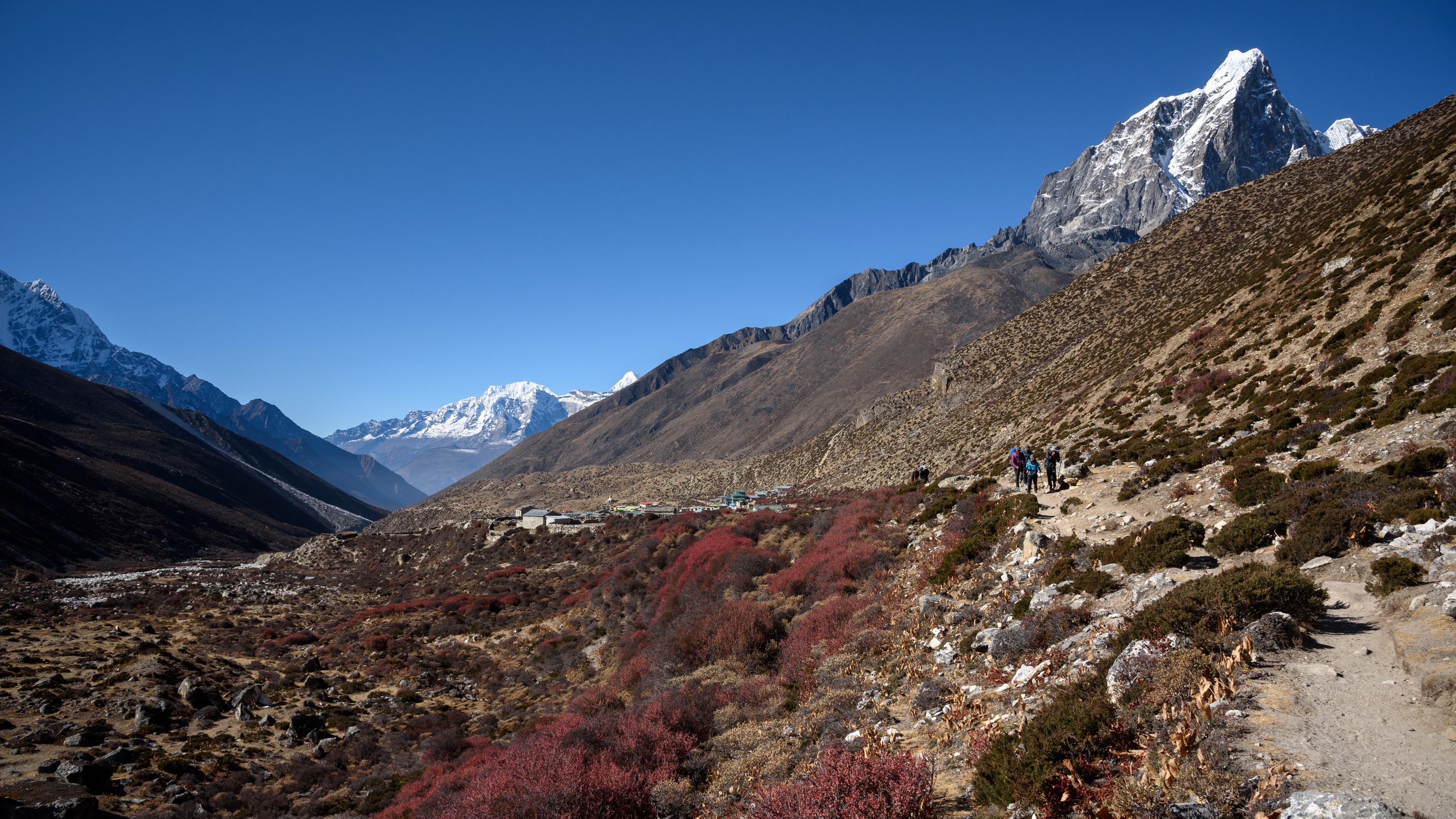
Today, we tackle the third and final of the passes on our trek route! Renjo La (5,360 m) is not as high as the other two passes, and you might even see some locals with their yaks using the path. It's a very quiet pass in terms of trekkers.
To start, we leave Gokyo behind as we head west by walking along the northern shore of the lake. As we begin our climb up the pass, the view back to Gokyo and Ngozumpa Glacier is gorgeous, and just gets better the higher we climb. The terrain up Renjo La is rocky and uneven, making it another good day for trekking poles.
View of Everest from Renjo La
Needless to say, the views to both the east and the west upon summiting Renjo La are incredibly rewarding!
Descending the western side of the pass is a much steeper affair than its ascent. We head to Marulung for the night. This is one of the relatively few settlements in this neck of the woods, as we're now trekking through a more sparsely populated section of Sagarmatha.
Day 16 – Trek to Namche Bazaar
- Starting point: Marulung (4,210 m / 13,810 ft)
- Overnight: Namche Bazaar (3,440 m / 11,286 ft)
- Accommodation: Teahouse
- Distance trekked: 9.5 km / 5.6 mi
- Hours trekking: 7-8 hours
- Highlight: Passing through Thame
We spend much of today walking alongside the Bhote Kosi
Today we trek alongside the Bhote Kosi. The valley starts out very steep and then widens further on. It's a quiet valley that's not as affected by tourism as some of the others in the region.
We pass through the pretty village of Thame, which was once home to the famous Sherpa mountaineers Tenzing Norgay and Apa Sherpa. Thame Monastery, above the village, is a must-see if there's time.
The village of Thame
We head back to Namche Bazaar, approaching it from the other direction from which we left it. The scenery is beautiful, as we walk a contour path along the northern bank of the Bhote Khosi, a tributary of the Dudh Khosi. Those who are lucky enough to be in Namche on a Saturday can pay a visit to its market.
Day 17 – Trek to Lukla
- Starting point: Namche Bazaar (3,440 m / 11,286 ft)
- Overnight: Lukla (2,860 m / 9,383 ft)
- Accommodation: Teahouse
- Distance trekked: 17.6 km / 10.7 mi
- Hours trekking: 7-8 hours
Namche Bazaar feels almost like a metropolis after the past few days' adventure
On the outward journey, we travelled from Lukla to Namche Bazaar over two days, stopping over in Phakding for a night. On the return route, we cover the same distance in one day, our lungs drinking in all that oxygen-rich air!

It's time to descend in altitude
Day 18 – Transfer to Kathmandu
- Flight: Lukla to Manthali Aiport (15 min)
- Drive: Ramechhap to Kathmandu (5 hr)
- Overnight: Thamel district, Kathmandu
- Accommodation: Arushi Boutique Hotel (or similar)
This morning we fly to Manthali Airport. You can expect beautiful scenery en route! It's just possible on the odd occasion that we can get a flight straight to Kathmandu's Tribhuvan International Airport. But given the major construction going on at that airport at present, it's highly unlikely.

Women sitting in the shade of a shrine in Kathmandu
From Manthali in Ramechhap, we drive to Kathmandu in our private vehicle, returning to the vibrant Thamel district.
Day 19 – Depart Kathmandu
Today is adieu and, hopefully, see you soon! We'll drive you to the airport, so no worries about logistics there.
That said, depending on your flight time, you could have a large chunk of the day to explore some more of Kathmandu – yay!
The streets of Thamel are a world away from the quiet and solitude of Sagarmatha!
One idea, if you have time today before your flight, is to go on the heritage walk from Thamel that takes you to places tourists don't always see, like old streets, temples and markets. You can also visit Kathmandu Durbar Square, which is a UNESCO site for its historic temples, palaces and palace courtyards.
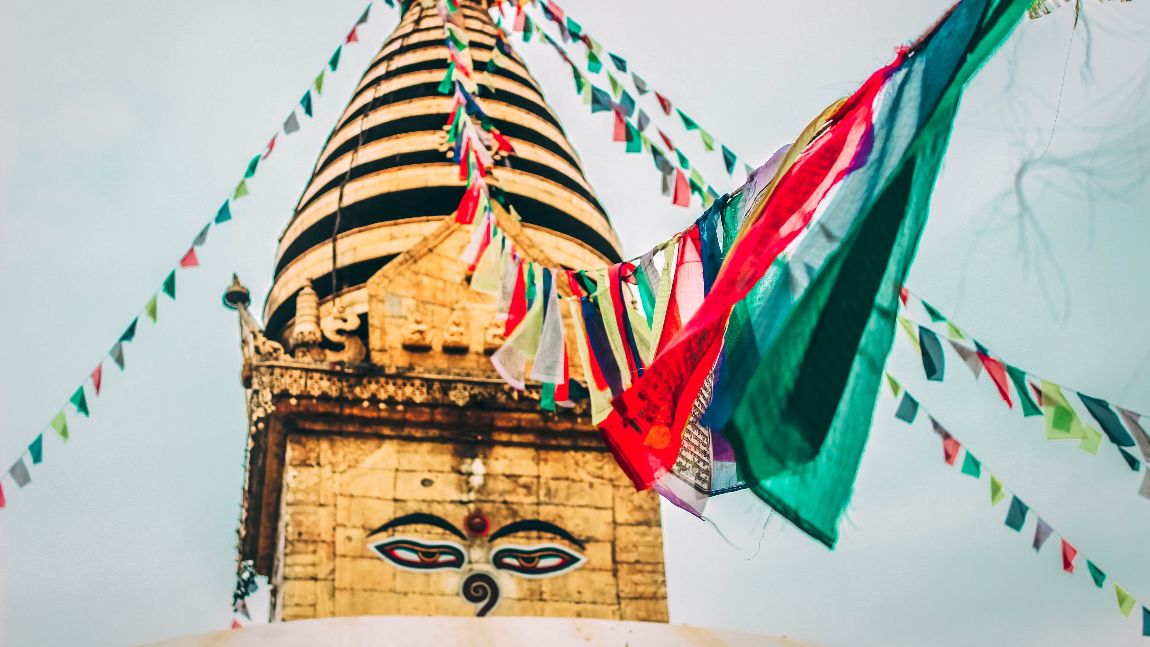
You might also like to pay a visit to Swayambhunath (also referred to as Monkey Temple), just west of the city on a hilltop. This ancient religious complex is an extremely important pilgrimage site for Tibetan Buddhists. It contains a large stupa, several shrines and temples, a monastery, and a museum. The name Swayambhunath means 'sublime trees', and yes, there are a variety of lovely trees all over the complex to enjoy.
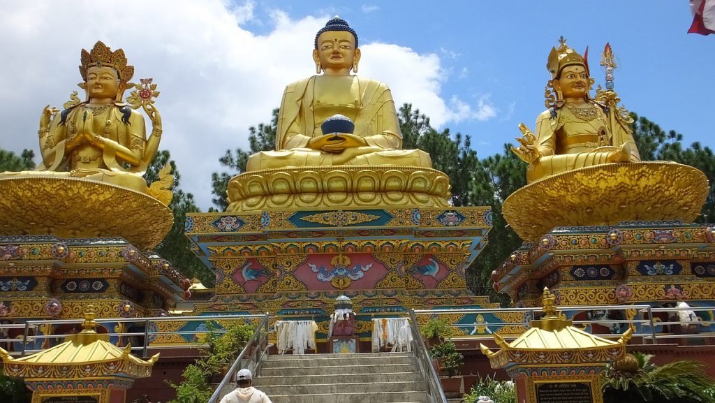
Three of the statues at the religious hilltop complex, Swayambhunath
Something else you might like to consider is taking a cooking class at Nepal Cooking School. How awesome to go home and know how to reproduce a taste of the yummy Nepali food you've no doubt grown to love over the past fortnight!
And that's the itinerary, folks!
If you loved reading about the Everest Base Camp and Three Passes trek but are a little uncertain about your own fitness to tackle it right now, why not take a look at the Annapurna Circuit? It's a similarly spectacular multiday trek in Nepal, but just not quite as long and arduous. It could even be the perfect 'tester' for the EBC trek.
All that said, if you are feeling up to the challenge of the EBC and Three Passes trek, we'd love to chat and see if we can help you make it happen! Just click on the contact button and drop us a line. 😀
