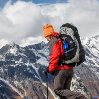


The Manaslu Circuit is without doubt one of Nepal's very best high-altitude treks. Yet it's not as well-known as the Annapurna Circuit and Everest Base Camp trek, and consequently offers a much quieter route and more authentic cultural experience.
Many compare the Manaslu Circuit to the adjacent Annapurna Circuit. This is a reasonable comparison, as both treks expose you to an exciting range of climates, landscapes, cultures and wildlife, both take you just above 5,000 m, and bring you into close proximity with some of the world’s highest peaks!
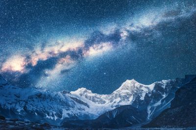
Yet the Manaslu Circuit isn’t as commercialised nor developed as the Annapurna Circuit. It's also much longer and more challenging. So it's a very different trek at the end of the day. Moreover, we can tell you that many seasoned trekkers actually consider the Manaslu Circuit to be the best and most beautiful mountain trek in all of the Himalayas!
So if you're considering tackling this epic adventure, or have already booked your spot, here's a breakdown of the trail to help you know what to expect. It will also hopefully fan the fire under you with regards to sticking to that training schedule!
We start with an overview of the route, followed by an elevation profile graph. We then list daily distances and trek durations, followed by a detailed account of what to expect each day along the trail. Finally, we give you a brief introduction the main people groups you will meet along the way.
The Manaslu Circuit route: an overview

You visit the glacial lake Birendra Tal during the trek
The first portion of the Manaslu Circuit sees you wending your way up the supremely dramatic Buri Gandaki River valley, which is protected within the Manaslu Conservation Area (MCA). The scenery is rugged from the start, but becomes even more so the higher you climb. You can anticipate crossing suspension bridges and navigating high contour paths, meeting different cultural communities while staying in highly remote villages, seeing beautiful rhododendron forests, yak meadows, alpine lakes, moraines, glaciers and towering peaks, and much more.
You eventually reach the head of the Buri Gandaki Valley and pass up and over snowy Larkya Pass, which is 5,100 m above sea level. En route to the pass you enjoy incredible views of Mt Manaslu (8,156 m), Syacha Glacier and more. You also pass various centuries-old Tibetan Buddhist monasteries, some of which welcome visitors.
In our itinerary we include a side hike to Manaslu Base Camp (4,800 m), which is an exciting add-on in our opinion as you see the campsite used by climbers readying to ascend the world's eighth highest mountain!
After crossing Larkya Pass and exiting the MCA, you descend sharply alongside a glacier into the Dudh Khola Valley. Your final day is spent trekking downriver to reach the village of Tilje on the eastern edge of the Annapurna Conservation Area.
Elevation profile of the Manaslu Circuit
The graph below shows the Manaslu Circuit in profile, and gives you a good idea of just how much climbing is involved. Note that we include the side hike to Manaslu Base Camp in this profile This fact, together with the very high altitude and the often right terrain underfoot, are the reasons why the Manaslu Circuit is rated a moderate to strenuous trek.
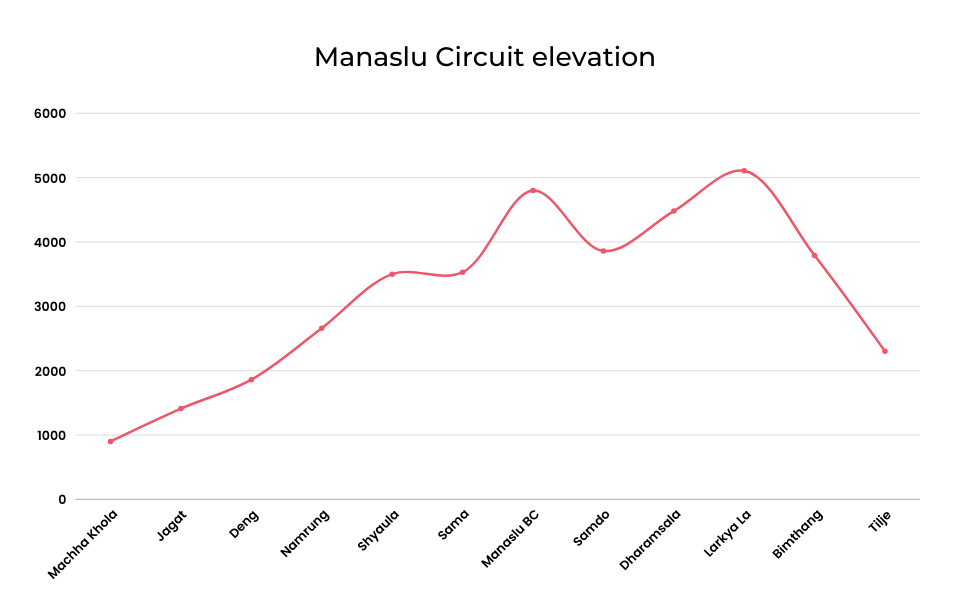
Graph showing the elevation changes on the Manaslu Circuit
Daily distances and trek times
The table below offers a quick overview of distances, durations and altitudes involved in a Manaslu Circuit trek when you include a visit to Manaslu Base Camp and also a Larkya Pass crossing.
The Manaslu Circuit: day-by-day descriptions
Let's now discuss in detail what you can expect each day on the trail. Warning: it will get you super amped to book and do this trip pronto!
Again, we include the days before and after the trek as offered in our Manaslu Circuit package so that you can understand the schedule and logistics involved in travelling to and from the Manaslu region.
Day 1: Arrival day
Today is mostly just about arriving in Kathmandu and settling in.
Your Follow Alice English-speaking guide meets you at Tribhuvan International Airport (1,365 m) and drives you for about 25 minutes to your hotel in Thamel, the heart of the city.
If you arrive earlier in the day and aren't too tired, you might like to head out into the city to explore a bit. Yet you don't need to get back into a car, as there are so many wonderful places to visit within walking distance.
For instance, Asan Bazaar is a lively traditional market where you can experience local culture and peruse stalls selling spices, beautiful textiles and handicrafts. There's also Thamel Chowk, the central area of Thamel, which is known for its colourful streets, street vendors and cultural performances. Be sure to head to the pedestrians-only Mandala Street if you like boutique shops, cafés and art galleries.
Day 2: Prep day
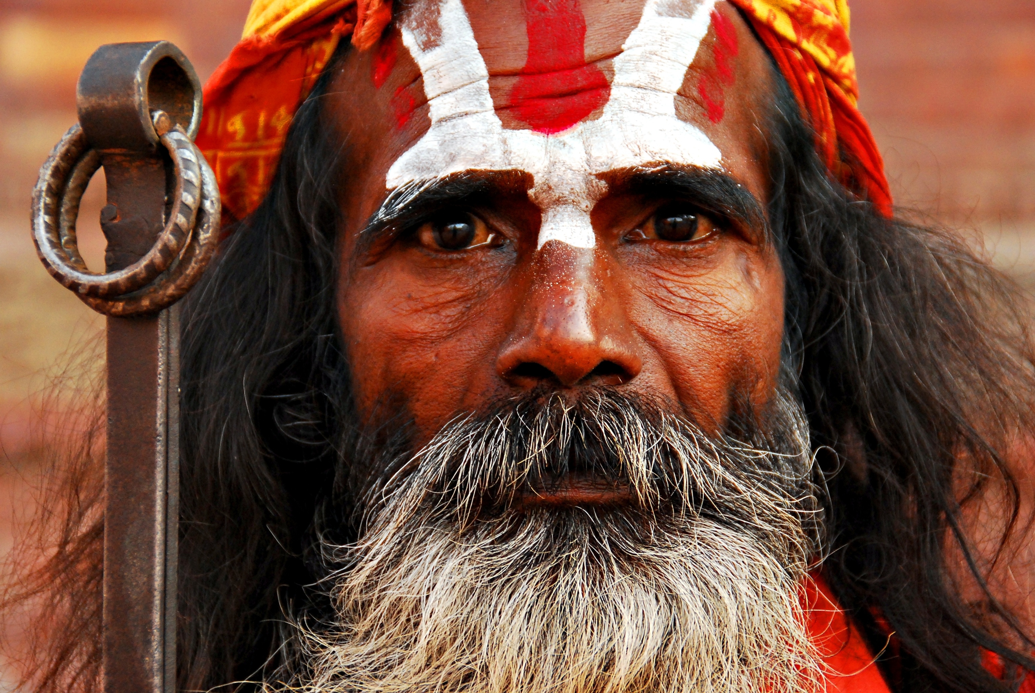
Holy men are ubiquitous in Kathmandu
We recommend that you ask your guide to look at your trekking equipment this morning to ensure everything is in order and you're not missing something crucial. If you are, then you're in the perfect part of the city to quickly rectify that. There are seemingly countless trekking shops in Thamel both selling and renting equipment suitable for Himalayan trekking. Note that we at Follow Alice can also rent you certain items, most notably a winter down jacket and trekking poles.
There should also be plenty of time left in the day to explore the city some more. One of the city's top highlights is Swayambhunath Stupa. A stupa, for those unfamiliar with the term, is a dome-shaped Buddhist shrine or monument that often contains relics, sacred texts or symbolic objects. Swayambhunath is also known colloquially as Monkey Temple for its popularity with the resident macaques. Another key site is Durbar Square, an historic palace plaza known for its intricate Newari architecture that is a UNESCO World Heritage Site.
You're likely going to meet some of the city's famous holy men (called sadhus) at Swayambhunath as well as other sacred sites in the city. They're often seated against buildings or in doorways, and tend to sport dreadlocks, long beards and colourful face and body paint.
Day 3: Drive from Kathmandu to Machha Khola

Terraced fields are ubiquitous in the lower Manaslu region
This morning you drive northwest to reach the riverside village of Machha Khola (900 m) in the remote Buri Gandaki Valley, also spelled Budhi Gandaki. The drive takes pretty much the whole day, but the scenery is very engaging! So bring your neck pillow, relax and enjoy the changing landscape.
Your destination for the night is the riverside village of Machha Khola (900 m), also spelled Machhakhola. Lower Buri Gandaki is a cultural melting pot, and the people largely follow a mix of Hindu, Buddhist and indigenous shamanistic practices.
Tonight is your first night in a teahouse (an independently owned lodge). Many of the Manaslu region's teahouses were rebuilt after the devastating March 2015 earthquake. As a consequence, they tend to be relatively modern and comfortable.
You go to sleep to the sound of the rushing Buri Gandaki River, whose pale-blue waters are fed by glaciers to the north near the border with Tibet.
Day 4: Trek to Jagat
- Distance: 22 km (14 miles)
- Duration: 7-8 hr
- Start point: Machha Khola (900 m)
- End point: Jagat (1,410 m)
- Highlights: Steep gorge, waterfalls, suspension bridges and small villages

The Buri Gandaki Valley is steep with small villages tucked alongside the river
Today your trek starts!
Some of the treats you can look forward to seeing or navigating today are steep paths, steeper valley walls, high contour paths, metal suspension bridges, a hot spring today and various tall waterfalls that cascade down precipitous valley walls. You can also anticipate meeting and passing many locals on the trails and dirt roads you walk, some of whom will be steering goods-laden donkeys and horses.
Save for the day that you summit Larkya Pass and your optional roundtrip hike to Manaslu Base Camp, today’s trail involves your biggest altitude jump during the trek: about 730 m. So you're right in the thick of things from Day 1!
Your destination for the night is the village of Jagat (1,410 m). Jagat is the checkpoint for entering the Manaslu Conservation Area (MCA). This important reserve protects a huge swathe of land that ranges from just 600 m (1,970 ft) to 8,163 m (26,781 ft) – the top of Mt Manaslu.
Day 5: Trek to Deng
- Distance: 20 km (12 miles)
- Duration: 7-8 hr
- Start point: Jagat (1,410 m)
- End point: Deng (1,860 m)
- Highlight: Entering the Manaslu Conservation Area
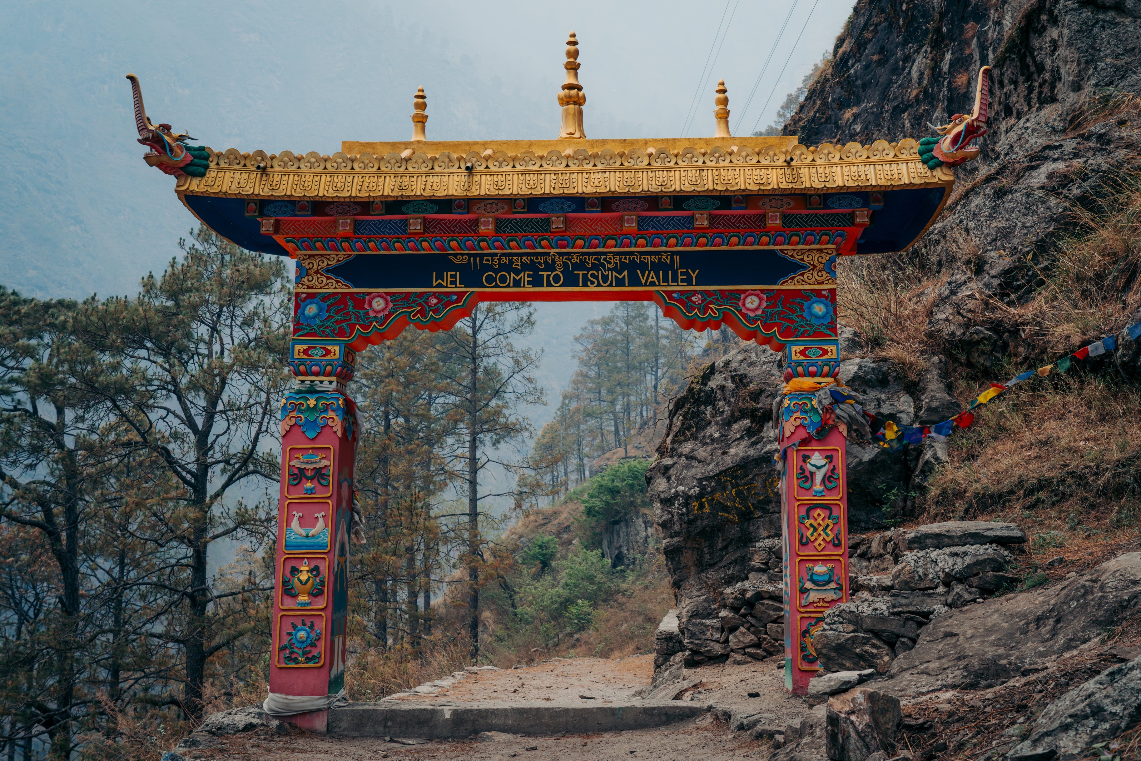
You pass the entrance to the Tsum Valley today
During the trek today you crisscross the Buri Gandaki a handful of times and pass over several tributaries. So you can look forward to your daily dose of suspension bridges, all of which offer captivating views up and down the main or side valleys. You also pass more long waterfalls. It’s the sort of Himalayan trekking route dreams are made of! As the day progresses, you climb up into drier and even more rugged terrain.
Your overnight stop is the village of Deng (1,860 m), also spelled Dyang. This small, traditional village has mani walls and chortens, which are typical of Tibetan-influenced settlements throughout the Himalayas. A mani wall is a sacred Buddhist structure made of stones inscribed with mantras, prayers and religious symbols. A chorten is a stupa but this is the Tibetan Buddhist word for it; the word stupa is used by Nepali speakers.
This lower section of the Manaslu Circuit takes you through communities that are mostly Gurung and Magar in origin and culture. Their religion and traditions tend to be a mix of Tibetanism, Hinduism and indigenous animism. Today, many Gurungs and Magars from the Manaslu region serve in the famously formidable Gurkha regiments.
Day 6: Trek to Namrung
- Distance: 20 km (12 miles)
- Duration: 7-8 hr
- Start point: Deng (1,860 m)
- End point: Namrung (2,660 m)
- Highlight: Entering the Upper Nupri region with its Tibetic cultural roots

One of the gorgeous views of the trail up the Buri Gandaki
The trail turns today from its northerly direction to a westerly one, steering you almost directly towards Mt Manaslu (8,156 m), the world’s eighth highest mountain. It’s the focal point of the Manaslu Circuit trek, as the circuit takes you around the eastern, northern and finally western sides of the mountain.
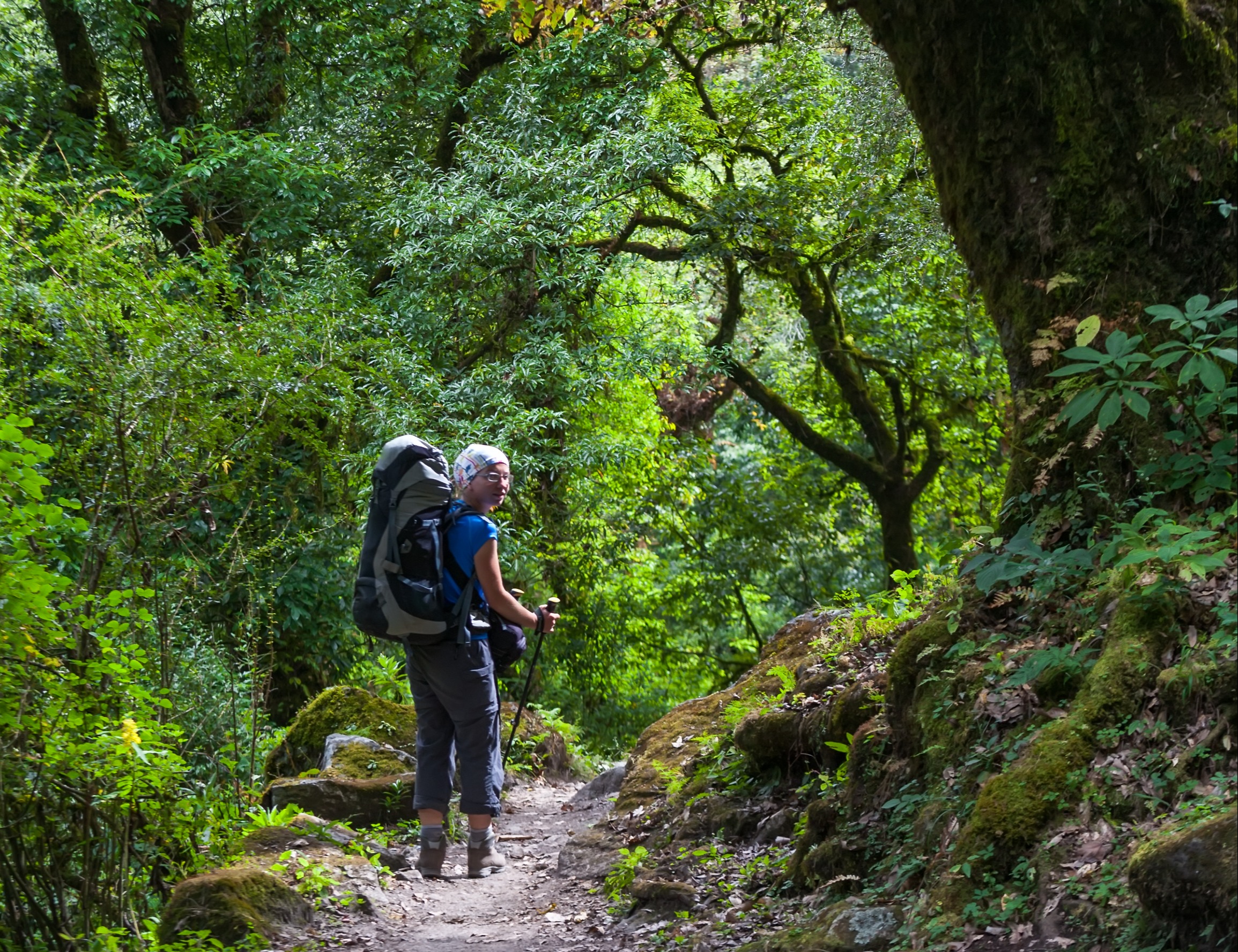
After climbing up to the village of Linga Chuta, you enter a beautiful forest of firs and rhododendrons. In spring, the rhododendrons offer a blaze of colour, and your steps are accompanied by the sound of birdsong. Be sure to keep your eyes open for the forest’s resident langur monkeys.
You spend the night in Namrung (2,660 m), which is a traditional Gurung hillside village that offers views of terraced fields, stands of fir trees, long waterfalls, precipitous and barren slopes, and snowy peaks. In centuries past, Namrung existed as a customs post on the Tibet–Nepal salt trade route, which saw salt from the north being traded for rice from the south. Today, it’s a relatively modern settlement, and you can still get Wi-Fi even this deep into the mountains.
Being on the edge of the Nupri region, the villagers of Namrung have a predominantly mixed Bhotia and Gurung heritage, with some Sherpa, Rai and Tamang ancestries in the mix too. In 2024, Milarepa Park was opened in Namrung; visitors can admire the intricately designed statues of various important Buddhist figures like Marpa Lotsāwa, Milarepa and Shakyamuni Buddha.
Accommodation options in Namrung are more developed than they were prior to the devastating March 2015 earthquake, so you can look forward to a few more comforts than those who trekked the trail in earlier times.
Day 7: Trek to Shyaula

The grandeur and beauty of the Manaslu Circuit are perhaps its greatest calling cards
- Distance: 10 km (6 miles)
- Duration: 5-7 hr
- Start point: Namrung (2,660 m)
- End point: Shyaula (3,500 m)
- Highlight: Come into view of Mt Manaslu, Mt Manaslu North and Naike Peak
Today is a significant day as you ascend nearly a vertical kilometre, and enter high altitude. So you should anticipate that your body might feel the strain tonight of the more rarified air. It's also going to grow colder.
Excitingly, Mt Manaslu, Mt Manaslu North (7,157 m) and Naike Peak (5,515 m) come into view at the head of the valley today. You also pass the route branching west to the base camp for Mt Himalchuli (7,893 m). You will also pass barley fields, and see watchtowers which were built in centuries past for defensive and communication purposes. Locals sometimes use them now to scout Himalayan bears. While some aren't maintained, the one in the village of Lho, which you pass through today, is safe to climb. Naturally, it sits in a spot that offers a fantastic vantage point, so it's worth asking your guide to arrange for you to climb it when you reach Lho.
Your overnight stop is in Shyaula (3,500 m), also spelled Shyala, which was severely damaged in the 2015 earthquake but has since been repaired.
Day 8: Trek to Sama with monastery side hike
- Distance: 10 km (6 miles)
- Duration: 5-6 hr
- Start point: Shyaula (3,500 m)
- End point: Sama (3,585 m)
- Highlight: Visiting Pungyen Monastery (3,800 m)

A meadow near Samagaon with grazing yaks
Today's route takes you to the village of Sama (3,530 m), also called Samagaon (variant spelling Samaguan). Sama sits at about the same elevation as Shyaula, so there's no major elevation jump today.
Sama is a major village in the Manaslu region, situated near the foot of Mount Manaslu, and it serves as a key entry point into the Upper Nupri (or Nubri) region. The communities here have stronger genetic and cultural ties to Tibet, their ancestors having migrated to the region in the 1600s from Tibet to the north. The local dialect reflects this heritage. Given the colder climate, residents can often be seen wearing Tibetan-style wraparound cloaks known as chubas.
After reaching Samagaun, we encourage you to also make the effort to hike to nearby Pungyen Gompa (3,800 m), a peaceful Tibetan Buddhist monastery that welcomes visitors. The trail to Samagaun from Shyaula is only about 4 km, so you will arrive at your overnight destination in good time to still fit in the 7 km roundtrip hike to the monastery.
When it comes to meals on the Manaslu Circuit, it's important to eat hearty meals, even if the high altitude has duled your apperite. You need the sustenance for the long days of trekking. In Sama, like elsewhere in the Upper Nupri, you can find some western dishes on the menu. But the local dishes are naturally superior, and include soups, curried dumplings and various noodle and rice-based options. We recommend eating vegetarian meals this far into the mountains as most of the meat on offer will have been transported a long way via pack animals.
Day 9: Rest day or roundtrip hike to Manaslu Base Camp
- Distance: 17 km (10 miles)
- Duration: 6-7 hr
- Start point: Sama (3,585 m)
- End point: Sama (3,585 m)
- Highlight: Visiting Manaslu Base Camp (4,800 m)

You see beautiful Birendra Lake on the Manaslu BC hike
Your body needs time to grow used to the new altitude, so today is an acclimatisation day.
If you’re taking strain, then the day can just be about resting in the village. If, however, you’re feeling relatively strong, then there’s a roundtrip hike on the cards to Manaslu Base Camp (4,800 m).
Manaslu Base Camp from Sama is a challenging hike as you face a stiff climb of at least four hours that sees you ascending over 1,200 m. While you start the hike in yak pasture, you soon have to contend with a path that takes you over mostly loose rocks and the moraine of Pungyen Glacier.
Please keep your eyes peeled for wildlife in the Upper Nupri as you could well see Himalayan tahrs (wild goats) and Himalayan blue sheep (called bharal). Also, where there are bharal, there are often snow leopards, though they're notoriously hard to spot.
Naturally, the scenery becomes increasingly mesmerising the higher you climb towards Manaslu Base Camp. Moreover, when you reach base camp, you have breathtaking views of Mt Manaslu, Manaslu Glacier and the pristine glacial Birendra Lake below. Today is sure to be one of the trek's most standout memories!
Note that hiking to a higher elevation during the day and then dropping back down for the night is a really effective acclimatisation strategy, so this hike is a great idea for yet another reason if you can manage it.
Day 10: Trek to Samdo
- Distance: 9 km (6 miles)
- Duration: 5-6 hr
- Start point: Sama (3,585 m)
- End point: Samdo (3,860 m)
- Highlight: Meeting a Khampa community

The twin peaks of Mt Manaslu are very distinctive
The trek today is a gradual climb, and takes you through alpine meadow where yaks graze in season. The trail can be rough underfoot in places, as you must navigate rocks, roots and some small streams, but overall it’s a straightforward and relatively easy hike. It’s the high altitude that makes the walk taxing.
You spend the night in the village of Samdo (3,860 m), which you enter through a white kani (traditional gateway). Incredibly, you should be able to have a hot shower tonight, a real luxury this high in the Himalayas. But before you head indoors, be sure to hike Samdo Ri (5,150 m), the peak just nest to the village, as this spot offers a truly sublime view of Mt Manaslu and Larkya Glacier as well as the Tibetan plateau to the north.
Samdo is home to a Khampa community. The Khampa are a Tibetic subgroup with a distinct culture of their own. They’re known for their strength, horsemanship, unique dialect, colourful clothing and strongly held Buddhist traditions. Their past warrior culture and fierce independence have been replaced with a culture of warm hospitality. The villagers mostly make a living through servicing the trekking industry as well as their traditional activities of yak herding and trade with Tibet.
Samdo’s residents can often be seen praying at the various monasteries, chortens and mani walls in and around the village.
Day 11: Trek to Dharamsala
- Distance: 9 km (6 miles)
- Duration: 4-5 hr
- Start point: Samdo (3,860 m)
- End point: Dharamsala (4,480 m)
- Highlight: Climbing up the head of the Buri Gandaki Valley

Dharamsala's seasonal campsite
You start today with a downward trail through fields before starting the long climb towards Larkya Pass. Your destination for the night is Dharamsala (4,480 m), also known as Larkya Phedi. North of Dharamsala is Fukang Glacier, which feeds the Buri Gandaki, and just north of that is the border with Tibet.
En route to Dharamsala you're rewarded with showstopper views of Manaslu as well as Larkya Glacier. You're also in a great place for some excellent birding, as there's so much solitude and silence this high in the mountains. Be on the lookout for the likes of alpine accentors, Tibetan and Himalayan snowcocks, Himalayan monals, and Himalayan griffon and bearded vultures.
Dharamsala is a tiny, wind-battered settlement that's only inhabited during trekking seasons. It's essentially base camp for summiting Larkya Pass. It boasts a simple teahouse and campsite, and not much beyond that. You want to head to bed relatively early tonight as tomorrow is a really big day! That said, note that it’s quite normal if you struggle to sleep, as very high altitude often causes insomnia, interrupted sleep or vivid dreams. The important thing is to just rest as best as you can.
Day 12: Summit Larkya Pass and descend to Bimthang
- Distance: 24 km (15 miles)
- Duration: 8-10 hr
- Start point: Dharamsala (4,480 m)
- End point: Bimthang (3,790 m)
- Highlight: Summiting Larkya Pass (5,106 m)
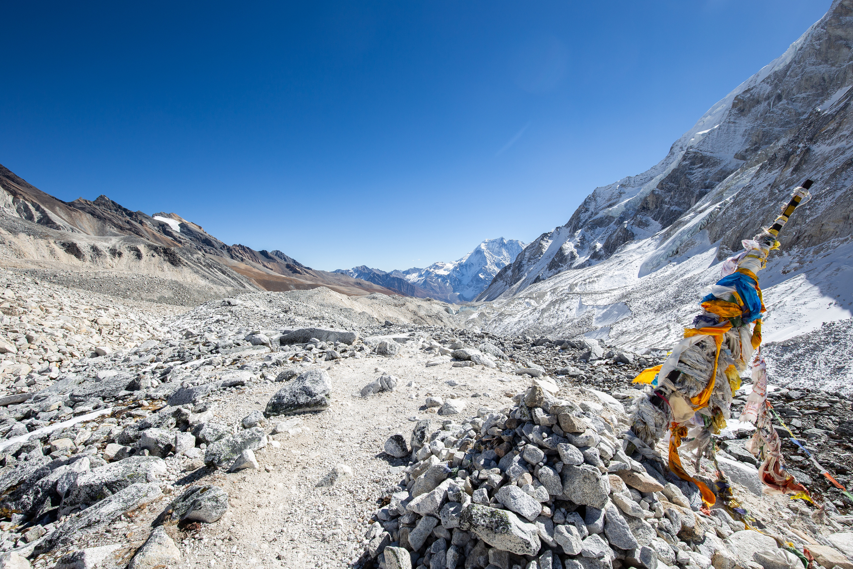
Tibetan prayer flags at the top of Larkya Pass
Today is the longest, hardest and most rewarding day of the whole Manaslu Circuit trek!
Starting early in the morning, you must finish the final stretch climbing out of the Buri Gandaki Valley to reach the snowbound mountain pass known as Larkya La (also spelled Larkye or Larke La), which is a sobering 5,106 m above sea level. This means climbing well over a vertical kilometre while your lungs contend with the thin air of such high altitude.
En route to Larkya La you pass a moraine and four frozen lakes. You must also almost always battle strong or even fierce winds that make the sub-zero air feel even colder. This is partly because the pass is so exposed, but also because it sits near glaciers which create strong temperature differences that cause katabatic winds (cold air flowing down). So it's a tough climb for more than one reason.
Yet all of that effort is worth it when you stand at the top of the Larkya La and take in the showstopping view (on clear days) of some enormous peaks, including Annapurna II (7,937 m), Himlung Himal (7,126 m), Gyaji Kung (7,030 m), Kang Guru (6,981 m) and Cheo Himal (6,820 m).
After the understandable high fives and photo ops, it's time to descend to Bhimthang (3,790 m), also spelled Bimtang. You do this in the company of Bimthang Glacier, which provides an itterly picturesque backdrop. You overnight in the village of Bhimthang (3,790 m), which sits in a pasture in the wide Dudh Khola Valley.
Day 13: Trek to Tilje then drive to Besisahar
- Distance: 26 km (16 miles)
- Duration: 4 hr
- Start point: Bimthang (3,790 m)
- End point: Tilje (2,300 m)
- Highlight: The softening landscape and warmer temperatures
You end the trek back down in a gentler climate zone
It's your final day of trekking, and it's a fairly short one. So any wobbly legs need only hang in there for a little longer.
The trail runs alongside the glacier-fed Dudh Khola as it flows southwest towards the green village of Tilje (2,300 m), your overnight stop. You drop nearly 1,500 m in altitude during the course of the trek, so the scenery changes greatly, starting with alpine meadow and transitioning into pine, juniper and rhododendron forests as well as terraced farms. You actually walk along the eastern edge of the Annapurna Conservation Area for the last part of the day.
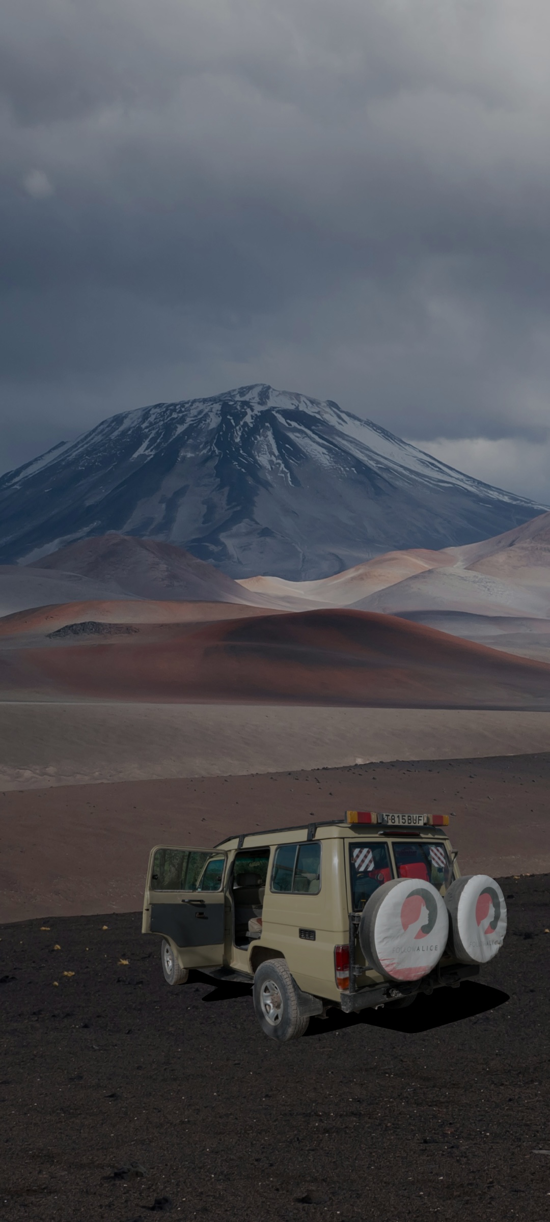
When you reach Tilje, you catch a ride to the town of Besisahar in a local sharing jeep. At just 830 m above sea level, Besisahar is sure to provide you with an oxygen-rich night of blissfully good sleep!
Day 14: Drive back to Kathmandu by local bus
This morning you catch a ride back to Kathmandu on a public bus.
While the ride is long and takes most of the day, there's time in the evening after settling into your hotel to stretch your legs again and maybe head out into town for a final group dinner.
Kathmandu is heaven for foodies, and you don't need a bottomless wallet to enjoy quality cuisine. We recommend trying Newari food, which is the core of Kathmandu cuisine. Alu tama, for instance, is a tangy and spicy Newari curry made with potatoes and fermented bamboo shoots. There are also various imported dishes, like momos (dumplings), which originated in Tibet but are now a street food staple in Kathmandu. For dessert, you might like to try the highly popular juju dhau, which is a sweet and creamy custard-like treat made from buffalo milk.
Day 15: Departure day
Today we take you to the airport in good time to catch your flight home. We bid you a fond farewell and hope that you'll return to Nepal soon to tackle another of the country's incredibly beautiful and rewarding Himalayan treks with us!
If you're keen to trek the Manaslu Circuit, we'd love to take you! Please check out our exciting Manaslu Circuit with Larkya Pass package to see all that we include as well as some more photos of this exceedingly beautiful corner of the world.

Mt Manaslu awaits you!