


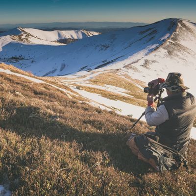
Africa has some of the most beautiful and unusual mountain ranges in the world, not to mention some of the least-known and most unexplored. (We're sure every true-blooded trekker is tingling at this thought!) The continent also boasts iconic freestanding mountains like Kilimanjaro. What's more, many of these mountains can be summited without any technical expertise. So with that in mind, here's our trekking guide to the 10 mountains in Africa that we believe offer the most rewarding adventures.
We start in the north and work our way southwards ...
1. Mount Toubkal, Atlas Mountains, Morocco
- Location: High Atlas Mountains, central Morocco
- Highest point: 4,167 m
- Reserve: Toubkal National Park

Snow on Mount Toubkal is seasonal
Mount Toubkal (or Jebel Toubkal in Arabic) is the tallest mountain in the Atlas range. It therefore also enjoys the status of being North Africa's highest mountain, a label that naturally serves as a siren call to all avid trekkers.
Lower Mount Toubkal is fertile and lush, and you can find terraces of walnut, apricot and cherry trees as well as apple orchards and olive groves. It's here, at 1,750 m above sea level (asl), that you enter Toubkal National Park.
Ascend the mountain a little more and you enter a drier landscape of juniper and oak forests. It's in this vegetation band that those trekking the main mountain trail pass Sidi Chamharouch Shrine, a pre-Islamic shrine believed by devotees to possess healing powers.
Next comes the alpine zone and then, finally, the summit, which is a world of bare rocks and loose scree, though in winter it receives the softening look of snow. Like any self-respecting peak, the summit of Mount Toubkal truly delivers when it comes to views: you can look forward to a panorama of the surrounding Atlas mountains and valleys. What's more, on clear days, you can even see the Sahara Desert to the south!
Speaking of the desert, Mount Toubkal's proximity to both the fertile plains of nearby Marrakech to the north and the arid vastness of the Sahara Desert to the south make it part of a unique ecological transition zone.
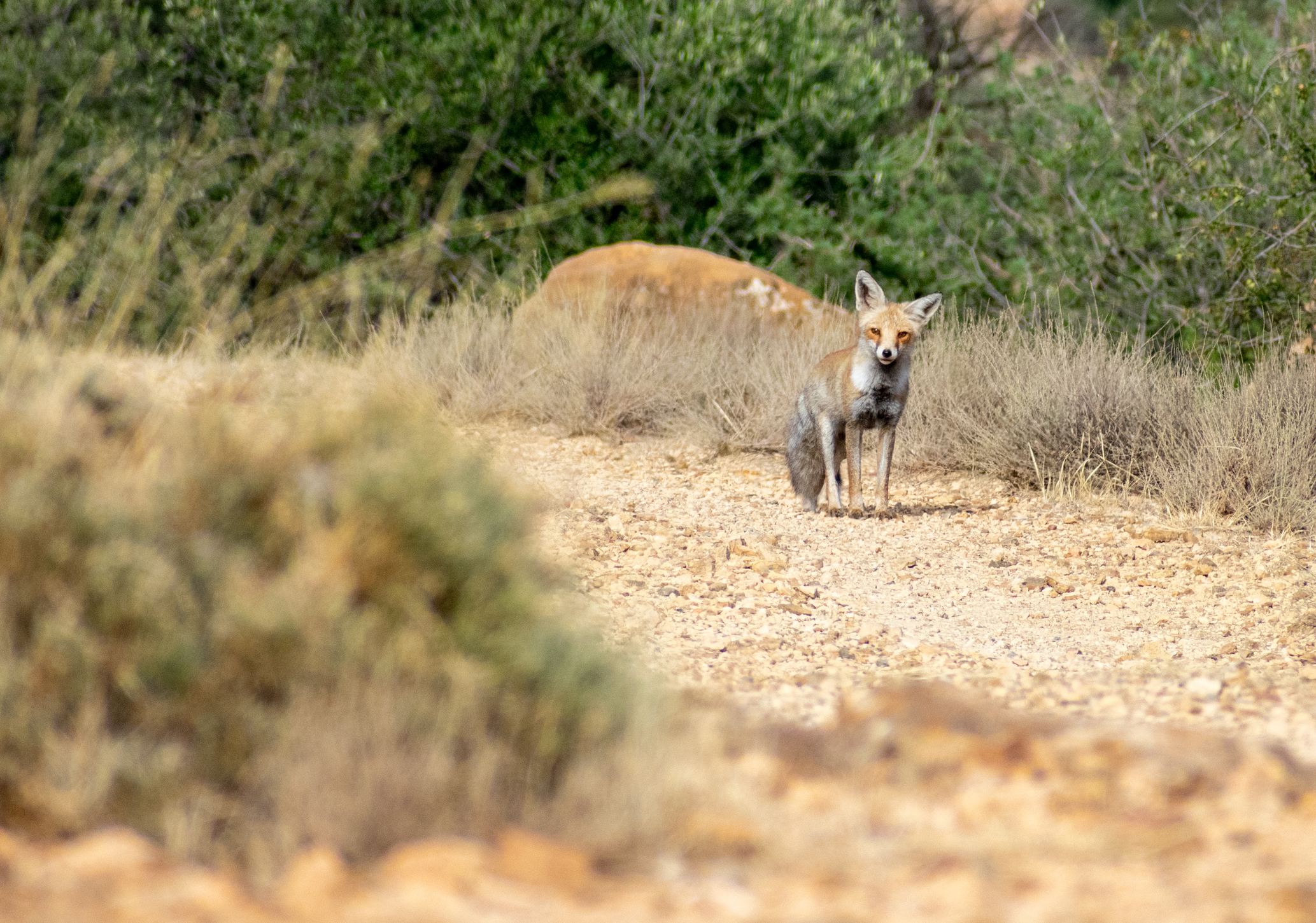
A Maghreb red fox spotted on Mount Toubkal
Some of the mammals you might hope to see on Mount Toubkal are the Maghreb red fox, Barbary sheep, Barbary macaque, and North Africa hedgehog.
As to birds, golden eagles, peregrine falcons and bearded vultures are often spotted soaring above the mountains' cliffs. Other birds you can find high on the mountain include alpine choughs and crag martins, while further down you might spot Atlas horned larks, Moussier’s redstarts, Levaillant’s woodpeckers and Tristram’s warblers.
Trekking Mount Toubkal
- Main trek: Summit climb (non-technical)
- Duration: 2-4 days
- Trek guide: Compulsory
- Best time: April, May, September and October

The village of Imlil, the gateway to Toubkal National Park
Almost all treks up Mount Toubkal start in Imlil, a collection of small, traditional villages clinging to the mountain's northern foothills. Imlil's residents are mostly Berbers (or Imazighen), a people group believed to be the original inhabitants of North Africa.
Mount Toubkal has well-established trekking infrastructure, making it a great option for trekking newbies. For starters, there are mountain refuges that offer meals as well as dormitory-style accommodation, so you can trek with little equipment. That said, you can also camp if you'd prefer.
The trails on Mount Toubkal are also well-established, so there's no getting lost. That said, as of 2019, trek guides are now compulsory, so you wouldn't stand a chance of getting lost anyways.

Trekkers on Mount Toubkal
A Mount Toubkal trek can be done over two to four days. The three-day itinerary is a good choice for most folks, but if you're concerned about feeling yucky from the high altitude, perhaps consider the four-day option. A trek like this is an adventure, after all, not a race!
There are plenty of local and international tour operators offering Mount Toubkal treks, so you really are spoilt for choice. Some of the established operators who specialise in Atlas Mountains treks are Toubkal Trekking, Toubkal Peaks, Mount Toubkal, Toubkal Guide and Morocco Toubkal Adventure. (We wish you luck remembering which is which! Smug smile from us, a company with a truly unique name. 😏)

A café on the main Mount Toubkal trail
The best (and busiest) months for trekking Mount Toubkal are April and May (spring) and September and October (autumn). Spring ushers in warmer weather while still offering the beauty of some snow on the summit (though said snow can also make the trail a bit muddy when it starts melting). Autumn is a great option as it enjoys stable, dry weather and tends to offer the clearest views. In winter you risk doing the entire climb in snow.
Finally, please note that you'll need crampons if there's snow and ice on the mountain. That said, Mount Toubkal always remains a non-technical climb.
How to reach Mount Toubkal
Mount Toubkal is wonderfully easy to reach, as you simply fly into Marrakech Airport and then drive south for 1.5 hours to reach Imlil.
2. Simien Mountains, Ethiopia
- Location: Amhara, Ethiopian highlands, northern Ethiopia
- Highest point: Ras Dejen (4,533 m), also spelled Ras Dashen
- Reserve: Simien Mountains National Park
The Simien Mountains are one of Ethiopia's most beautiful regions
The Simien Mountains, a UNESCO World Heritage Site since 1978, are an unusual-looking mountain range, except perhaps for those familiar with the Drakensberg. This is because, like the Drakensberg, the Simiens are an escarpment range, characterised by a series of high plateaus and pinnacles separated by very deep and steep-sided valleys. The Simiens are often covered in a deep green, though in winter they can become blanketed in snow.
The difficult terrain means the Simien Mountains have very few residents. But among those who do call the Simiens home, most belong to the Amhara people group. The Amhara speak Amharic and have a rich cultural heritage deeply intertwined with the Ethiopian Orthodox Church. They tend to live as nomads or in small, rural settlements.

A troop of gelada baboons photographed by E. Williams in the Simien Mountains
There's a high level of endemism in the Ethiopian Highlands, particularly in relation to its wildlife. And the Simien Mountains in particular are a sanctuary for many of these species.
The endemic and highly unusual-looking gelada monkey, for instance, has become the symbol of the Simien Mountains. Also called the gelada baboon, this primate has a small, furless red patch on its chest that looks a little like an upside-down, bleeding heart. Happily, gelada sightings are common; they can usually be seen in troops of roughly 20 to 30 individuals, but sometimes move around in giant troops of 300 or more!
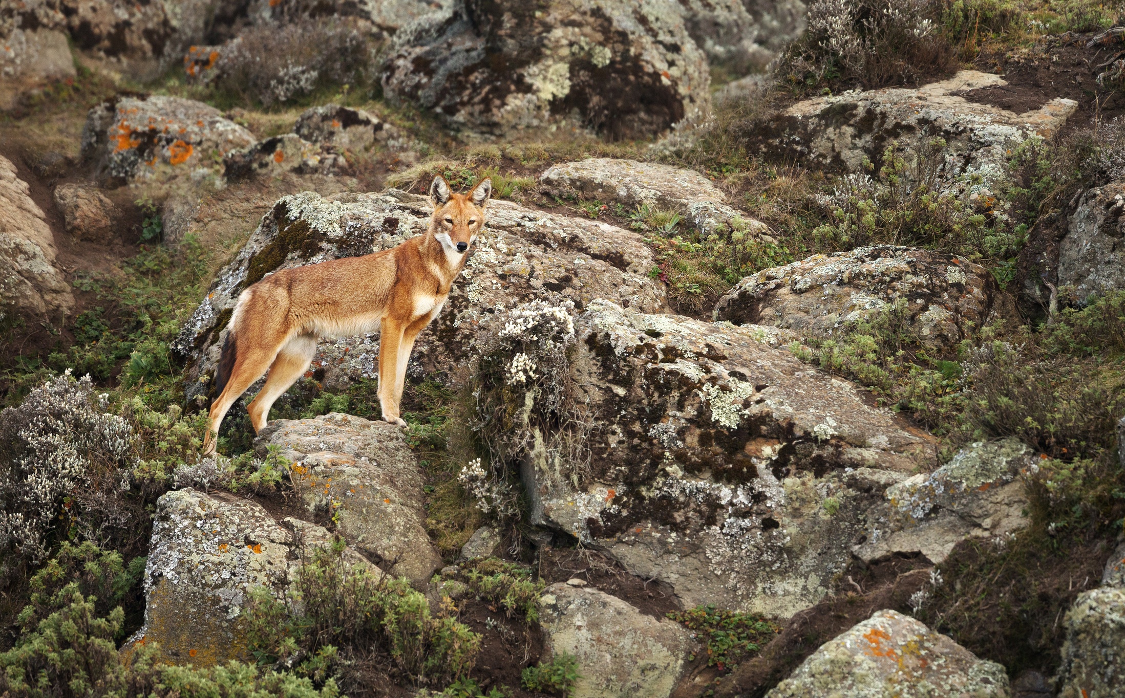
The very rare walia ibex (or Abyssinian ibex), a type of giant goat, can also only be found in the Simien Mountains. Other wildlife to look for include Menelik's bushbucks, klipspringers, caracals and Ethiopian wolves.
When it comes to birds, the Simien Mountains are especially known for bearded vultures. The mountain range also hosts six endemic species, namely the Abyssinian longclaw, Abyssinian catbird, Ethiopian bush crow, spot-breasted lapwing, Ankober serin, and black-headed siskin.

A rare walia ibex
Trekking in the Simien Mountains
- Difficulty: Non-technical
- Trek guide: Not mandatory, but highly advisable
- Best time: Any month except April or May
While you can trek to the summit of Das Rejen in order to reach the highest point in Ethiopia, the idea of a mountain summit isn't really the main pull of the Simien Mountains.
One of the true delights of trekking in the Simien Mountains is spending time in a pristine and largely untouched environment. It's also very special as the terrain, wildlife and vegetation are very different to what most visitors have ever seen before. And the Amhara culture is one that few foreigners ever have the privilege of encountering. You usually overnight in community lodges that offer dormitory-style accommodation.
The Simien Mountains are therefore truly a bucket-list-worthy destination for anyone who likes to take on adventures the mainstream isn't even aware exist.
The Simiens are also a great option for anyone who doesn't mind roughing it a little. For instance, the paths heading up the escarpment often aren't well developed and can be very steep and slippery . So at times you'll be quite literally treading along paths that are off the beaten track!
There are various routes you could opt to trek in the Simien Mountains. The five-day Debark to Chenek Trek, for instance, is a great option as it takes you into the heart of the mountains. This route can be challenging, as some days you cover 25 km and the high altitude can take a toll. But know that the wild scenery is supremely rewarding.

The views from atop the Simien Plateau are breathtaking
When visiting the Simien Mountains, you want to trek in the company of a local scout and a trek guide. Your scout will be armed to protect you from any potential incidents with the wildlife. Your trek guide will ensure you're always safe, don't become lost, and learn all about the nature and culture that you encounter. Remember that you can't rely on the sorts of emergency services you might enjoy in more developed parts of the world.
Brilliant Ethiopia offers a range of exciting treks in the Simien Mountains, including some community treks. Such treks ensure most of your money stays highly local, which is a central pillar of sustainable tourism. You might also like to check out Trek the Simien Mountains with Simon Assefa. Simon grew up in the Simien Mountains and takes great pride in sharing his heritage with trekkers. A third option is Awaze Tours, which is an Ethiopian tour company based in Addis Ababa.
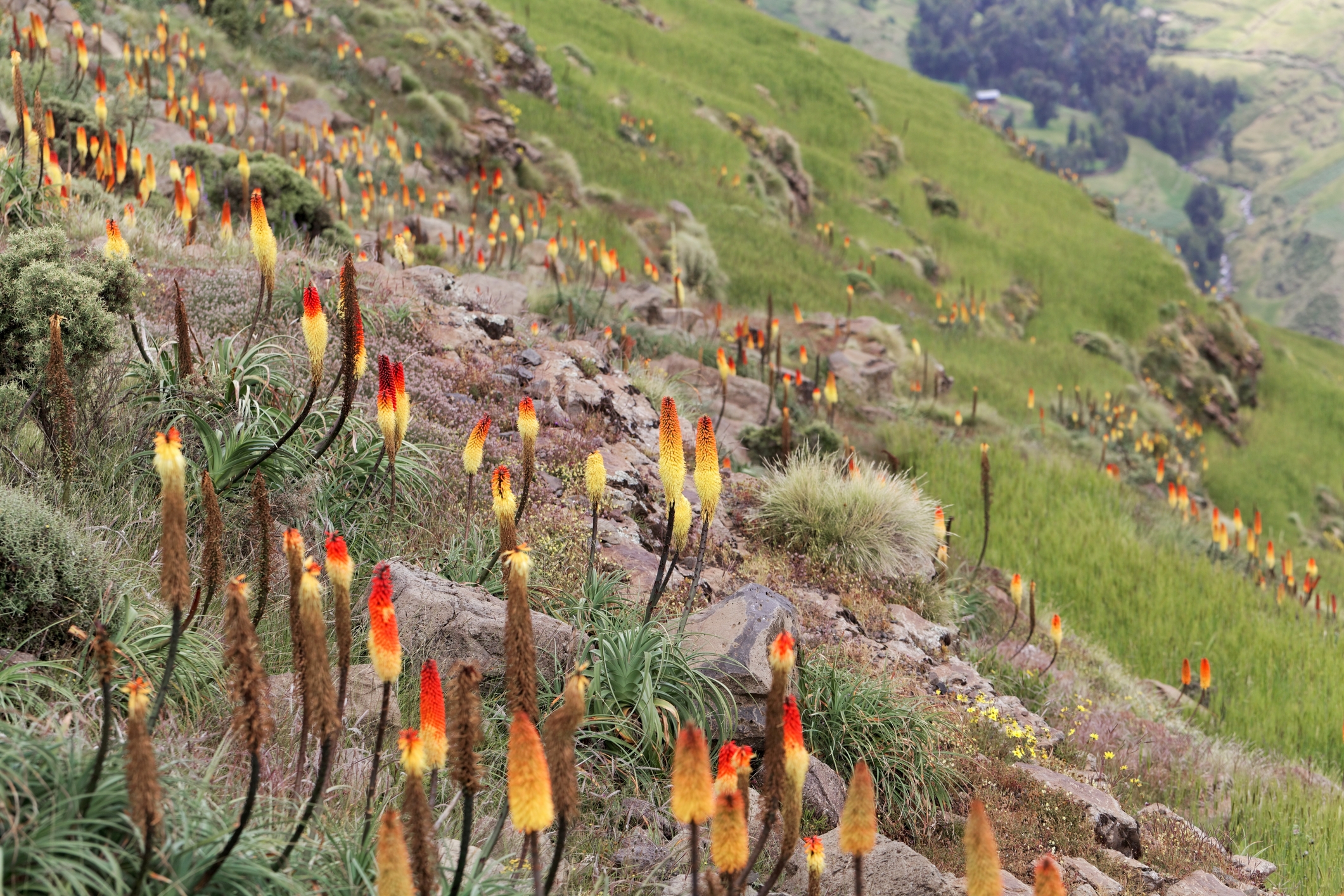
Red hot pokers abound in the Simien Mountains
For a detailed and unaffiliated guide to travelling in this neck of the woods, we recommend reading Stephen Gollan's Trekking Guide – Simien Mountains National Park Ethiopia. He also discusses the pros and cons of trekking in the different seasons. Don't make the mistake that some foreigners do of thinking that Africa doesn't get cold! The Simien Mountains experience regular snow and the wind can be a villain.
How to reach the Simien Mountains
The best way to reach Simien Mountains National Park is to fly into Addis Ababa Bole International Airport in central Ethiopia, and then catch a domestic flight to Gondar Airport. From the town of Gondar, it's only a two-hour drive to reach the park.
3. Bale Mountains, Ethiopia
- Location: Oromia, Ethiopian Highlands, southeast Ethiopia
- Highest point: Mount Tullu Dimtu (4,377 m)
- Reserve: Bale Mountains National Park

Sunset over the Bale Mountains
Another of the many incredible ranges in Ethiopia offering superlative trekking is the Bale Mountains. This mountain range is also part of the highlands of Ethiopia, though is found much further south in the country.
The key drawcard of the Bale Mountains is its truly incredible biodiversity. As explained on the Bale Mountains National Park website:
Ethiopia is one of the top 25 biodiversity-rich countries in the world, and the Bale Mountains have one of the highest incidences of animal endemism of any terrestrial habitat on earth; the park itself holds 26 percent of Ethiopia’s endemic species.
A core reason why Bale Mountains National Park (BMNP) is able to boast such biodiversity is its great altitude range and consequently diverse landscapes and biomes. The centre of the park is dominated by the enormous Sanetti Plateau, which sits above 4,000 m and is covered in striking Afroalpine meadows.
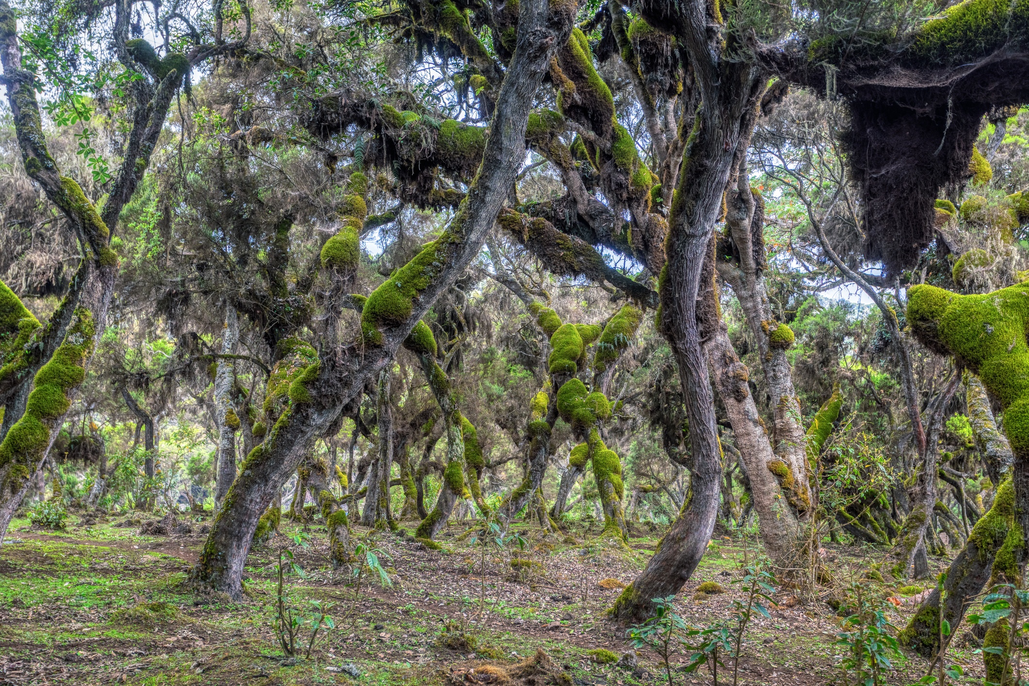
There are also beautiful forests in the south of BMNP, where the plateau drops down by 2,000 m, creating the Harenna Escarpment. For instance, there's a belt of erica trees here that's often wreathed in mist, and so lichens and moss cling to the tree trunks, creating the look of a magical fairyland. Elsewhere on the escarpment you can find small clumps of endangered wild arabica coffee trees.
The Bale Mountains are the main habitat of Ethiopian wolves
Some of the endemic animals to look for in the Bale Mountains are mountain nyalas, Menelik's bushbucks, Bale monkeys, Starchk's hares and giant molerats. Other exciting wildlife includes grey duikers, olive baboons, black-and-white colobus monkeys, mantled guereza monkeys and warthogs.
But by far the most noteworthy creature that all visitors hope to see in BMNP is the Ethiopian wolf. Also called the Simien fox or red jackal, this is Africa's rarest canid. It has a beautiful red-and-white pelage, which helps with efforts to spot it.
Notably, the Bale Mountains are rated by the African Bird Club as the #4 birding spot in all of Africa! Over 300 species of birds live in the park, and a further 170 migratory species have been seen here. Of the resident birds, six are endemics: the blue-winged goose, yellow-fronted parrot, Abyssinian longclaw, Abyssinian catbird, spot-breasted plover and Ethiopian siskin.
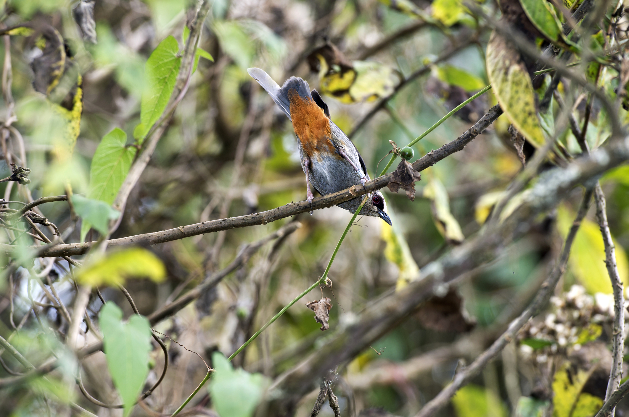
An Abyssinian catbird
Trekking in the Bale Mountains
- Treks: Non-technical
- Guide: Highly recommended
- Best time: November to February and June to September
The Bale Mountains aren't on this list of the best mountains in Africa for trekking because they present a challenging summit adventure. You can, in fact, drive along a rough dirt road to reach Mount Tullu Dimtu on the Sanetti Plateau. It's the least peak-looking peak you could envision.
The joy of trekking in the Bale Mountains is, instead, about visiting the striking range of landscapes and appreciating the rich biodiversity they host. The high degree of plant and wildlife endemism means this is a true bucket-list destination for dyed-in-the-wool nature lovers.

Bale Mountains treks are all about the nature, not reaching a peak
Trekking in the Bale Mountains is therefore open to a plethora of itineraries. You could go on a day's hike or enjoy more than a week of trekking. You can also camp or do community stays. Whatever you choose, be sure to go with a local guide to get the most out of the experience and also ensure you don't lose your way.
Similarly to the Simien Mountains, you might like to research the packages offered by Awaze Tours or Brilliant Ethiopia. Then there's also Bale Mountains Trekking, which specialises in trekking, birdwatching and nature tours and was founded by Bale Mountains native Mohammed Worko. Alternatively, Bale Mountains Eco Trekking, based in Bale, offers standard as well as customised treks in the Bale Mountains.
A section of the Harenna Forest
The best times of year to trek in the Bale Mountains are the two dry seasons. The first dry season (November to February) tends to offer clear skies, great animal-spotting conditions, and lots of migratory birds The other dry season (late June to September) offers a lush landscape near the start, as well as milder plateau temperatures.
How to reach the Bale Mountains
You're going to fly into Addis Ababa Bole International Airport in central Ethiopia. You could then drive or catch a bus south for roughly eight hours to reach BMNP. Alternatively, fly on to Robe Airport just outside of BMNP, but do note that these flights don't run every day. From Robe Airport, it's about a two-hour drive to the park.
4. Mount Kenya, Kenya
- Location: Meru and Nyeri counties, central Kenya
- Highest point: Batian (5,199 m)
- Reserve: Mount Kenya National Park and Reserve
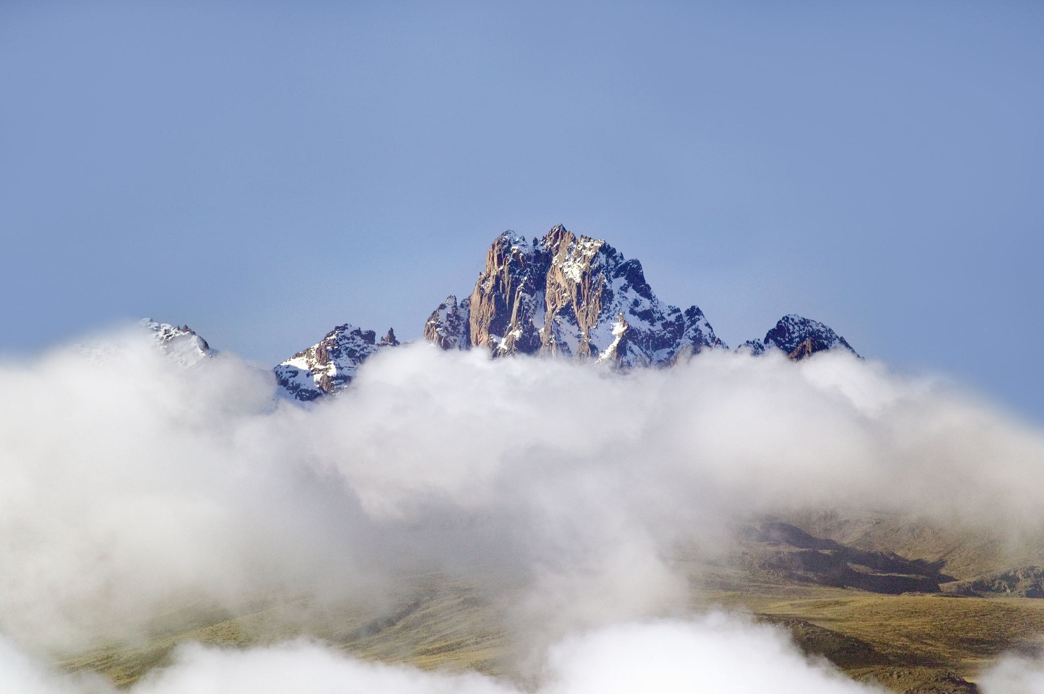
The peak of Mount Kenya ringed by cloud
Mount Kenya is Africa's second-tallest mountain after Mount Kilimanjaro in neighbouring Tanzania. It's also the first of the volcanic mountains that we discuss in this guide to the greatest mountains in Africa to trek. (But it certainly isn't the last, as the Great Rift Valley of East Africa is a hotbed for enormous volcanoes, pun intended.)
Mount Kenya has a particularly jagged profile, which adds to its romance in the eyes of many. In fact, there are five distinct peaks on the mountain, of which Batian (5,199 m) is the highest. Adding to the mountain's allure are the 12 remnant glaciers spread across its arctic summit.

Two rock hyraxes in the moorland band of Mount Kenya
A UNSECO World Heritage Site and International Biosphere Reserve, Mount Kenya is a must-visit for nature lovers. The lower part of the mountain has wetlands, montane forest and bamboo thickets. This part of the mountain hosts elephants, buffaloes, lions, leopards, elands, bushbucks, black-fronted duikers, olive baboons, black-and-white colobus monkeys and blue monkeys, among other mammals.
Higher up in the heath and then alpine zones you enjoy sweeping views of the countryside. There are also various striking plants to appreciate in the heath band, like ericas, giant lobelias and giant groundsels. These larger plants give the landscape a certain otherworldly charm, especially when there's mist adding to the enchantment. You're also quite likely to spot curious hyraxes scuttling among the rocks.
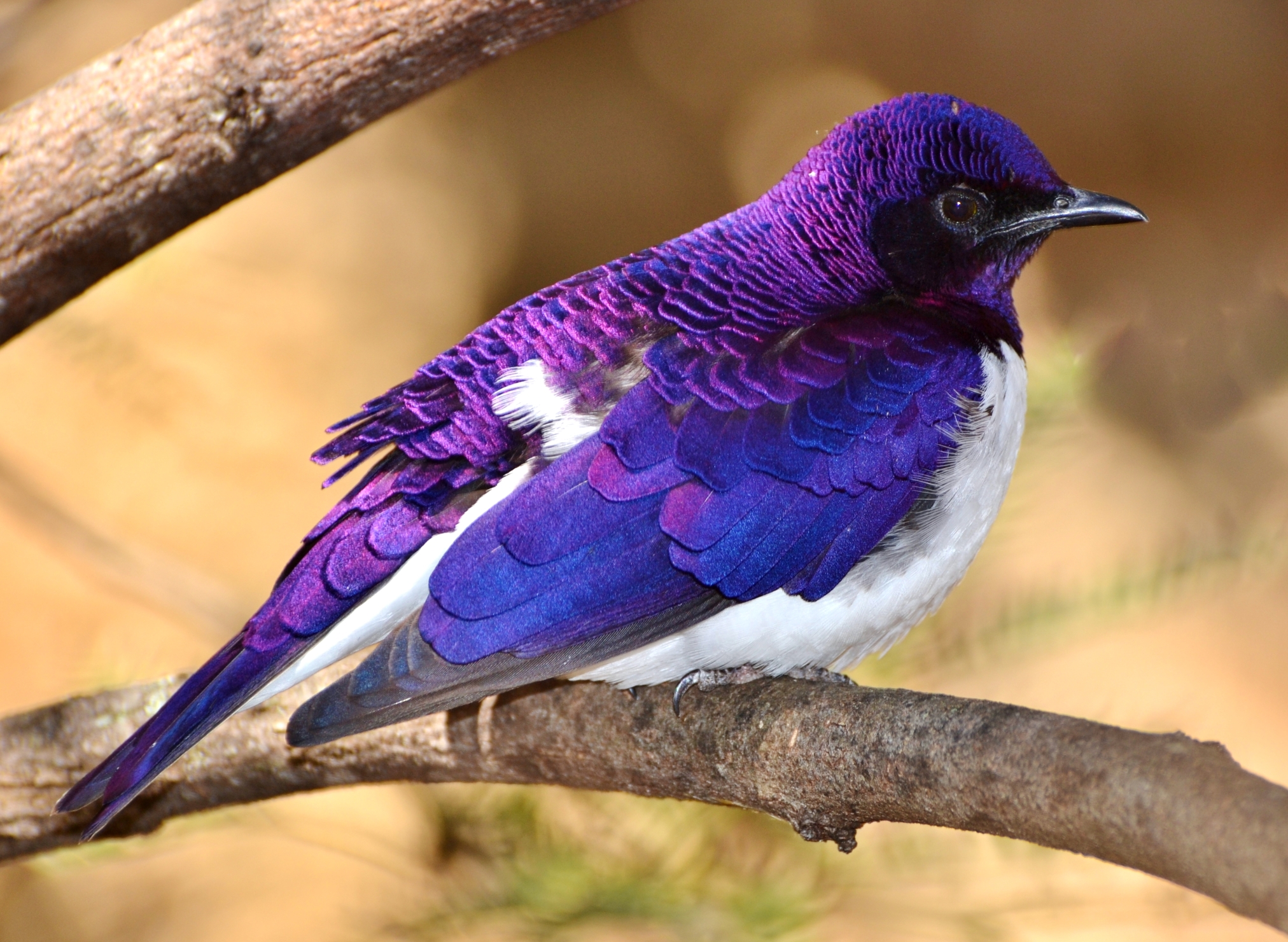
Violet-back starlings can be found on Mount Kenya
There are over 130 bird species within Mount Kenya National Park, including some highly localised species. For instance, look for violet-backed starlings, green pigeons, cinnamon-breasted bee-eaters and Meyer’s parrots.
Trekking Mount Kenya
- Main treks: Summit climb (technical) or peak trek (non-technical)
- Duration: 3-6 days
- Guide: Optional, but highly recommended
- Best time: January to February or June to September

A trekker on Naro Moru, Mount Kenya's most popular route
Mount Kenya offers Africa's highest mountaineering summit, since Mount Kilimanjaro, while taller, has a non-technical summit.
There are several established routes leading up Mount Kenya. The most popular are Naro Moru on the western slope, Chogoria on the eastern slope, and Sirimon on the northern slope. Happily, you can ascend one route and then descend via a different one, all the better to enjoy as much varied scenery as possible.
For anyone wanting to climb Batian Peak or Nelion Peak (the second-tallest peak on the mountain), or both, note that you need to have proper mountaineering experience and equipment. We highly recommend climbing with a reputable company such as Adventure Alternative.
If you don't have mountaineering experience but still want to climb Mount Kenya, then you can head for Point Lenana (4,985 m), which is a trekking peak. The mountain's third highest peak, Lenana is about two kilometres as the bird flies to the southeast of Batian Peak.
Please note that the final stretch up Point Lenana is still tricky, as it's very steep and rocky. But this does mean that it offers a great sense of achievement when you reach the top, not to mention incredible views, which include an eyeful of Batian Peak.
There are various tour operators offering guided Mount Kenya treks to Lenana Point. If you'd like to support a local tour operator, perhaps investigate Go to Mount Kenya or Kenya Wildlife Tours.

Trekkers in the alpine desert zone of Mount Kenya
The best time to climb Mount Kenya is during one of the dry seasons: January to February or June to September. Not only should you have clearer views during the dry seasons, but you also shouldn't have to contend with rain and slippery trails.
How to reach Mount Kenya
Mount Kenya is pretty easy to reach. It's just a four-hour drive north from Nairobi, the capital city of Kenya. Helpfully, Nairobi's airport – Jomo Kenyatta International Airport – is the main hub for airlines flying into East Africa, so you should be able to fly there directly from other continents.
Note that while private transport is the easiest way to reach Mount Kenya, there are various private bus companies you could also research.
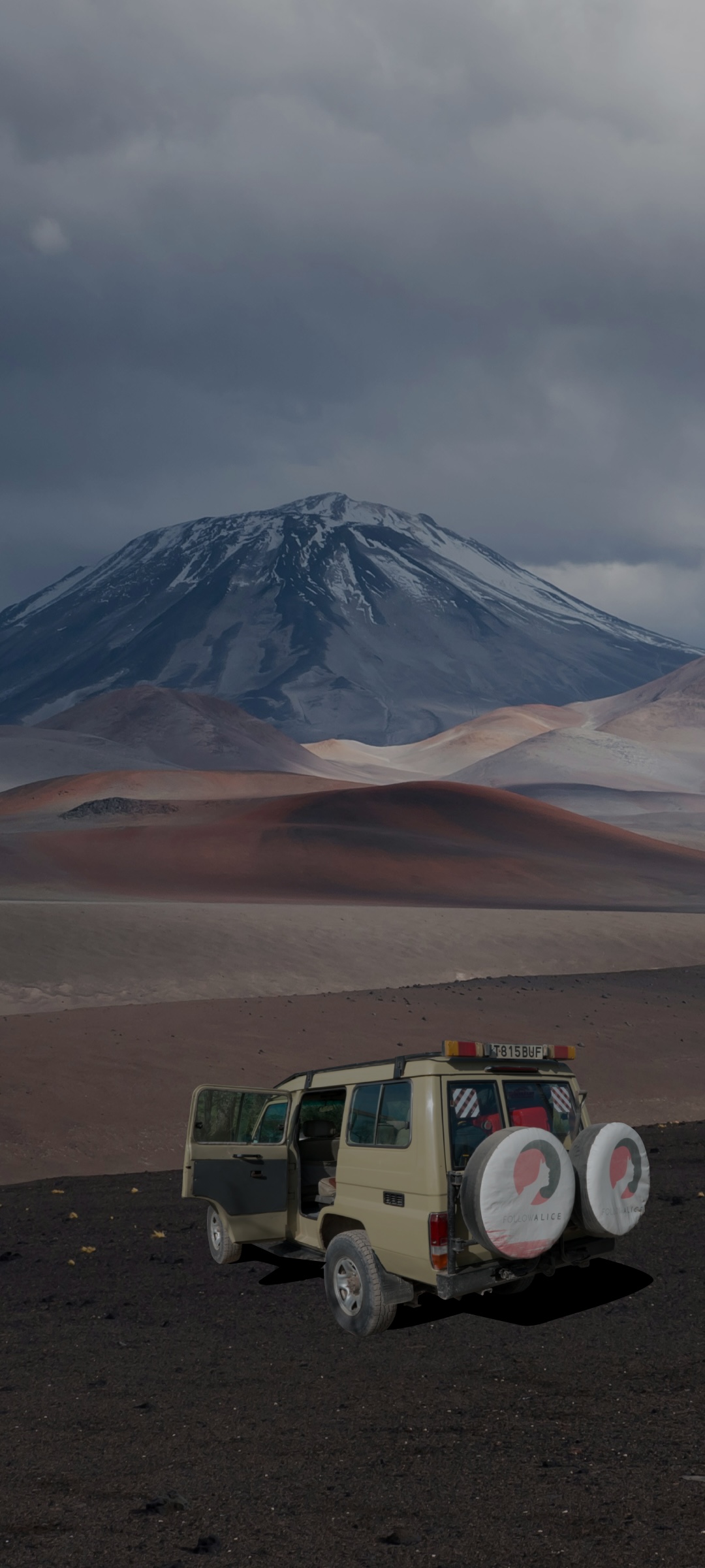
5. Mount Ol Doinyo Lengai, Tanzania
- Location: Northern Tanzania, near the border with Kenya
- Highest point: 3,188 m
- Reserve: Ngorongoro Conservation Area
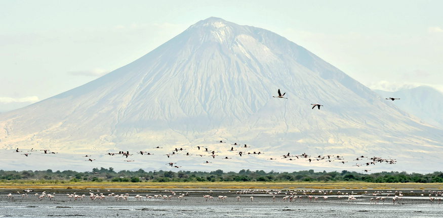
Mount Ol Doinyo Lengai with Lake Natron in the foreground
Another of the iconic freestanding mountains of the African continent is Mount Ol Doinyo Lengai. This conical mountain is located a stone's throw from the border with Kenya, another stone's throw from the escarpment of the Great Rift Valley, and a further stone's throw from Lake Natron.
Given these details, we're sure you can appreciate that the view from the top of Mount Ol Doinyo Lengai is legendary! What's more, the inward view from the summit is no less mesmerising. This is because Ol Doinyo Lengai is an active volcano. That's right. Instead of a peak, the 'summit' of the mountain is the highest point on its crater rim, and trekkers who reach the top enjoy a sobering view down into the maw of this mighty mountain.

Teeny-tiny trekkers on the crater rim and the steep slope to the volcano's ash pit
Mount Ol Doinyo Lengai is sacred to the Maasai people. In fact, they believe that Ol Doinyo Lengai is the dwelling place of Enkai (or Engai), their god or supreme deity. The name Ol Doinyo Lengai ctually means "Mountain of God" in the Maasai language. Enkai is associated with both blessings (such as rain and fertility) and punishments (such as drought or volcanic eruptions). For this reason, the Maasai sometimes perform prayers and offerings at the mountain's base.
You won't see much game on the mountain during your trek, especially as your ascent is undertaken in the dark (more on this below). But you might be lucky enough while at the summit to spot a bird of prey or two circling above. African fish eagles, Verreaux's eagles, Rüppel's vultures and Taita falcons are common to the region. Finally, during your descent, you might well spot some Thomson's or Grant's gazelles on the lower slopes.
Trekking Mount Ol Doinyo Lengai
- Main trek: Summit climb (non-technical)
- Duration: 8-12 hours
- Guide: Compulsory
- Best time: June to October

A Maasai shepherd in front of Mount Ol Doinyo Lengai
While most of the treks in this blog post require two or more days, Mount Ol Doinyo Lengai is tackled in just one day. We even have a blog post with a title to that effect: Hike Ol Doinyo Lengai: East Africa’s most challenging one-day climb. Although perhaps this title misleading, as it's actually an overnight hike. But there's just no sleeping taking place.
You normally start climbing Ol Doinyo Lengai a little before midnight and finish up late the next morning. The reason for this strange timing is that you want to avoid the sometimes crippling daytime heat.
Trekking Mount Ol Doinyo Lengai at night simply adds to the epic nature of the adventure, in our opinion. Moreover, you then enjoy glorious sunrise views while standing on the crater rim.
Please note that trekking Mount Ol Doinyo Lengai isn't for the fainthearted. Firstly, there are some very steep sections near the top. Secondly, it's a very rocky climb. And thirdly, there's lots of loose gravel and scree to navigate. It's a tall order of a hike, pun intended, so you need to be pretty darn fit and have a head for heights.
We at Follow Alice would love to guide you on a Mount Ol Doinyo Lengai climb if you're keen to take on this challenge. Please check out our exciting Tanzania safari and hiking itinerary to learn more.
Your guide up Ol doinyo Lengai will be a local Maasai, who will be able to share with you the mountain's lore. It's also very good on such a treacherous hike to have someone who's able to pick out the best path and can also literally lend you a hand at times.

Trekkers descend the last stretch with the Great Rift Valley escarpment in the distance
If you wish to see a green Ol Doinyo Lengai, then plan to trek during or at the tail end of one of the rainy seasons (March to May or November to December). Since there's never much rain in this region, it isn't particularly risky to plan a rainy-season trek; just allow at least one backup night for the trek and you should be fine. If you want the coolest, driest weather, then we recommend planning your trek for sometime between mid June and October.
Mount Ol Doinyo Lengai takes some commitment to reach, as it's very remote. That, of course, is also part of its appeal! Very few travellers actually make the effort to visit, and so you have the privilege when there of being very far from any sort of crowd. In other words, the region doesn't really have peak seasons. In fact, you're highly likely to be the only party climbing the mountain on any given night!
How to reach Ol Doinyo Lengai
To reach Mount Ol Doinyo Lengai, fly into Kilimanjaro International Airport in northern Tanzania. Note that those coming from outside of Africa might need to first fly into a bigger airport (like Dar es Salaam or Nairobi) and then catch a short connecting flight to Kilimanjaro Airport. You must then travel north by car, first on paved roads and then, finally, on a long and bumpy dirt road. This final road runs parallel to the Great Rift Valley escarpment and takes you through very rural Maasai villages, so it's quite the experience.
Allow the better part of a day for this journey. It's also necessary to travel in a 4x4 since the dirt road is very rutted in places. You'll stay in one of the accommodations near Lake Natron and this will be your base for your Mount Ol Doinyo Lengai trek.
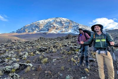
6. Mount Kilimanjaro, Tanzania
- Location: Northern Tanzania, right on the border with Kenya
- Highest point: Uhuru Peak (5,895 m)
- Reserve: Mount Kilimanjaro National Park

Kilimanjaro rises out of a subtropical plain
Mount Kilimanjaro, a UNESCO World Heritage Site, is the tallest mountain in Africa, making it one of the world's Seven Summits. It's also the tallest freestanding mountain in the world!
Kilimanjaro is a volcanic mountain that rises up out of a plain and is not far from the Equator. Consequently, it has a fascinating range of concentric climate bands. At the mountain's base you have agricultural land that's used to grow coffee and bananas. Next comes beautiful montane forest, then Afroalpine heath, then an alpine desert, and finally an arctic world that sustains (for now) permanent glaciers.
In the rainforest, you can look forward to hopefully spotting some of Kilimanjaro's unusual wildlife, like black-and-white colobus monkeys. There's also a flower that grows nowhere else in the world but in the Kilimanjaro forest: the Kilimanjaro impatiens.
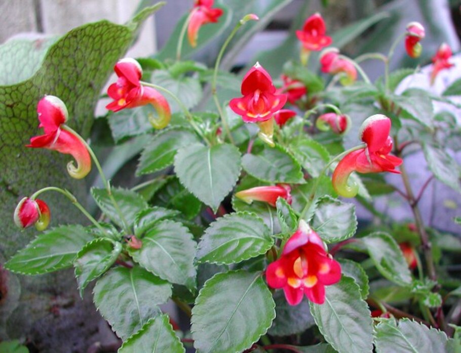
The Kilimanjaro impatiens is endemic to the mountain
Next you have the heath (or moorland) band, which is possibly the most iconic vegetation zone on the mountain. Here you find giant groundsels and giant lobelias, enormous plants that are like nothing most folks have ever encountered. They're a photographer's dream. And let's not overlook the gorgeous, round, pale yellow Kilimanjaro sugarbush (or protea).
Once you reach the alpine desert, the landscape becomes less of a focus and is replaced by an obsession with the views! Sometimes you can see the vast plains below and distant Mount Meru, other times a fluffy, far-reaching bed of cloud. Once you near the summit, your views include beautiful glaciers as well as snow and ice in season.

A misty heath scene on Mount Kilimanjaro
Not everyone is aware that Mount Kilimanjaro actually has three cones on it. These cones were formed by volcanic eruptions long ago, and so each cone has a crater at the top.
Trekkers naturally want to climb to the highest point in Africa, and so nearly everyone who climbs Mount Kilimanjaro climbs the central cone, Kibo. The highest point on the crater rim of Kibo – and therefore the summit of Kilimanjaro – is Uhuru Peak (5,895 m). The word uhuru means freedom in Swahili.
Trekking Mount Kilimanjaro
- Main trek: Summit climb (non-technical)
- Duration: 5 to 9 days
- Guide: Compulsory

Trekkers cross Shira Plateau on their Kilimanjaro trek
One of the interesting things about Mount Kilimanjaro is that it isn't the hardest mountain in Africa to climb even though it's the tallest. Mount Kenya and Mount Stanley, for instance, are technical climbs requiring mountaineering equipment and experience. Kilimanjaro, on the other hand, can be climbed with just regular hiking gear. This is what makes it so popular – it's the highest peak in the world that a regular trekker can aim to climb.
All that said, Kilimanjaro is a tough climb, and only about half of those who start the trek actually manage to reach the summit. The main reasons for this are:
- Many trekkers don't have the necessary endurance
- Folks try to ascend it too quickly and develop altitude sickness.
The most important thing when planning this adventure is to choose one of the routes that lets you ascend slowly enough to reduce your chances of developing altitude sickness. With this in mind, we recommend opting for the nine-day Northern Circuit or eight-day Lemosho; most climbers on these routes make it to the summit. However, if you've already done a high-altitude trek and know that the extreme elevation isn't much of an issue for you, you could consider the seven-day Machame or seven-day Rongai.
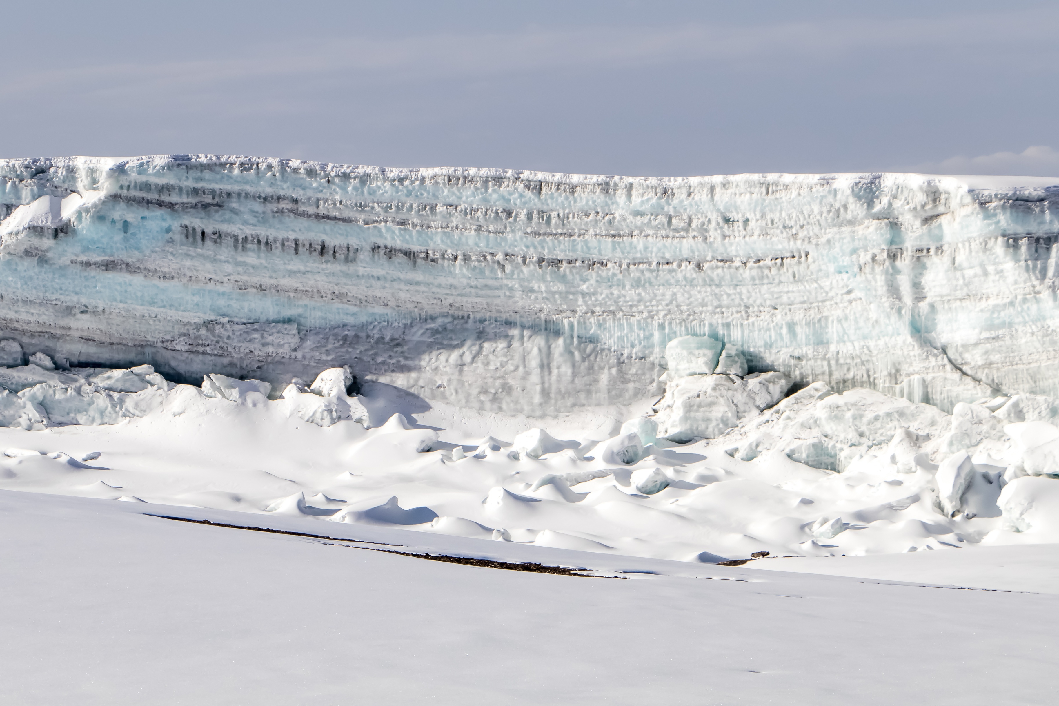
There are permanent glaciers atop Kilimanjaro
Of all the mountains in Africa, Mount Kilimanjaro is the most established in terms of its climbing infrastructure and overall setup. There's a bevy of tour operators offering to take climbers up the mountain, and they vary greatly in terms of the quality of service and amenities provided. And yes, you're not allowed to climb Kilimanjaro on your own – you must trek with a locally registered tour operator.
We strongly encourage anyone considering climbing Kilimanjaro to research potential tour operators in terms of their staff treatment. The simplest way to do this is to visit the Kilimanjaro Porters Assistance Project (KPAP) website and look at their Partners for Responsible Travel list. Only companies who have been vigorously vetted by KPAP make it onto this list. We at Follow Alice are on this list – and this is proof that we take the welfare of our mountain crew seriously.
Please check out our Kilimanjaro climb packages to see the different routes and durations that we offer.
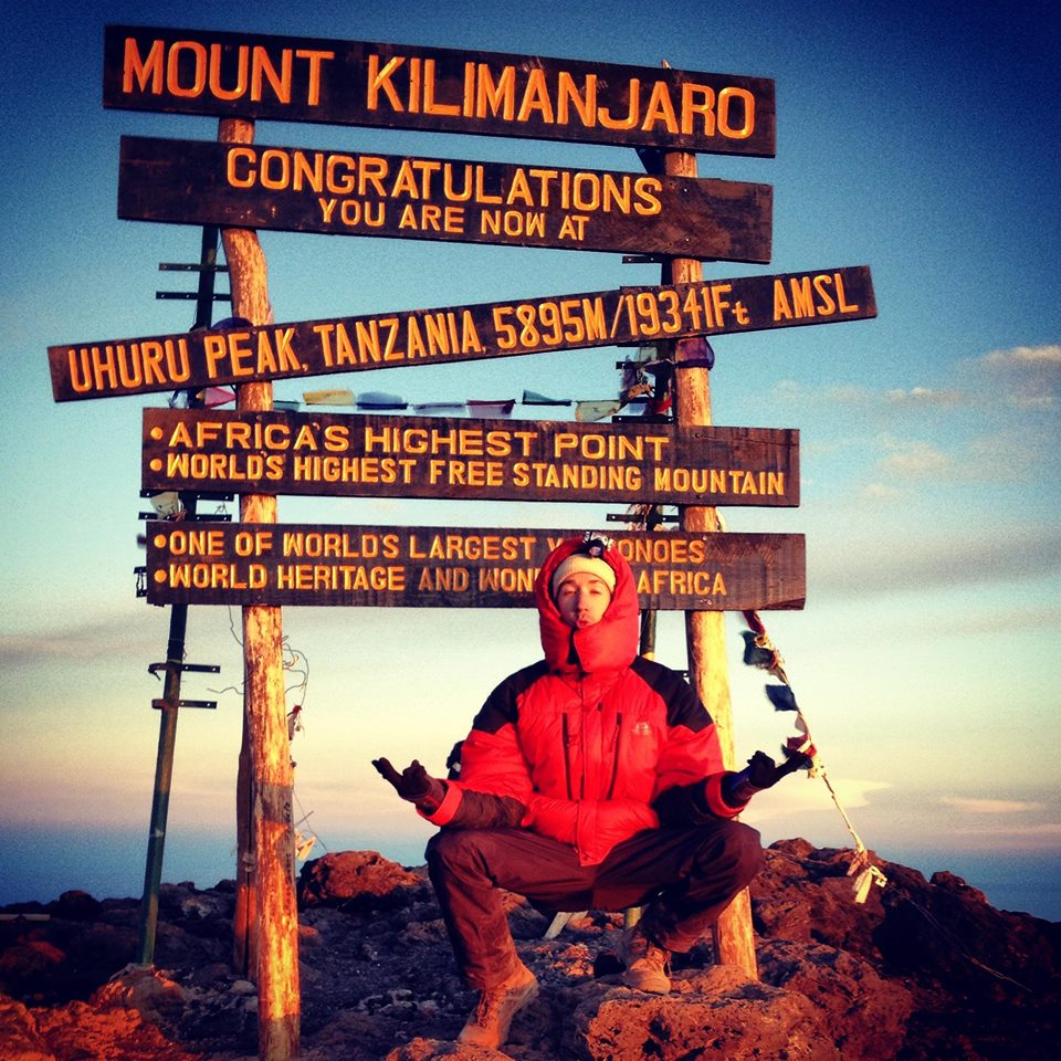
The summit of Kilimanjaro is the highest point in Africa
How to reach Mount Kilimanjaro
The easiest way to reach Mount Kilimanjaro is to fly into Kilimanjaro International Airport, which sits just outside of the city of Arusha. It's only about a two-hour-drive from the airport to nearest gate into Kilimanjaro National Park.
Alternatively, you could fly into Nairobi and then drive south across the border into Tanzania. Factoring in time for border control, it will likely take you around eight hours to reach your accommodation in Arusha or the neighbouring city of Moshi. We don't recommend this travel route unless you're also planning to go on a Kenyan safari during your trip, as you'll need to purchase an East African visa instead of just a Tanzanian visa.
7. Mount Meru, Tanzania
- Location: Northern Tanzania, 68 km from Mount Kilimanjaro
- Highest point: Socialist Peak (4,566 m)
- Reserve: Arusha National Park

Mount Meru, like nearby Mount Kilimanjaro, rises out of a plain
While not as famous as neighbouring Mount Kilimanjaro, Mount Meru is another striking volcanic mountain in the Great Rift Valley of East Africa.
The climb up Mount Meru is very pretty, and one hikes through three distinct climate zones, namely rainforest, Afroalpine heath and alpine desert. Similarly to Kilimanjaro, Mount Meru's summit is dominated by a crater, meaning its highest point is a spot on the crater rim.
Mount Meru is part of Arusha National Park, which is a strikingly diverse park, having the mountain with its various ecosystems as well as beautiful grasslands and flamingo-dotted crater lakes.

A slight morning mist lingers over the forest of Mount Meru
Mount Meru is quite different from Mount Kilimanjaro in terms of the wildlife you can hope to see during your trek. In fact, those who climb Mount Meru are far more likely to encounter large game than those who climb Mount Kilimanjaro. You're actually not allowed to climb Meru without an armed ranger, as there are large species like buffaloes roaming the lower slopes.
Other animals you might hope to spot during your time on Mount Meru are giraffes, zebras, wildebeests, bushbucks, blue monkeys, black-and-white colobus monkeys and warthogs. If you've very lucky you might even spot an elusive leopard or hyena.
Also be on the lookout for birds when visiting Mount Meru. There are special birds to be found like Narina and bar-tailed trogons, Hartlaub's turacos, red-fronted parrots, scaly francolins and silvery cheeked hornbills. When you ascend above the tree line, be sure to keep your eyes peeled for raptors like tawny, Verreaux's and African fish eagles and peregrine falcons.
Trekking Mount Meru
- Main trek: Summit climb (non-technical)
- Duration: 3 or 4 days
- Guide: Compulsory
- Best time: December to early March and June to October

Saddle Hut campsite on Mount Meru
Mount Meru is easier to climb than Mount Kilimanjaro as its summit is nearly 1.5 km lower. That said, it shouldn't be undertaken lightly. It's still a steep and taxing climb that takes you to high altitude. Moreover, you need a decent head for heights as you must walk some narrow contour paths and ridges.
We feel that Mount Meru, similarly to Mount Toubkal in Morocco, is an ideal summit climb for anyone new to high-altitude trekking. We say this because the trek introduces your body to the effects of a challenging altitude without pushing it to go too high or trek for too many days.
One of the great things about trekking Mount Meru is that your reward at the top is an incredible view over the plains below as well as of Mount Kilimanjaro in the distance! In saying that, we don't wish to overlook the dramatic inward view of the deep crater and its ash pit.

Mount Meru's crater as seen from Rhino Point (3,800 m)
You can climb Mount Meru at any time of the year. But the drier months (December to early March or June to October) are the most popular as the forest section can become slippery when wet. Fortunately, Mount Meru doesn't experience crowds in the same way as Kilimanjaro, largely because you can't camp and so trekker numbers per day are limited to the number of beds in the communal huts. For more detail, please read When is the best time to climb Mt Meru?
There are various tour operators offering Mount Meru climbs. These tour operators are the same as those offering Mount Kilimanjaro climbs. So our recommendation for finding a reputable and ethical operator are the same, namely looking for one that's listed on KPAP's Partners for Responsible Travel list.
We also suggest visiting independent review sites to check out what past clients have to say about a tour operator's safety practices and client service. We at Follow Alice have online reviews you can peruse on TrustPilot, TripAdvisor and Google Reviews.
If you're interested in the climb, please check out our four-day Mount Meru itinerary. Note that we don't recommend trying to do the climb in three days, as such itineraries see you tackle the summit climb and downhill all in one day! This makes for an exceptionally long day, not to mention one that's pretty tough on the knees.
How to reach Mount Meru
Similar to our advice above for reaching Mount Kilimanjaro, we recommend flying into Kilimanjaro International Airport on the outskirts of the city of Arusha. The drive from the airport to the gate into Arusha National Park (where Mount Meru is located) takes only about an hour. But you'll likely overnight in the city before heading to the park for your trek.
8. Mount Stanley, Rwenzori Mountains, Uganda
- Location: On the border Uganda–DRC border
- Highest peak: Margherita Peak (5,109 m)
- Reserve: Rwenzori Mountains National Park

Mount Stanley as seen from Bujuku Valley
The Rwenzori Mountains, a UNESCO World Heritage Site since 1994 for its unique natural beauty and biodiversity, is by far the highest mountain range in Africa. (Remember that Mount Kilimanjaro and Mount Kenya are standalone volcanic mountains.)
In fact, the Rwenzoris have the third, fourth and fifth highest mountains in Africa. These three towering peaks are only a few kilometres apart and together form a triangle, and so have for millennia been known as the Mountains of the Moon.
Fairytale nomenclature aside, the Rwenzoris have a mystical quality to them. The lower slopes are home to spongey, tangled forests that are often threaded with mist. The forest's trees support orchids, ferns, old man's beard, mosses, lichens and more.

Trekkers watching sunrise in the beautiful Rwenzoris
The higher heather zone is no more ordinary as it boasts oversized, otherworldly plants like 10 metre-high giant lobelias, top-heavy giant groundsels, and colourful heather trees. In the arctic world of the peaks, glaciers meet dark cliff faces of gneiss and granite and often merge with the grey of an opaque sky. It can be hard to remember that you're almost in line with the Equator when you're up here!
Given the instability of the DRC, those wanting to visit the Rwenzoris must head to Rwenzori Mountains National Park in southwest Uganda. This park has 70 mammal species, which is truly impressive. Most are shy and hard to spot, but keep your eyes peeled at all times. Resident species include forest elephants, giant forest hogs, leopards, African golden cats, sittungas (marsh bucks), bushbucks, Rwenzori red duikers, chimpanzees and l’Hoest’s monkeys. And if you're into chameleons, be sure to try to spot the Rwenzori bearded chameleon, Rwenzori plate-nosed chameleon, and three-horned chameleon, among others.

The Rwenzori forest is a chameleon wonderland
Rwenzori Mountains National Park also has around 260 recorded bird species, which is a staggering number. Many of these are endemic to the Albertine Rift Valley. You can look for beauties like the Cassin’s hawk eagle, Rwenzori turaco, bamboo warbler, Rwenzori nightjar, barred long-tailed cuckoo, Shelley’s crimsonwing, and Rwenzori double-collared sunbird.
Trekking Mount Stanley
- Main treks: Summit climb (technical) or circuit trek (non-technical)
- Duration: 7 or 8 days for Margherita Peak
- Guide: Compulsory
- Best time: December to February or June to August
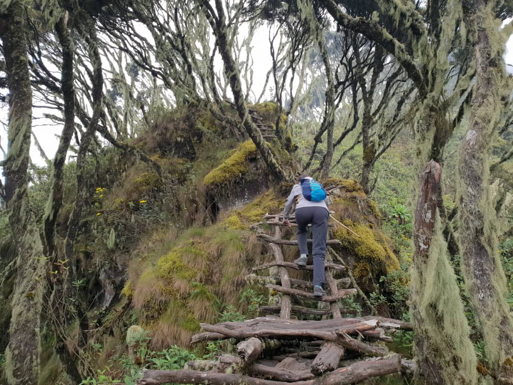
Rustic ladders help trekkers navigate slippery sections of the forest
The Rwenzori Mountains offer the best mountaineering opportunities in Africa. Mount Stanley, also called Mount Ngaliema, has a few peaks and two glaciers. Margherita Peak is its highest peak, piercing the sky at 5,109 m above sea level. That's 300 metres higher than Mont Blanc!
There are two main trek routes in Rwenzori Mountains National Park: the Central Circuit Trail and the Kilembe Route. The Central Circuit Trail enters the mountain range from the east and does a large, anticlockwise loop. The Kilembe Route, on the other hand, takes you into the mountains from the south and follows a longer circuit which runs in a northwest–southeast direction. Both routes can be used to summit Margherita Peak or any of the other Mountains of the Moon peaks. That said, you can also enjoy trekking them and simply exclude any summit climbs.
Please note that Margherita Peak is a glacial summit climb and so requires mountaineering experience and equipment. Some of the other high peaks are also technical climbs. Also, whether you choose to do a summit climb or a multiday mountain trek, there's hut accommodation on offer, which makes life a little simpler.

Margherita Glacier requires mountaineering equipment
The best times of year for trekking in the Rwenzori Mountains are June to August or December to February as there's less rainfall during these months. That said, the forest trails can still be slippery in the drier seasons.
If you'd like to trek or climb in the Rwenzori Mountains, please reach out to us and we can make this happen for you! Or if you'd like to learn a little more, please read Hiking and trekking the Rwenzori Mountains of Uganda.
How to reach the Rwenzori Mountains
The most direct way to reach the mountain range is to fly into Entebbe International Airport outside of Kampala, the capital of Uganda. From here, in the south of the country, you must drive for about seven hours northwest to reach Rwenzori Mountains National Park.
9. The Amphitheatre, Drakensberg, South Africa
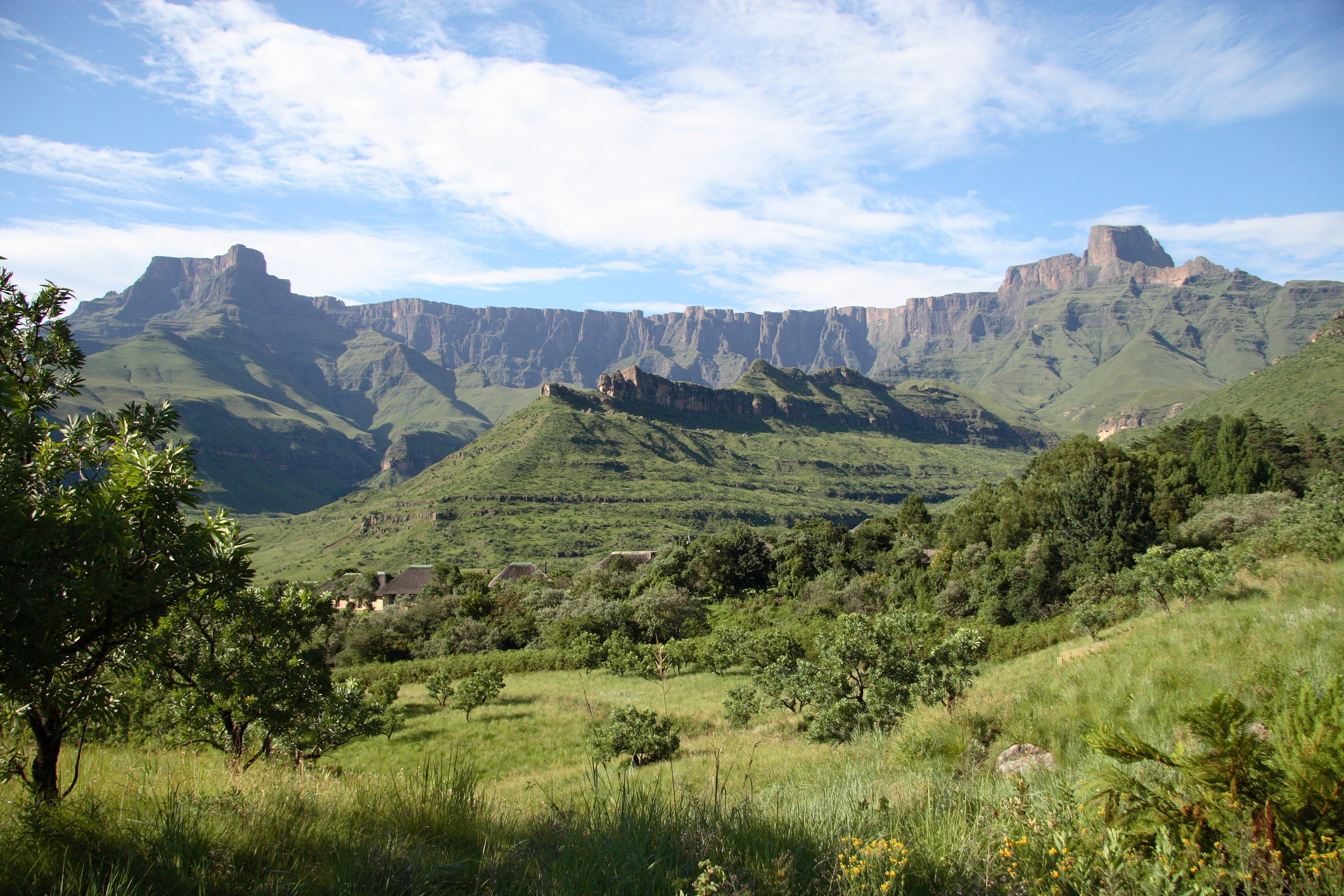
The classic view of the Amphitheatre
- Location: Northern Drakensberg, South Africa–Lesotho border
- Highest point: Mont-aux-Sources (3,282 m)
- Reserve: Maloti-Drakensberg Park
The Maloti-Drakensberg Park, a UNESCO World Heritage Site since 2013, is a transnational reserve. It comprises the uKhahlamba-Drakensberg Park of South Africa and the Sehlathebe National Park of Lesotho.
The Drakensberg is the highest mountain range in Southern Africa. Like the Simien Mountains in Ethiopia, it's an escarpment range. This escarpment serves as a natural border between South Africa and Lesotho, the latter of which is an enclave that sits atop the plateau.
The Drakensberg is an exceptionally beautiful mountain range, famous for its dramatic cliffs, green foothills, significant biodiversity, and the centuries-old rock art of the San people. The San are an ancient hunter-gatherer people who were sadly hunted to extinction in this part of South Africa during the colonisation era.
The Amphitheatre isn't the highest mountain in the Drakensberg – that honour goes to Mount Thabana Ntlenyana (3,482 m) in Lesotho. But it is arguably the most iconic and spectacular of the Drakensberg's many mountains. Its concave cliff face is about 5 km long and rises over 1,200 m from the valley floor, creating a truly dramatic spectacle when viewed from below.
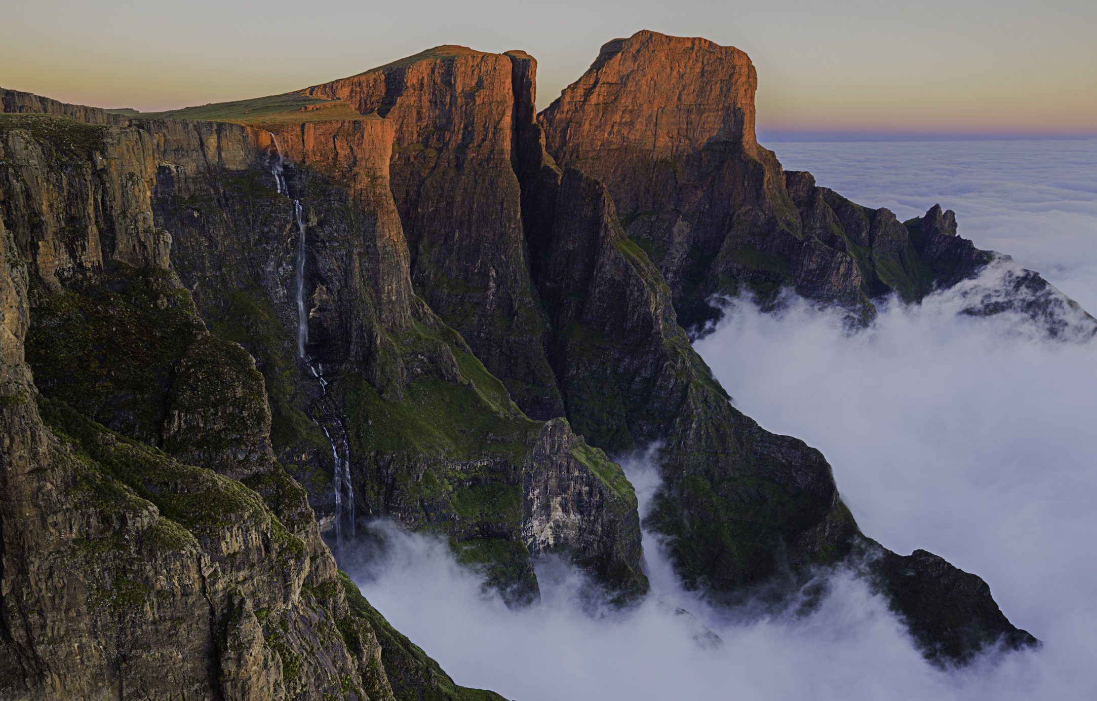
Tugela Falls as seen from atop the Amphitheatre's plateau
The Amphitheatre is also special for another reason: it's the site of Tugela Falls. This narrow waterfall plunges 948 m in five steps from the top of the Amphitheatre down to the foothills. It's possibly the tallest waterfall in the world, depending on how you measure these things.
Trekking the Amphitheatre

The Chain Ladder route up the Amphitheatre
- Main trek: Summit trek (non-technical)
- Duration: 1-2 days
- Guide: Optional
- Best time: April, May, September or October
There are two routes up the Amphitheatre. The Chain Ladder is the shortest path. Sentinel Gulley is the longer, more gradual route, but it's considered trickier as the terrain is rougher and you must do some scrambling. We suggest ascending via one and descending via the other in order to enjoy as much varied scenery as possible.
A roundtrip Amphitheatre trek can be completed in around six to seven hours. That said, you can camp atop the mountain, which gives you more time to explore the plateau.
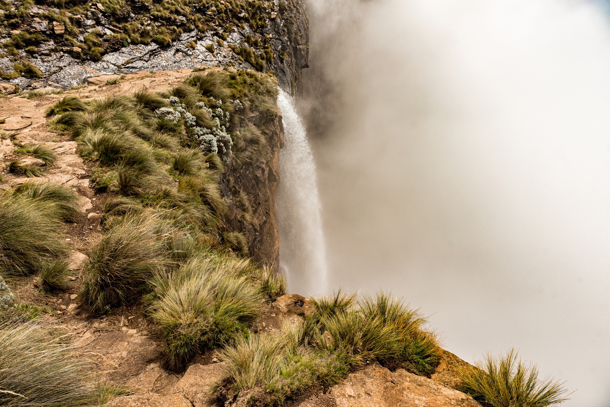
The top of Tugela Falls
The best times of year to trek the Amphitheatre are April to May (early autumn) and September to October (early spring). In summer you risk afternoon thunderstorms, while in winter there could be snow, and the winds at the top can be supremely biting.
The Drakensberg Mountains have long been the home of the Zulu people of what is today South Africa and the Basotho people of what is today Lesotho. Doing the trek in the company of a local guide will not only enhance your safety but also your understanding and appreciation of local history and lore, not to mention indigenous plants and their traditional medicinal uses.
Whether you'd like to hike the Amphitheatre in one day, as an overnight trek, or as part of a longer and broader Drakensberg multiday trek (which we can highly recommend!), here are some local tour operators you might like to research: Soul Adventures, Drakensberg Hiker, South Africa Adventures and Active Escapes.
That said, if you wish to hike unguided, the paths are well-trod and have clear signposts. You can find cellphone reception in certain places, but you shouldn't rely on having coverage the entire time. And if you wish to camp, note that you must bring everything you need with you, as there are no facilities at all at the top.
How to reach the Amphitheatre
The most efficient way to reach the Drakensberg from outside of the country is to fly into Oliver Tambo International Airport in Johannesburg, South Africa. You then drive south for around 4.5 hours to arrive at the foothills of the Amphitheatre.
10. Table Mountain, Cape Town, South Africa

Table Mountain earned its name as its top appears flat when seen from Blouberg Beach
- Location: City of Cape Town, extreme southwest corner of South Africa
- Highest point: Maclear's Beacon (1,086 m)
- Reserve: Table Mountain National Park
Our list of the best mountains in Africa to trek consists mostly of multiday adventures that take place at high altitude. Table Mountain is a notable exception. This hike takes only a day, if that, but is an incredibly scenic, iconic and rewarding one, so we simply had to include it!
Located in the middle of the city of Cape Town, Table Mountain is one of the great icons of South Africa. In fact, it's made Cape Town one of the world's most easily recognisable cities. How can anyone ever forget the sight of that remarkably flat-topped mountain rising out of an urban centre? Or how can you fail to be enchanted when thick cloud descends over it and creates the illusion of a white tablecloth?

Most of the vegetation on and around Table Mountain is fynbos
We must finally mention that Table Mountain is smack in the middle of the Cape Floristic Kingdom, the world's second largest floral kingdom. During your time on the mountain you can look forward to seeing some beautiful examples of this diverse vegetation type, including (hopefully) some proteas, the national flower of South Africa.
Hiking Table Mountain
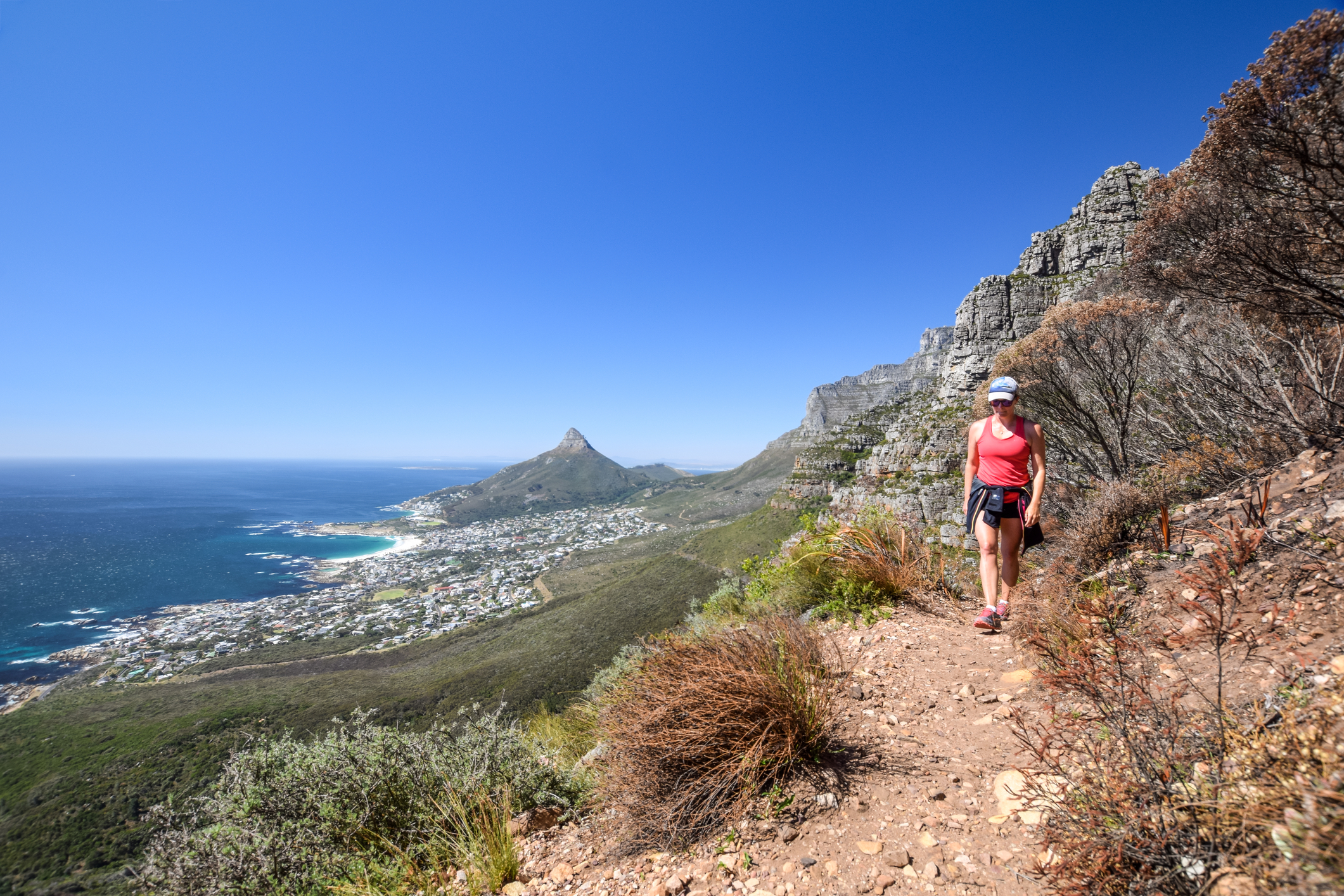
A hiker on Table Mountain
- Duration: The better part of a day
- Guide: Optional
- Best time: March to November
The four most established hiking trails on Table Mountain are as follows:
- Platteklip Gorge is the steepest, most direct route up the mountain. It's a challenging climb up the exposed northern face of the mountain, and as such offers stunning views of the city below, nearby Lion's Head mountain, and the Atlantic Ocean on both sides of the Cape Peninsula.
- India Venster is the most challenging and thrilling route as it involves some scrambling and walking along narrow ledges. Note that this route isn't suitable for anyone with a fear of heights. Like the Platteklip Gorge route, it leads you up the northern face of the mountain, so the views are incredible.
- Skeleton Gorge is a slightly longer route, and incorporates a different descent route, which is always fun. The ascent trail takes you from the world-renowned Kirstenbosch National Botanical Gardens up a forested gorge. So it's a good option in hot weather. The descent route leads you down a more exposed ravine (on the southeast face of the mountain), so you still enjoy sweeping views. This is the ideal route for flower lovers, as you begin and end your hike in the botanic gardens.
- Kasteelspoort (or the Pipe Track) is a longer and gentler route that offers wholly different views to the other trails, including stunning vistas of Camps Bay and the Twelve Apostles (a row of mountains overlooking the Atlantic Ocean). And while we say it's a gentler route, it still has its steep sections, but there are some ladders in place to make things easier.
The established trails are well marked and can be navigated without a guide. That said, a guide will obviously enhance the experience. Also please note that there has been the odd criminal incident on the mountain, but if you hike in a decently sized group you shouldn't have to worry at all.
If you would like to hike with a guide, perhaps check out these reputable local operators: Hike Table Mountain, The Fynbos Guy, Table Mountain Walks, Cape Trekking or Table Mountain Hiking Tours.
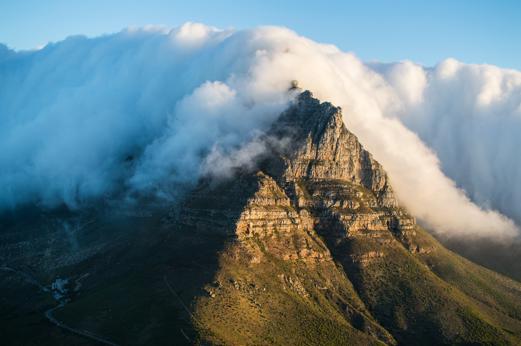
You don't want to hike when Table Mountain it's covered with its tablecloth
You can climb the mountain at any time of the year. However, think carefully before hiking after rain, as this can make sections of the climb treacherous. Also, summer (December to early March) is when you're more likely to encounter the mountain's famous 'tablecloth' (a thick cloud covering the mountaintop). So always check the weather before heading up the mountain.
Fortunately, you can always catch the cable car down the mountain if the weather turns bad, or if you're just tired or short on daylight.
How to reach Table Mountain
This is by far the easiest mountain in this list to reach, as you simply fly into Cape Town International Airport and then take a roughly one-hour drive to any of the trailheads.
That's it for our list of the 10 best mountains in Africa for trekking. We hope you enjoyed learning about them and are feeling inspired to add one or two to your travel plans!